DOWNLOAD MY NEW FREE JOESTRADAMUS WEATHER APP FOR ANDROID

THE APP IS ABSOLUTELY FREE TO ALL BUT CONSIDERING SUBSCRIBING TO PATREON FOR A WEATHER EXPERIENCE FREE OF ADS, EXCLUSIVE VIDEOS FOR MEMBERS ONLY AND MUCH MORE…STARTS AT $2 A MONTH..MESSAGE ME AT ANY TIME

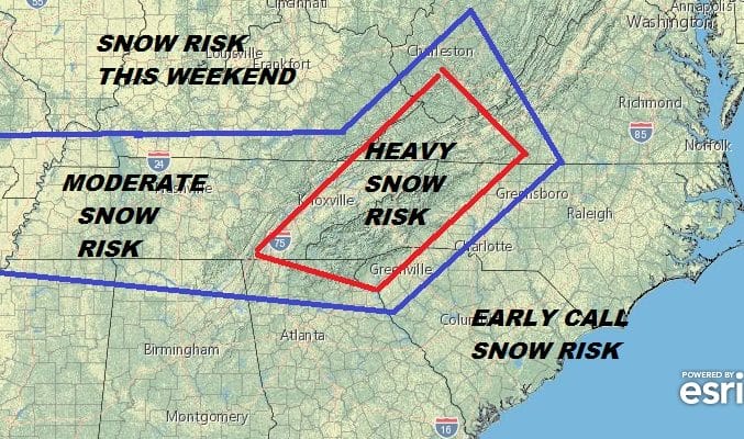
Weekend Snowstorm Threat Grows For Interior Mid Atlantic States
Western Virginia, Western North Carolina south to North Georgia & Eastern Southern Kentucky & Tennessee At Risk for Heavy Snow This Weekend
We are continuing to watch the evolution of a storm now getting ready to move into California. This storm will be moving across the deep south late this week and head for the Southeast US. Colder air is going to be coming down from Canada and enveloping itself around the low. Weather models have been remarkably consistent showing that the area listed above is at risk for a snowstorm. We know that in the Southern US it usually takes less snow to be disruptive but this system has the potential to drop a foot or more of snow in some areas.

This is a very early call and I decided to focus on the south here since this would be a very unusual very early heavy snowstorm for some areas particularly in the mountains in Western North & South Carolina and Eastern Tennessee as well as Southwestern Virginia.

The current operational run offers a very suppressed look to this system as far as the areas from Southern Pennsylvania to Southern New England are concerned. At the surface it would seem that the target is set for the coastal cities from Washington to NYC to Boston but take a look at the upper right and you will see a cold front in Southeastern Canada. This is part of a short wave trough in the upper air that will act to suppress this storm well to the south.
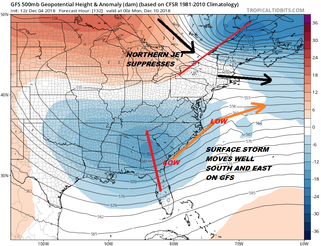
With upper air winds from NYC north and east from the northwest Sunday evening the storm has no where to go but out to the east and offshore. However the supposedly new and improved GFS also known as the parallel GFS (running side by side until January when it becomes the operational model) has a different opinion of all this.
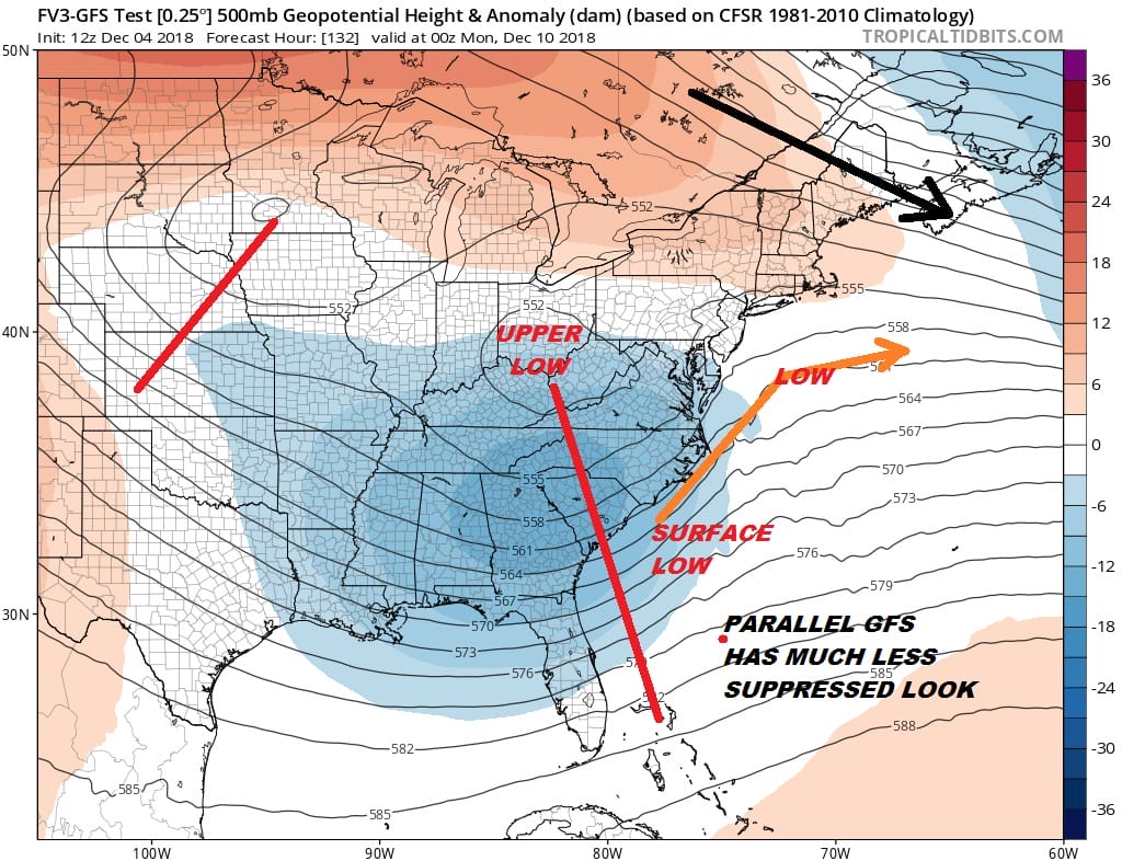
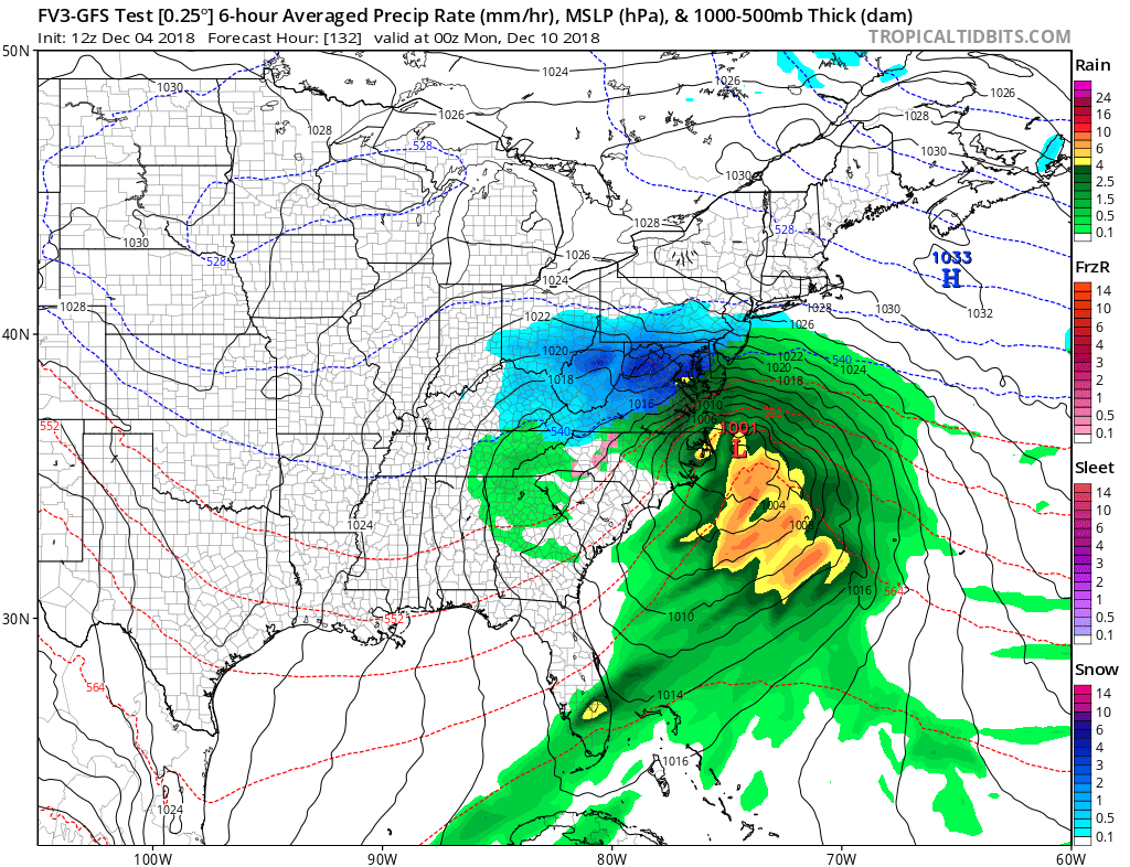
The parallel GFS has a much more developed southern stream feature but it also has a much weaker northern stream short wave that moves through Northern New England in the upper right corner. Northwest winds only extend south into Northern New England and not to NYC. The result is a much more robust shield of snow that gets further north by Sunday night.
The overall look of the entire upper air suggests that the suppressed looks of the models is the more realistic solution at this point especially since lately models have mishandled the northern jet and its strength quite a bit. We lean in this direction at this point and that snow would not make it much further north than say Northern Virginia. But we remain cautious here and since we are still more than 5 days away our mind remains open to a less suppressed look allowing snow to make it further north. Until then cold and dry will be followed by colder and dry into the weekend regardless of what this storm does.
MANY THANKS TO TROPICAL TIDBITS FOR THE USE OF MAPS
Please note that with regards to any tropical storms or hurricanes, should a storm be threatening, please consult your local National Weather Service office or your local government officials about what action you should be taking to protect life and property.