
A couple of things of note for the weekend forecast and for next week. First off in the tropics first before we get to what is going on off the southeast coast of the US. Tropical Depression 9 looks to have weakened and should be downgraded to a remnant low shortly. The broad ciculation west of the Cape Verde Islands has become Tropical Depression 10 this morning. This has a chance of becoming a Tropical Storm however it is now moving into an area of increasing shear so while strengthening is still possible, it has too much going against it to warrent any attention for us.

With regards to the system that is off the southeast coast. This has some potential for development over the next couple of days and it will be what we often refer to as the home grown variety. This time of year when you have low pressure developing in that area it starts as a cold core system and then gradually transitions to warm core thanks to among other things, the very warm ocean off the coast which is running still above normal. Water temperatures there are in the low to mid 80s. These transitions are usually very slow in occuring and often times they take on more of subtroical structure. Either way there is some disturbed weather there that will bring rains to the Carolina coast over the next few days.

The visible satellite view this morning of this shows that it is purely non tropical at this point. I want to see how the loop looks later today. There is a little twisting occurring on the southwest border of the convection and that might be some sort of circulation developing but let’s see later today what it looks like.
Models range from locking this away off the southeast coast with no impact here next week, to the European’s view where it wants to take a low up the coast offshore but with rain being thrown back to the coastline Tuesday into Wednesday.
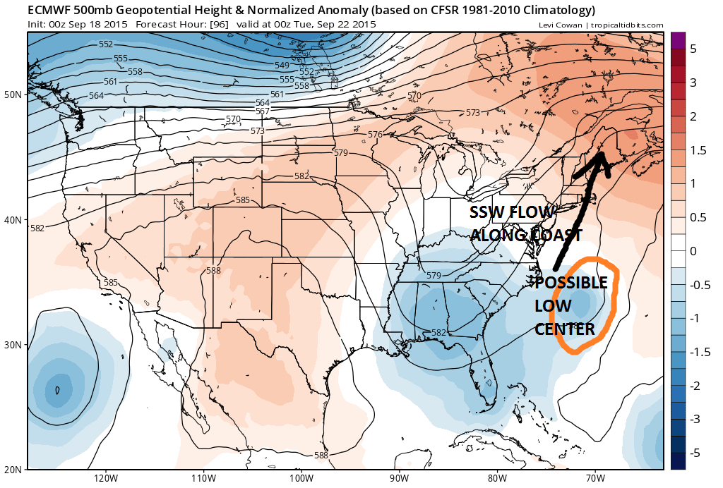
My Joestradamus piece last night addressed this and the variations of what this might do. The outcome here could be anything from sunny skies and no impact at all to the European’s view which would mean some rain. Nothing that came out last night makes anything clearer as far as this goes. I was leaning toward the European’s idea yesterday and am still leaning in this direction but forecast confidence is very low. I will have more on this later today. In the meantime as far as the weekend forecast goes we have a great weekend ahead with sunshine Saturday and Sunday. Cooler and dry air returns Sunday with a cold front passing Saturday night and rain with this will dry up across Pennsylvania so I’m not even going to put in for a shower Saturday night. Temperatures will be in the mid to upper 80s Saturday and upper 70s to near 80 Sunday. Even cooler temps are likely Monday.
Be sure to download my weather app and subscribe to my weather forecasts. The download is free and the subscription is just 99 cents a month. No advertisments and no security issues.


