
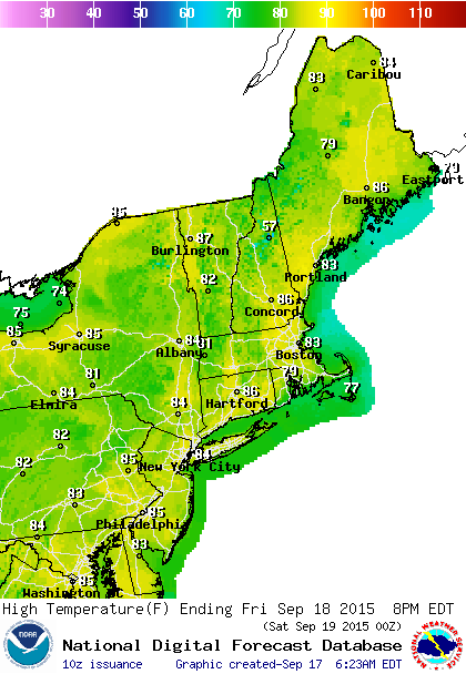
We continue on cruise control with regards to the weekend forecast and for the next 6 or 7 days at least. We are on the backside of high pressure to our south and east. Temperatures are going to warm to the mid to upper 80s today Friday and Saturday which make for great beach days as this is the last weekend of the summer before autumn arrives Monday. The benign pattern is typical for this time of year as we are in what is usually the driest time normally from mid September to mid October.

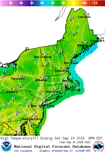
A cold front will be coming through Saturday night. It should come through dry. I dont’t its worth mentioning a shower in the forecast. Notice that the temps go back into the 70s on Sunday. Monday and Tuesday highs will be in the low to mid 70s with low humidity.

The only issue regarding the forecast will be on Monday afternoon and evening as some models show an upper air disturbance moving through producing a few light showers late Monday afternoon or Monday evening. Im a little dubious about this but for now I will just keep it as a mention. Except for that the European which yesterday was trying to bring some rain up here for midweek and has backed off so the possibility of going another week with no rain looks fairly high.
One side issue that we will be watching will be clouds and showers off the southeast coast of the US. With high pressure to the north all next week there will be an onshore flow developing from the mid Atlantci states southward. Low pressure is likely to form off the southeast coast and conditions there could actually be somewhat favorable for tropical storm development so we will keep an eye on this. Given the season we had, storm formation has been a struggle. On the other hand 4 storms have developed out of non tropical systems this seasons so we will watch and post any updates on the tropical weather page.
Be sure to download my weather app and subscribe to my forecasts. The app is free and the subscription is just 99 cents a month; advertiser free and no security issues.


