Weekend Brings Ocean Winds Clouds Sun Saturday Rain Possible Sunday
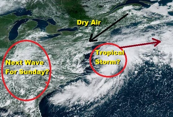
Most areas have enjoyed a nice change. East and northeast winds have taken over around low pressure developing offshore. In fact that low as evidenced on the satellite loop is developing a well defined circulation and it may become a tropical depression or a tropical storm this evening. It will have no impact on our weather other than roughing up the coastal waters. It might indirectly impact the next wave of low pressure headed here for Sunday as there are questions regarding the rain with it and how far north that rain gets. But for now it is a nice east wind and lower dew points giving us a well deserved break in the humidity.
SATELLITE

REGIONAL RADAR

Radars are showing showers offshore as well as showers in Southern New Jersey that are moving southwestward which is a little unusual. Otherwise the radars are quiet for this evening for most of us and there shouldn’t be weather issues overnight.
LOCAL RADAR NEW YORK CITY

LOCAL RADAR PHILADELPHIA


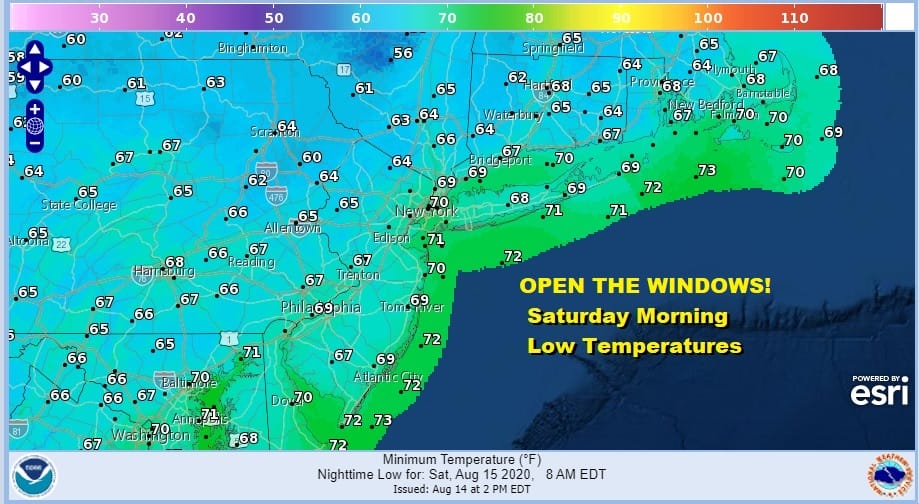
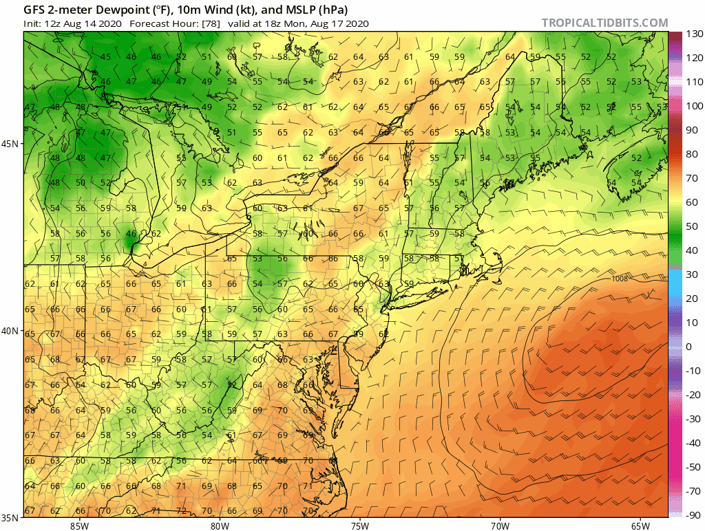
We have seen very few nights where lows have broken below 70 in the warmer urban locations but tonight we may just do it if skies remain reasonably clear. High pressure is strongly building southward from Eastern Canada and it is also helping to keep the dew points low. Temperatures by morning should bottom nicely in the 60s. If we can maintain a breeze from the northeast overnight it is definitely a night for open windows!
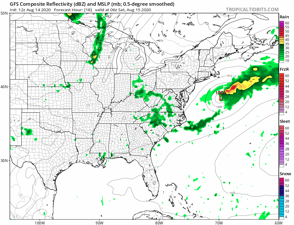
There is much disagreement with weather models for both Saturday and Sunday. We have an aggressive GFS model which is showing us another wave heading our way. However most models are showing a rather suppressed look like the NAM which would support a day of sunshine and highs in the upper 70s to lower 80s.
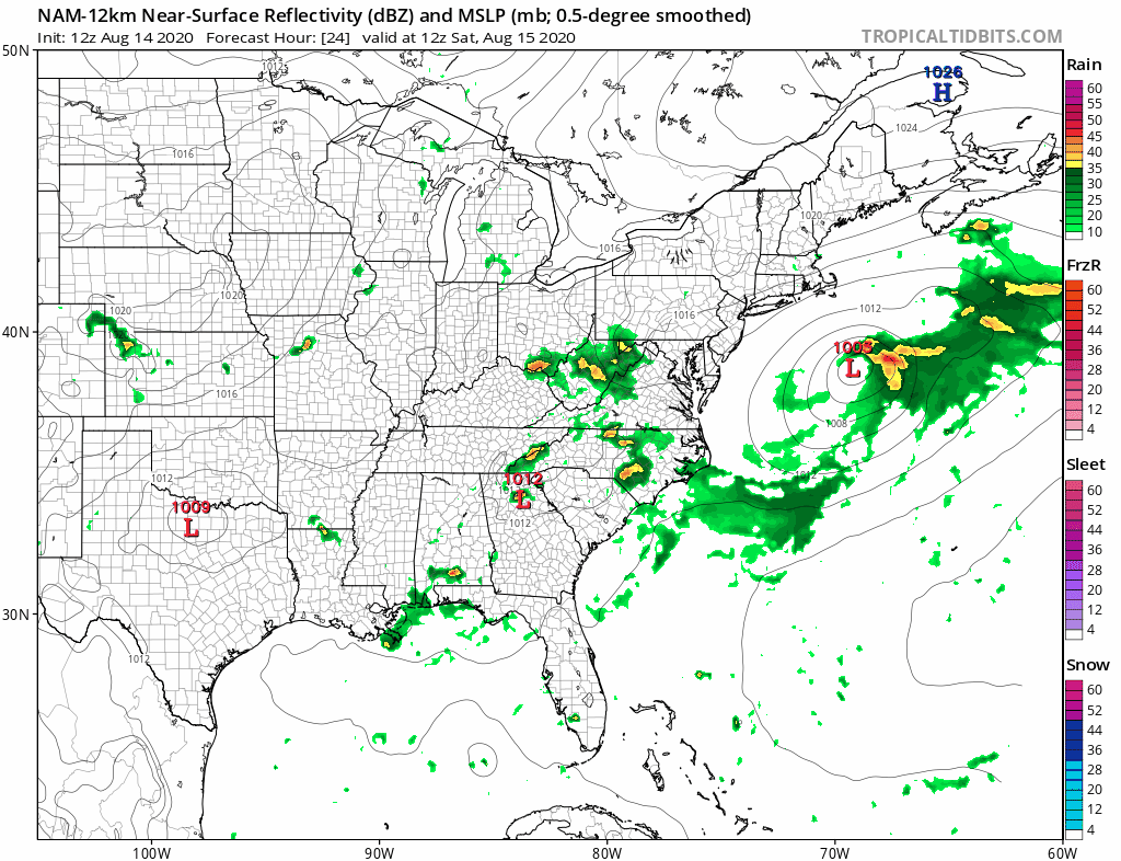
The GFS seems to be under doing the developing system offshore especially if it becomes a tropical storm. That developing system is helping to bring down dry air from Eastern Canada. We lean to the idea that Saturday should be fine for most areas other than perhaps some late day arriving clouds.

Now the question becomes what of Sunday. We will lean to the idea that the dry air may be more important and suppresses the rain somewhat to the south. I think we will see lots of clouds either way with highs in the 70s. If the models are overdoing the suppression idea then we will see rain move up the coast but there will be a sharp cut off at the northern end. Either way Sunday’s highs will be in the 70s to near 80 but if it is a more pessimistic outcome, temperatures will be in the low end of that range.
Once the Sunday low moves away Monday should see some improvement with sunshine and clouds. There is a weak front coming through with perhaps a late shower or thunderstorm. Highs will be in the upper 70s to lower 80s. Dew points will be taking a nice drop after that front passes.
Tuesday and Wednesday look like two nice days with sunshine and highs in the low to mid 80s but the humidity will be low and it will be quite comfortable, especially when we compare it to what seemed endless days of high humidity. Enjoy it when it comes.
BE SURE TO DOWNLOAD THE FREE METEOROLOGIST JOE CIOFFI WEATHER APP &
ANGRY BEN’S FREE WEATHER APP “THE ANGRY WEATHERMAN!
MANY THANKS TO TROPICAL TIDBITS FOR THE USE OF MAPS
Please note that with regards to any severe weather, tropical storms, or hurricanes, should a storm be threatening, please consult your local National Weather Service office or your local government officials about what action you should be taking to protect life and property.


