
Labor Day Weekend Underway Cool Start
Warmer More Humid Sunday
Heat Humidity Most of Next Week
We start the holiday weekend off on a rather cloudy note however there is dry air from New England that will attempt to bleed its way southwestward today. That dry air could make it as far south as Central New Jersey where areas north and east of there go to a mix of sun and clouds while it stays mainly cloudy elsewhere. At least from the stand point of rain it should be dry today even through a few light showers are dotting the landscape over parts of Long Island this morning. These should be done in short order and temperatures today will be mostly in the 70s. A few 80 degree readings might be reached inland where the ocean flow has perhaps a bit less impact.
EASTERN SATELLITE

REGIONAL RADAR

Radars this morning are showing some light showers along the coast and some heavier showers off the Delaware coast. These showers should disappear later this morning and they should not have much impact.
LOCAL RADAR NEW YORK CITY

LOCAL RADAR PHILADELPHIA


There is no change to the outlook for the rest of the weekend. We will see clouds and some sun warmer and more humid conditions Sunday with the risk for a downpour or a thunderstorm. Highs will reach into the 80s at least away from the ocean. Monday begins the next round of disgusting heat and humidity with sunshine, the chance for a downpour or a thunderstorm with highs 85 to near 90. It is not the best of Labor Day weekends but it is not the worst either and it won’t be a washout.
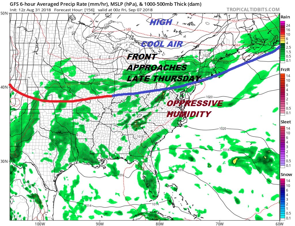
The next weather front arrives late on Thursday and much like this one it is likely to move through and stall out to the south. Leading into that Tuesday through Thursday will be hot and humid with sunshine and the risk for a downpour or a thunderstorm (small risk) with highs each day reaching into the 90s accompanied by disgusting humidity.
MANY THANKS TO TROPICAL TIDBITS FOR THE USE OF MAPS
Please note that with regards to any tropical storms or hurricanes, should a storm be threatening, please consult your local National Weather Service office or your local government officials about what action you should be taking to protect life and property.
LATEST JOESTRADAMUS ON THE LONG RANGE


