Week Ahead Mostly Dry Temps Close to Average Watching 2 Storm Systems

Weather in 5/Joe & Joe Weather Show Latest Podcast
Week Ahead Mostly Dry Temps Close to Average Watching 2 Storm Systems
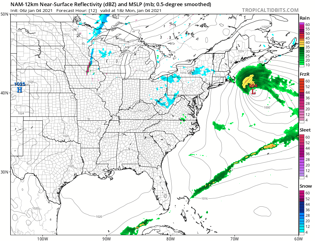
Yesterday’s weather system is now offshore and will be indirectly controlling our destiny weather wise this week. The low is 300 miles east of Atlantic City but is about to turn north northeastward. It also will be hanging round offshore for the next 3 or 4 days which means that weather systems won’t be doing their usual progression of passing through every couple of days. Instead we will be sitting in leftover clouds today with some breaks of sunshine developing. There isn’t much in the way of colder air behind this so temperatures today will be topping out generally in the upper 30s and lower 40s. We are seeing some leftover snow this morning over parts of Southern and Southeastern New England but that shouldn’t last for too much longer in those areas.
SATELLITE

Regional radar is showing precipitation in Southeastern New England and a few bands extending northward into New Hampshire and Maine. Across the Mid Atlantic states we have no precipitation echoes showing up.


Skies should at least partially clear tonight with most lows in the upper 20s and lower 30s. Tuesday we will see some sunshine and clouds. Our low will still be sitting to our east and northeast and not going anywhere fast. Highs will be again in the upper 30s and lower 40s.
The low to the east will continue to sit east of New England Wednesday into Thursday and that will actually tighten the pressure gradient over us meaning the wind will pick up Tuesday night and be a bit on the busy side Wednesday into early Thursday. Wednesday we should see some sunshine. Highs will be in the upper 30s to lower 40s. Thursday look for sunshine giving way to arriving clouds later in the day with highs in the 30s.

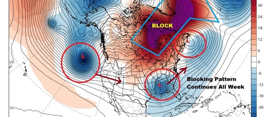
We have been in what I would describe as a blocky pattern since the beginning of December and it has already yielded one major snow storm in the Northeast so far this winter. Now I would describe the pattern as one with a strengthening block. This may be an example of what happens when you have too much blocking. The low to the northeast is stuck new Newfoundland. This will likely prevent the strong trough and low pressure moving across the Gulf States from moving northward up the coast. Instead it will likely slide out to the east northeast.
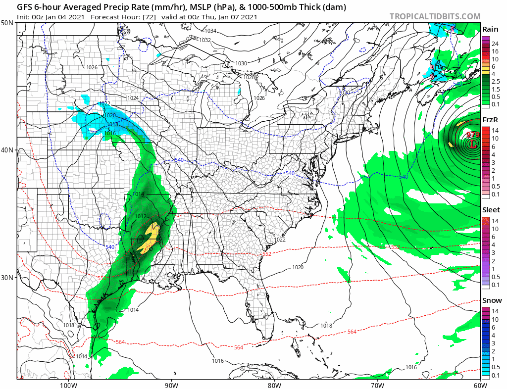
This will bring some snow to North Carolina and Virginia away from the coast. We will likely be sitting in clouds Friday with highs in the 30s. Another system coming into California will head east taking a southern route and this could be a player in our weekend weather but that will depend on the block and how much room there will be for a storm to turn up the east coast.
BE SURE TO DOWNLOAD THE FREE METEOROLOGIST JOE CIOFFI WEATHER APP &
ANGRY BEN’S FREE WEATHER APP “THE ANGRY WEATHERMAN!
MANY THANKS TO TROPICAL TIDBITS FOR THE USE OF MAPS
Please note that with regards to any severe weather, tropical storms, or hurricanes, should a storm be threatening, please consult your local National Weather Service office or your local government officials about what action you should be taking to protect life and property.


