Week Ahead Humidity Returns
Waves of Showers From Tropical Storm Fred Remnants

Weather in 5/Joe & Joe Weather Show Latest Podcast
Week Ahead Humidity Returns Waves of Showers From Tropical Storm Fred Remnants
We are looking at a weather map this morning that has 1 tropical storm and two tropical depressions on it. This speaks to the type of atmosphere we are headed into and that is one where tropical characteristics dominate. If you are not being impacted by a tropical storm, you are sitting in a tropical environment. The latter is where we are headed as clouds increase today. The old frontal boundary which was Friday’s cold front stalled in Virginia over the weekend and is now backing slowly northward. High pressure that brought the dry air in yesterday is now moving off the New England coast.
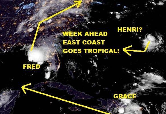
SATELLITE

We are already seeing the impacts of those changes on the radar where some scattered light showers are showing up. Much of this precipitation is aloft but it is telling us the warm front is coming and the air is about to get saturated with humidity once again.
WEATHER RADAR


Bearing all this in mind, temperatures today probably will have a tough time breaking the 80 degree mark in a lot of spots so we will give it a general range of upper 70s to lower 80s. Most of the scattered showers are away from coastal areas and the thinking is that inland areas are going to me more susceptible to waves of rain coming up from the south over the next few days.
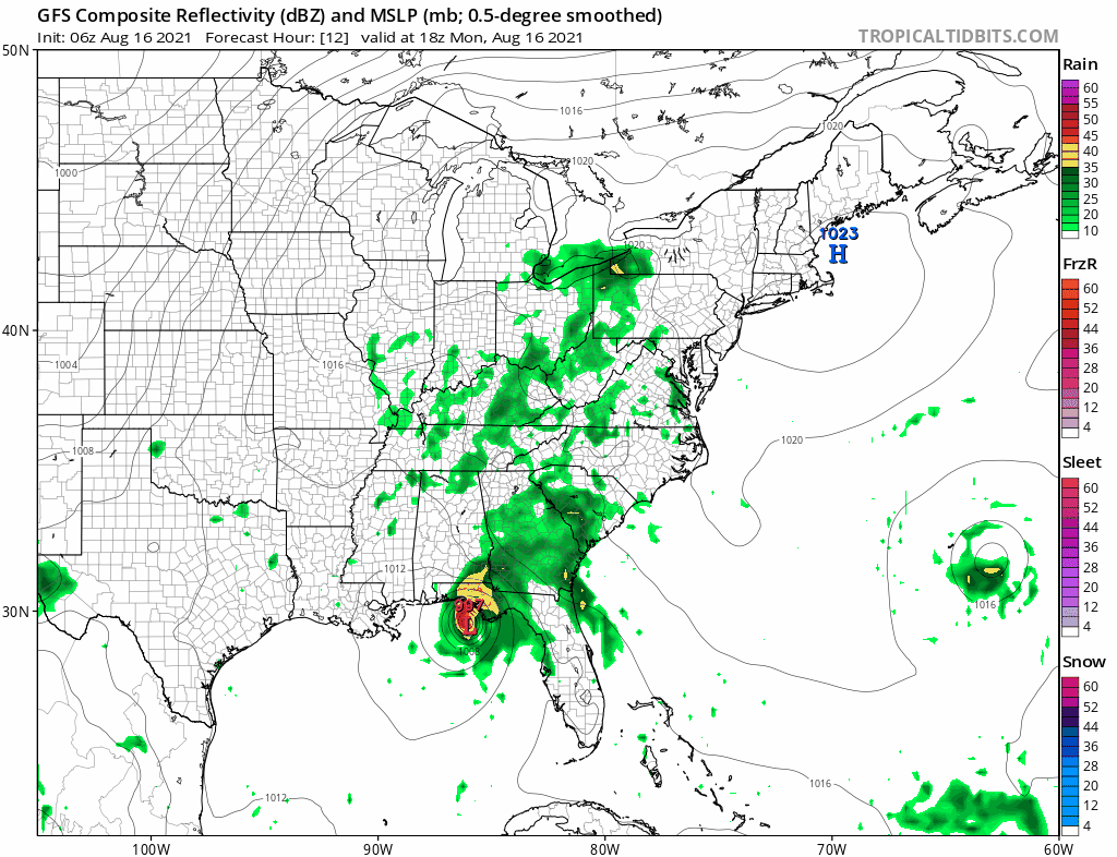
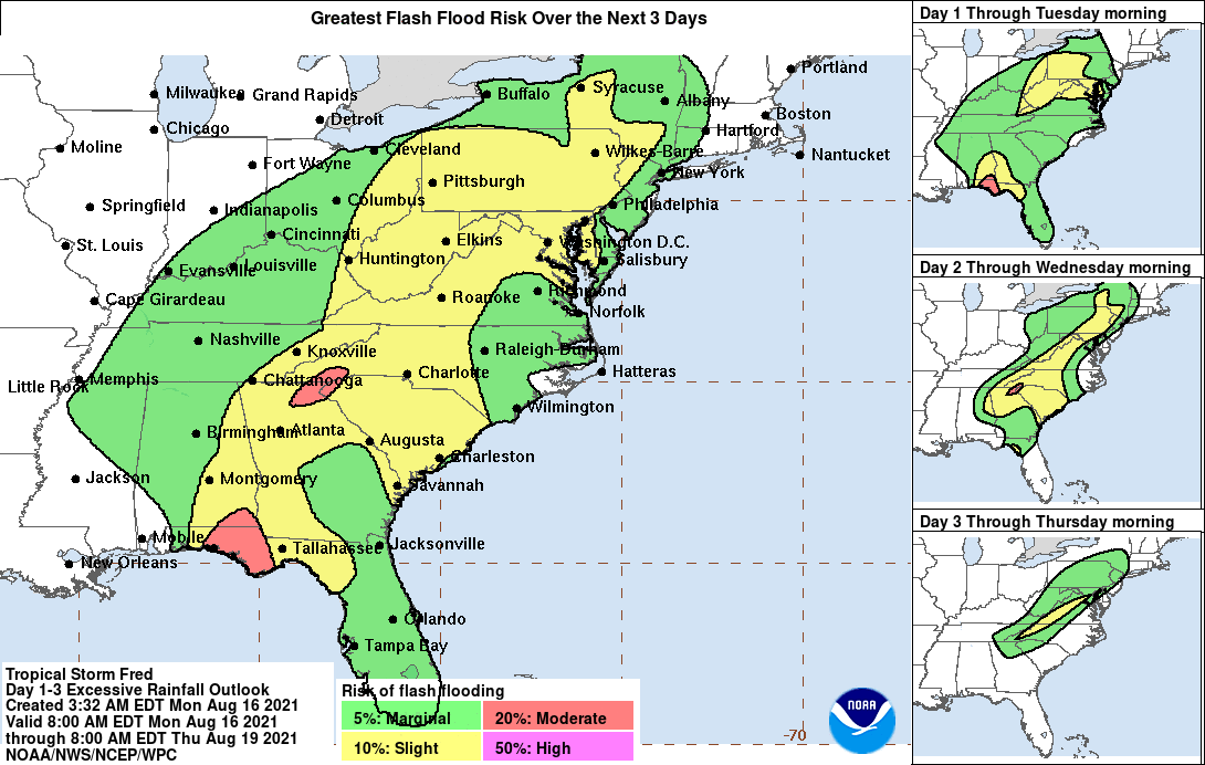
Tropical Storm Fred is going to make landfall on the Florida panhandle this evening. Top winds will likely be in a range of 50 to 60 mph at land fall. The bigger deal is the rain as the eventual remnant low tracking along the spine of the Appalachians. This will bring rain up the coast in waves BUT the heavier rains will be well inland as the forecast maps indicate. If you are in Western New Jersey westward and southward (northwest of the I-95 corridor) you will be more susceptible to these waves of rain. The heaviest rains will likely fall along the I -81 corridor.

The best way to approach the outlook is to call for cloudy to partly sunny conditions with more clouds to the west. Rain east of I-95 will be minimal Tuesday and Wednesday and will pick up some Thursday into Friday. West of I-95 expect waves of showers and downpours with the heaviest along and west of I-81 where flash flood potential exits later this week.
Temperatures each day will reach the 80s with nights very warm and humid. Lows in the upper 60s to lower 70s. This forecast likely carries into the weekend thanks to a southwest flow in the upper atmosphere and another trough dropping into the Eastern US.
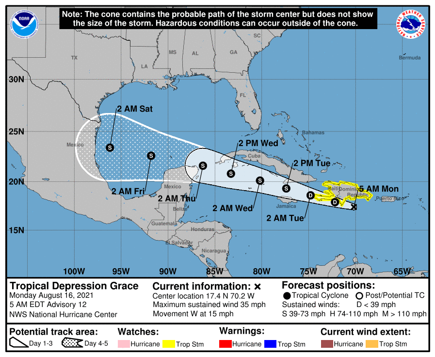
Grace is likely to become a tropical storm later today or tonight as it heads west. The track is now to pass south of Cuba and into the Gulf of Mexico where Grace could become a hurricane. It will be travelling underneath an east west upper high so it is of no threat to the East Coast in any way.
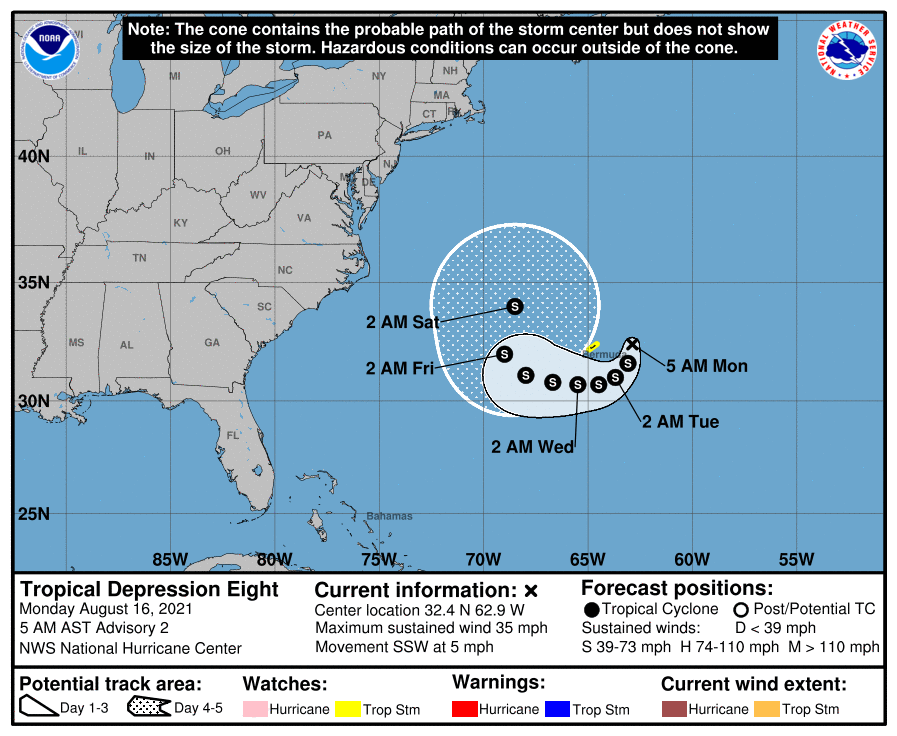
Low pressure east of Bermuda is now Tropical Depression 8 and is forecast to become Tropical Storm Henri later today. This system is likely to turn southwest and then west in the coming days and while no threat to land, it will start kicking up the surf along the East Coast later this week, especially if it strengthens into a hurricane which is entirely possible. Additional coverage on these tropical systems and local weather can be found on my subscription platform on Patreon.
BE SURE TO DOWNLOAD THE FREE METEOROLOGIST JOE CIOFFI WEATHER APP &
ANGRY BEN’S FREE WEATHER APP “THE ANGRY WEATHERMAN!

MANY THANKS TO TROPICAL TIDBITS & F5 WEATHER FOR THE USE OF MAPS
Please note that with regards to any severe weather, tropical storms, or hurricanes, should a storm be threatening, please consult your local National Weather Service office or your local government officials about what action you should be taking to protect life and property.


