
The pattern is so bone dry overall that the idea that rain could even get close has become somewhat exciting! The GFS model today does bring light rain very close to the coastline Tuesday night into Wednesday morning before it pulls it away to the southeast and south. Even if it happens we are talking about very little anyway. That and clouds are the only complication in the forecast for the early part of the week.

The visible loop today shows the low level center way to the southwest of the thunderstorms that are lifting up northward ahead of today’s cold front. It moved through this morning with little precip and just clouds. Dry air and high pressure initially build in to the north.
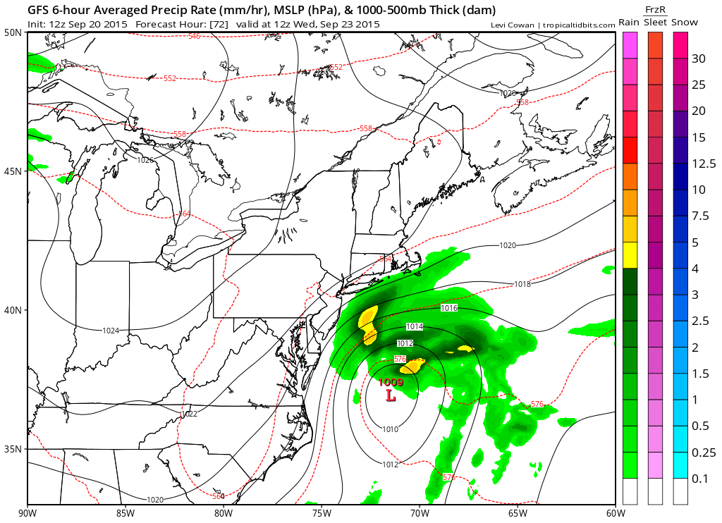
Apparently the gfs model keys on that low level center to the south and develops a separate area of rain with it as it pushes northward. However what happens is that another high builds in from the northwest and the upper trough weakens and drops southward. As a result the low only gets so far north before it collapse and weakens as the upper support lags and simply goes away.
Given the circumstances clouds may be more of an issue beginning later on Monday as they move in from the southeast and east. There should still be a fair amount of sun on Monday early and more clouds later. Tuesday we will call it mostly cloudy especially along the New Jersey coast and Long Island to about NE New Jersey and southern portions of the Hudson Valley to interior southern New England. You can see the rain on this model touches Eastern Long Island and the New Jersey shore.
Once we get past Wednesday morning, we will probably see more drying toward the end of the week as that high to the northwest builds across into New England.
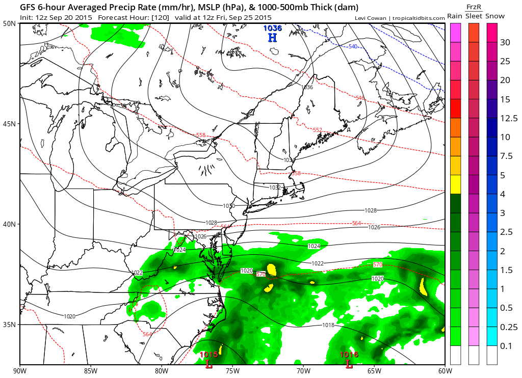
The other possibility is that the high builds in and strengthens the onshore flow even more and that could keep us in clouds for much of the rest of the week! For now we will be optimistic beyond Wednesday morning but if the look shown above happens then we may have much more cloud cover and as a result, cooler temps right through Friday.
One thing we should note here is that the coastal waters are going to be roughed up a bit with some wind and rougher ocean seas so Small Craft Advisories will probably be up for much of the week. You can keep abreast of this on the marine forecast page.
Be sure to download my weather app and subscribe to my forecasts. The app is free and the subscription costs just 99 cents a month. The app is free from ads and has no security or tracking issues. Have your own personal meteorologist with you where ever you go.