
The week ahead forecast features some uncertainty. The onshore flow we have right now is going to get reinforced this week and this is going to make it a difficult week to forecast on a number of levels. Clouds are going to be an issue almost every day. My thinking right now is that unless there is a renegade sprinkle or shower from the onshore flow into Monday that it will be rain free which takes the streak to 15 days. That might be the end of the streak as the next cold front approaches on Tuesday. We will take the Nam model at face value here for the possibility of showers or even a thunderstorm when the front comes through late Tuesday.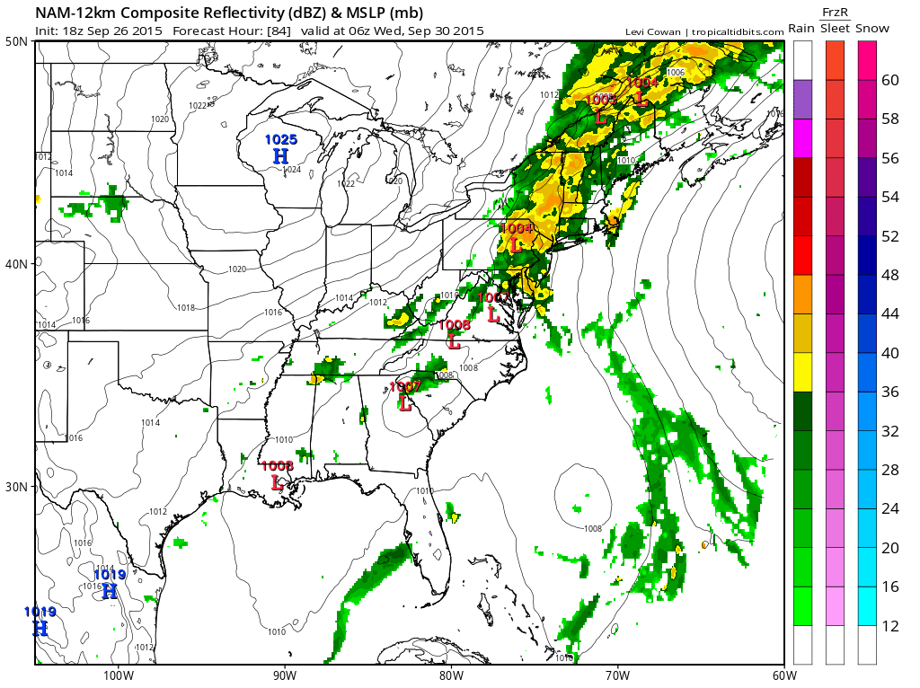 Let’s assume that this is a bit overdone given the circumstances lately when it comes to rain. It looks like we should get something with the front and some areas would get heavy rain with this Tuesday night as the front edges through if the NAM is right. The flow ahead of it is fairly moist so there could be some good interaction with the front as it nears the coast and a wave tries to develop on the front as it goes by. Fingers crossed. The GFS supports this idea to a large degree. The Canadian has a different idea as a coastal low develops Monday night and throws back rain, while the European doesn’t show much at all as the front goes by. Remember lately the model that shows no rain has been the model that winds up being right. The nam and European were right with this weekend with the gfs and Canadian wrong on the rain coming up the coast for tonight and Sunday.

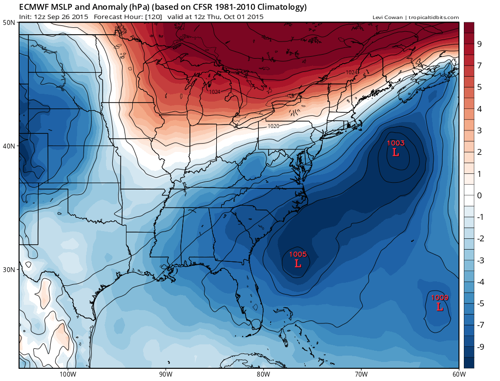
What happens after Tuesday is that the front stalls offshore. Strong high pressure builds to the north and a strong onshore flow gets established again. All three models are shown below and the GFS and European have a similar idea with a developing wave offshore and the coast getting clipped by some rain along with some wind and higher than normal tides.
The Canadian to me is a little strange as it continues to do what it has been doing all fall which is developing renegade tropical systems that really aren’t there. Without showing you the maps I will just tell you that the Canadian has a solution that borders on silliness so we will discount it as it develops a nor’easter that basically has rain and wind here for 4 or 5 days as an upper low plunges southeastward and captures and stalls it. Frankly given the drought pattern it is really hard to buy so we toss it.
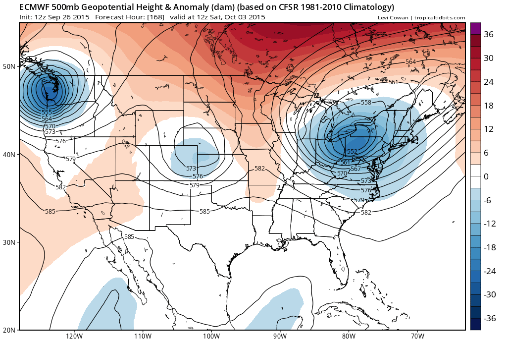
 One of the interesting things about the European is that it shows a strong upper low over the east by next Saturday which brings down a pretty strong shot of cold air (for this time of year). The European has been showing this kind of idea over the last few days so we will continue to monitor how this model evolves over the next few days.
 In summary, the week ahead forecast is dry Sunday into Monday..some showers late Tuesday, warm and humid ahead of it..drying out and cooling down Wednesday and then uncertainty about rain for late in the week. If it doesn’t rain it will be quite cool as we see temps Thursday and Friday probably not out of the 60s by day. At least the pattern seems to be changing to something more active in the next few weeks and as October arrives.
Be sure to download my weather app and subscribe to my forecasts. The app is free and the subscription is just 99 cents a month. The app is free from advertising and there are no tracking or security issues.


