
While we certainly don’t want serious flooding we do want a soaking rain and radars tonight are showing rain over Pennsylvania moving slowly into western New Jersey as of 8pm Thursday evening.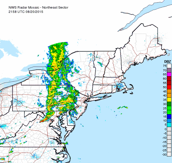 We have seen rain over the area and the radar as of 8pm still has more rain to go. If it takes its time as the models suggest then rainfalls could be signifcant on the order of a few inches but right now the heaviest rain will be just to our south. For now the Flash Flood Watch that is up for much of Eastern Pennsylvania remains south of the northeastern counties. Still the Weather prediction center shows 1 to 3 inch rains possible for totals in the next 24 hours.
 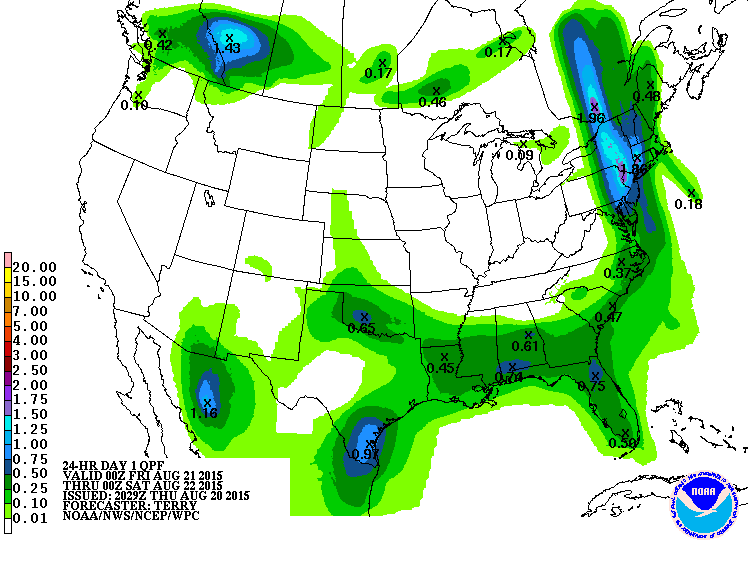 Steady rains should move out late tonight or first thing in the morning around or just after day break. There may be some lingering downpours or a thunderstorm during the day. Dry air aloft should clean things up for the weekend though it will still be warm and rather humid with the chance for pop up downpours or a thunderstorm. Much of the weekend should be rainfree.