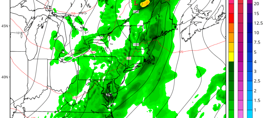
* FLASH FLOOD WATCH FOR PORTIONS OF SOUTHERN CONNECTICUT... NORTHEAST NEW JERSEY AND SOUTHEAST NEW YORK...INCLUDING THE FOLLOWING IN SOUTHERN ...CONNECTICUT...SOUTHERN FAIRFIELD. IN NORTHEAST NEW JERSEY...EASTERN BERGEN...EASTERN ESSEX... EASTERN PASSAIC...EASTERN UNION...HUDSON...WESTERN BERGEN... WESTERN ESSEX...WESTERN PASSAIC AND WESTERN UNION. IN SOUTHEAST NEW YORK...BRONX...KINGS (BROOKLYN)...NEW YORK (MANHATTAN)...NORTHERN NASSAU...NORTHERN QUEENS...RICHMOND (STATEN ISLAND)...SOUTHERN NASSAU...SOUTHERN QUEENS AND SOUTHERN WESTCHESTER. Afternoon model runs haven't changed too much. They seem to go back and forth a bit on the rainfall amounts but i think the idea of 1 to 2 inches of rain for everyone looks good with some local amounts to 3 inches possible depending on how the downpours set up. The ground is like cement pretty much due to the lack of overall rain for months. That I can recall off the top of my head we have only had 3 area wide soaking rains since mid April and deficits in some areas are running as high as 8 inches. Look for 2 surges of downpours with the first coming for this area after midnight and then ending around the middle or latter part of the morning rush hour drive.This first push could have some very heavy thunderstorms in the mix and possibly even a severe thunderstorm in there as well. Once that goes by the front will briefly stall which will allow another wave to develop and there should be a second surge from mid afternoon to mid evening Tuesday
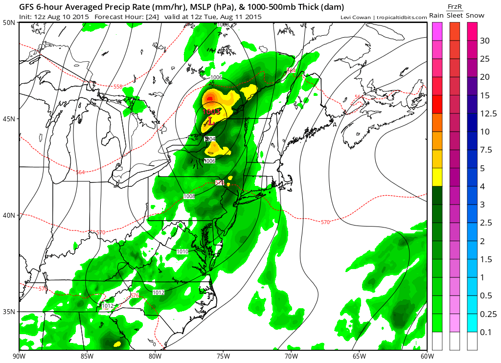
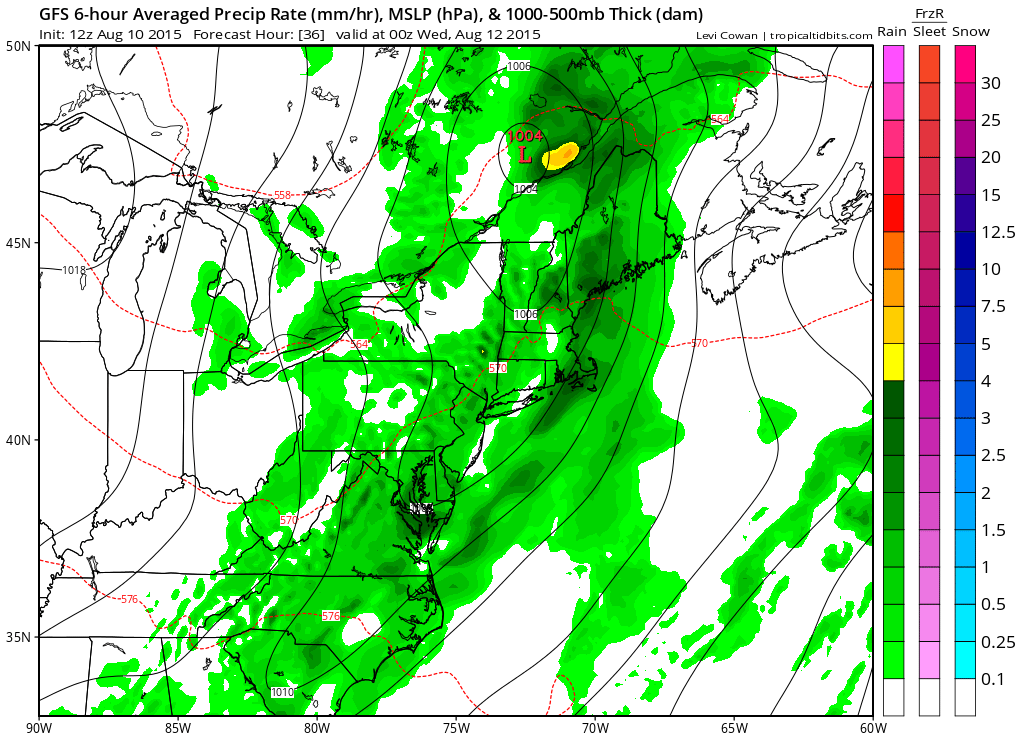
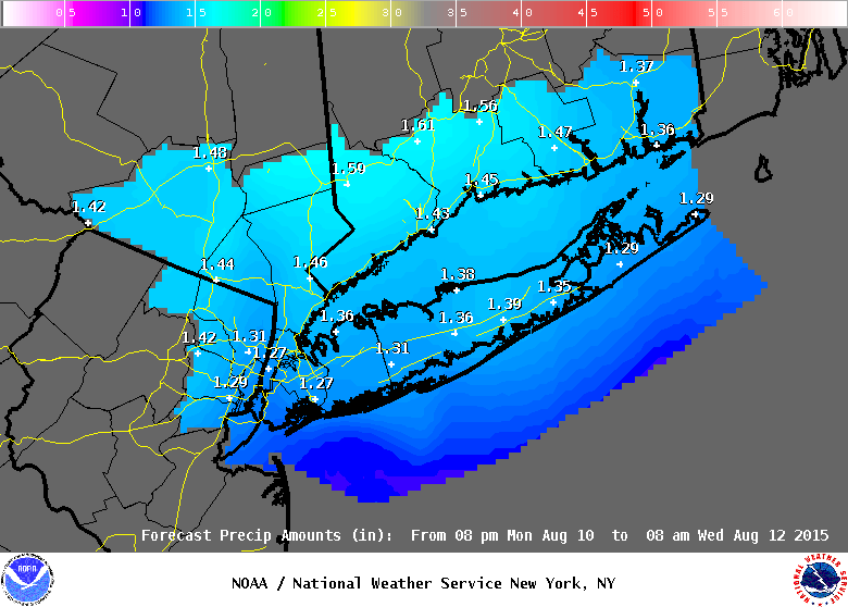
The National Weather Service forecast shows 1 to 2 inches of rain everywhere in its responsible zone area. We will wait for the other forecast offices to see what they do but they should be pretty much in line with this. Maps courtesy of Tropical Tidbits