
Lets put Erika aside for the moment because I really don’t think it is an issue for the northeast and middle Atlantic states and focus on the long range upper air pattern. The old definition of a heatwave used to be 5 days of 90 plus. Then it was changed to 3. If the long range upper air pattern that is setting up is correct then we may take out the 5 days and then some as we have a big ridge that is setting up in the east and it looks like it is going to hold for a good week to 10 days before breaking down. The outcome from day to day will be sunshine, little rain, and heat with highs in the 90s and nights in the 70s! It seems that it has waited all summer for this to set up as we now move into September.
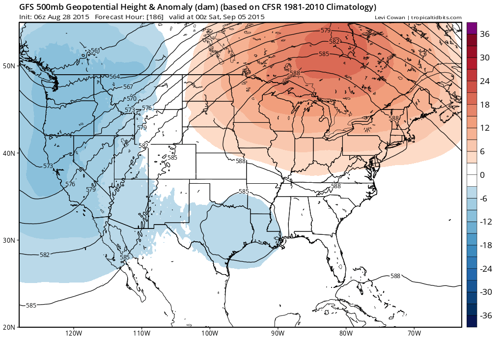
If this pattern is remotely close to being correct then we won’t get a break from this until September 10th!

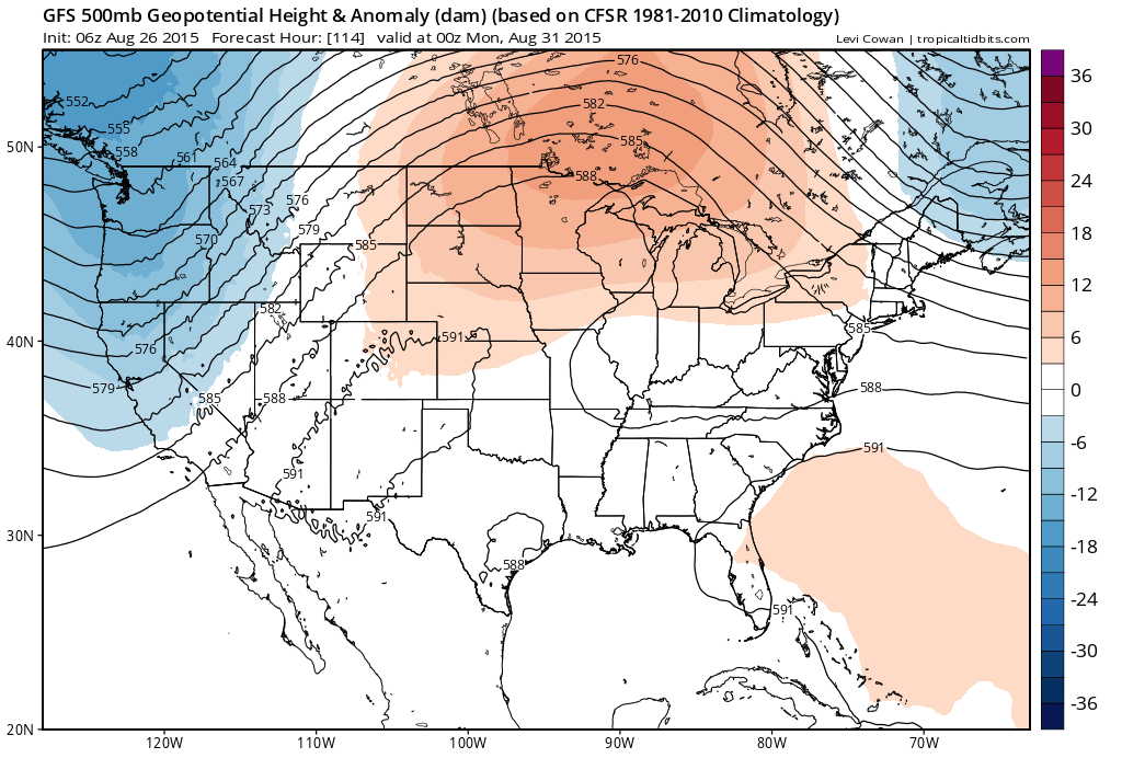
This ridge builds as a deep troung develops in the west along and off the pacific coast while a deep trough also forms in the Atlantic to our east and nothing seems to be moving or trying to break through to smash the ridge down.

This is an unusual set up though not unheard of. This type of pattern might be more likely in late June through early August but there have been long heat waves that have developed in the late August early September time frame.

 It isn’t until it finally breaks down on this model along or about September 10th! At least beach season will be prolonged.
One thing with regards to Erika and the tropics in general. First off one will need to consider that the weak steering that may be present might keep Erika around Florida (assuming it gets there in one piece) and make it a big rain maker for Florida and parts of the southeast. The other is that with this sort of upper air pattern, any other tropical systems that might form will not have the set up needed it to drive them up the east coast.
With regards to rain, this pattern is very dry so unless there is an isolated thunderstorm in the mix, we could really wind up baking the ground to cement.


