Weather Models Zeroing In On Second Low Verses The First
Weather Models Zeroing In On Second Low Verses The First
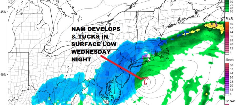
Most times when weather models show double lows so close together, it often gets resolved where one low becomes more important than the other and instead of 2 events you wind up getting just 1 or the first one is weak and the second one stronger. Weather models continue to trend in this direction where the system for Tuesday becomes less important and the second one for Wednesday and Wednesday night becomes more important. The late afternoon NAM model continues to lead us in this direction. The problem all along has been too much energy running around and models having a difficult time figuring out how this puzzle gets solved. The trend this afternoon is for the bulk of this precipitation coming from the second low late Tuesday night through Wednesday night. If model trends continue on this road, the threat for snow in most areas will go up considerably including areas north and west of NYC.
NAM MODEL WEDNESDAY EVENING 8PM
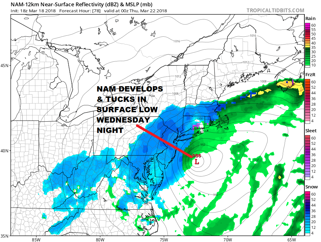
All this model jumping around has been dizzying over the last few days but not unexpected. However at least today all of the models seem to be coming together on this idea so lets see if the overnight series continues to tighten up around a strong low just offshore for midweek.
Meanwhile the weather remains relatively calm and quite though cold. Skies are clear across much of the southern areas of the Northeast and Middle Atlantic States with just some clouds inland. The deep snow cover inland is evident on the satellite picture below.
US SATELLITE

REGIONAL RADAR

Look for a cold clear night with lows in the 20s to near 30 and teens in the cold areas in the Hudson Valley and interior Connecticut. Monday we should see a fair amount of sunshine with highs in the 40s before high clouds start rolling in later in the day and at night.
Weather conditions will start to deteriorate on Tuesday with a cold rain developing over Southern New Jersey and Southeastern Pennsylvania. During Tuesday night the precipitation spreads northward reaching Southern New England Wednesday morning. Rain changes to sleet and then to snow everywhere and continues into Wednesday night.
JOE’S EARLY CALL SNOW FORECAST MAP FOR TUESDAY & WEDNESDAY
MARCH 20-21, 2018
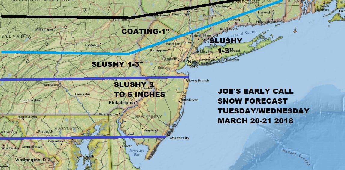
This is my early call but bear in mind this will change considerably if the trend of a stronger second low continues overnight and on Monday. Precipitation intensity and time of day will play a role of course.
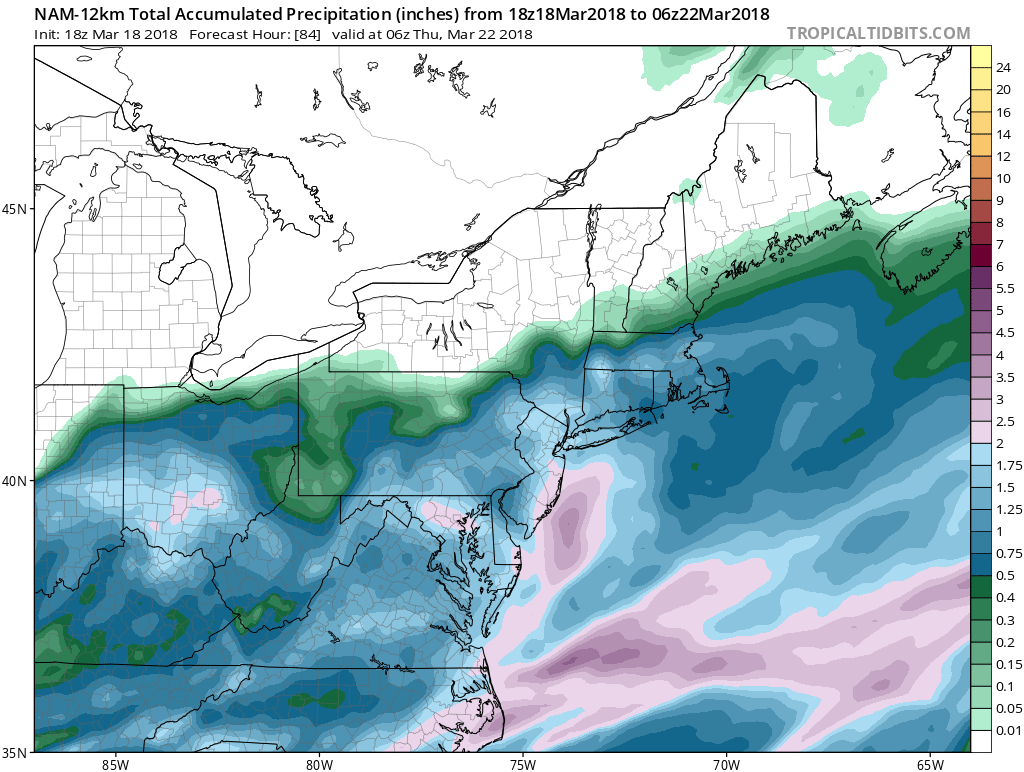
The NAM idea has a pretty wet scenario through Thursday morning 2am (and it is not done yet). 1 inch plus liquids penetrate pretty far inland. Again we need to wait for puzzle pieces to continue to tighten up and latch together overnight and on Monday before drawing final conclusions. In the meantime we carry on.
 GET JOE A CIGAR IF YOU LIKE

FiOS1 News Weather Forecast For Long Island
FiOS1 News Weather Forecast For New Jersey
FiOS1 News Weather Forecast For Hudson Valley


