Weather Models Stormy Pattern Ahead?

Weather Models Stormy Pattern Ahead?
We have telegraphing a pattern change for the second half of Novmeber and since the second half of November begins on November 16th, we are beginning to see model trends toward that idea. However I want to point out that I am still viewing this with some skepticism since the drought pattern has such a stranglehold on the Eastern US that it may take alot to break the back of the drought. It also appears that the stormier part of the pattern is wanting to change before we see a more solid change to something colder. That part of the equation may take more time to work out.
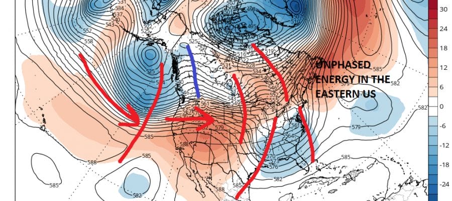
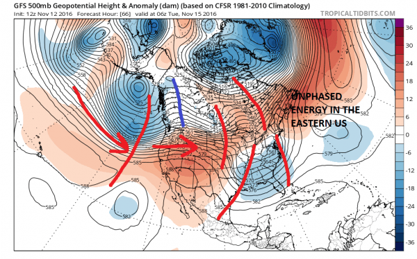
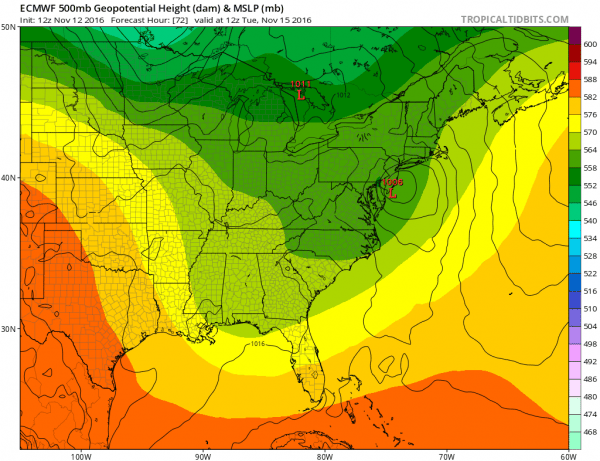
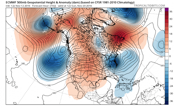
Both the GFS and European model show low pressure on Tuesday moving up the east coast. This is a small weak system that is among 4 weak systems shown on the map above. The fact that there 4 separate streams of energy all separate from each other, and that there is no 1 phased system is the reason why this system for Tuesday is going to be relatively weak. The fact that we are actually seeing more energy running around is a positive for the longer term.
The first system is weak on both weather models but the European weather model has a slightly more robust low. Much of the rain with this will be along the immediate coast rather than inland. Once this is done we turn our attention to the west where both weather models show a rather robust system that follows from the Pacific and is ejected eastward.
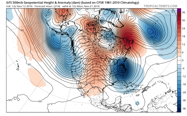
Now from here as the ridge breaks down in the east, the upper air system in the Plains is kicked eastward. To the north is energy in Canada that is dropping southward. The result on both models is to eventually phase all this along the east coast. The differences are a matter of timing as the GFS gets to the same place the European does only 24 hours later.
At this stage of the game skepticism is very high. Both models show strong lows just off shore and imply nor’easter conditions. Both models would also imply enough cold air for some snow well inland especially in elevated areas. One big negative in all this in the big picture is the fact that last week, the European had a 965mb low sitting in Southern New England on Tuesday for this first event and we know that ‘s not going to happen. So we need to look at this with a large degree of skepticism. The fact that the southern part of the jet appears to be getting active is a good sign to at least get the drought pattern to relax its stranglehold.
With regards to the colder part of the equation that at this point remains elusive until the pattern across Canada can correct itself. There is some evidence that may start to happen soon if one believes longer term indicators. But for now, any cold air will be generated by the cyclones themselves. This would favor some snow possibilities in parts of the Northeast away from the coast. Needless to say we have a long way to go here.
MANY THANKS TO TROPICAL TIDBITS FOR THE WONDERFUL USE OF THE MAPS
SNOW REMOVAL COMPANIES FOR YOUR WINTER NEEDS
LONG ISLAND ROCKLAND COUNTY Connecticut
WINTER 2016-2017 PART 1 OCEAN WATER TEMPERATURES
WINTER 2016-2017 PART 2 ARCTIC SEA ICE AND SIBERIAN SNOW COVER
FiOS1 News Weather Forecast For Long Island
FiOS1 News Weather Forecast For New Jersey
FiOS1 News Weather Forecast For Hudson Valley
NATIONAL WEATHER SERVICE SNOW FORECASTS
LATEST JOESTRADAMUS ON THE LONG RANGE
Weather App
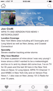
Don’t be without Meteorologist Joe Cioffi’s weather app. It is really a meteorologist app because you get my forecasts and my analysis and not some automated computer generated forecast based on the GFS model. This is why your app forecast changes every 6 hours. It is model driven with no human input at all. It gives you an icon, a temperature and no insight whatsoever.
It is a complete weather app to suit your forecast needs. All the weather information you need is right on your phone. Android or I-phone, use it to keep track of all the latest weather information and forecasts. This weather app is also free of advertising so you don’t have to worry about security issues with your device. An accurate forecast and no worries that your device is being compromised.
Use it in conjunction with my website and my facebook and twitter and you have complete weather coverage of all the latest weather and the long range outlook. The website has been redone and upgraded. Its easy to use and everything is archived so you can see how well Joe does or doesn’t do when it comes to forecasts and outlooks.
Just click on the google play button or the apple store button on the sidebar for my app which is on My Weather Concierge. Download the app for free. Subscribe to my forecasts on an ad free environment for just 99 cents a month.
Get my forecasts in the palm of your hand for less than the cost of a cup of Joe!

