
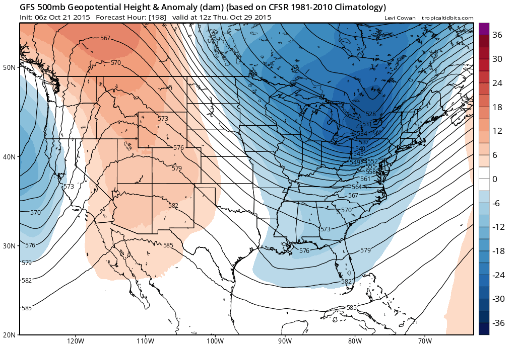
Weather models and model run to run frustrations continue from a forecast standpoint in that what happens on one run is gone in the next as there just seems to be so much going on impacting how everything gets resolved. The European model yesterday showed a fairly dynamic set up developing over the longer term (later next week) as did the Canadian to a lesser degree and then the Gfs which showed very little. The issue is how models handle the northern and southern stream energy and whether it phases or not and how it phases. I laid out here the European from yesterday with the 2 overnight runs of the Gfs. The Euro is the one in the middle and you can see how much more dynamic the European is (or was) from the other 2 gfs runs.
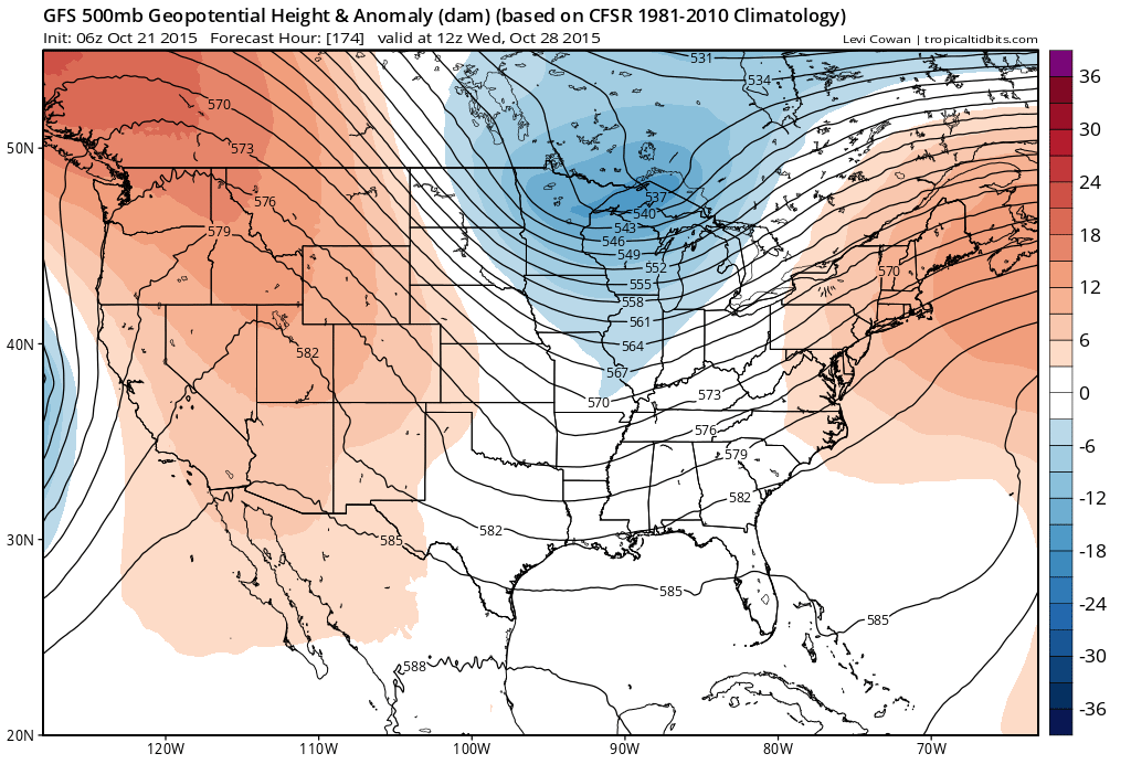
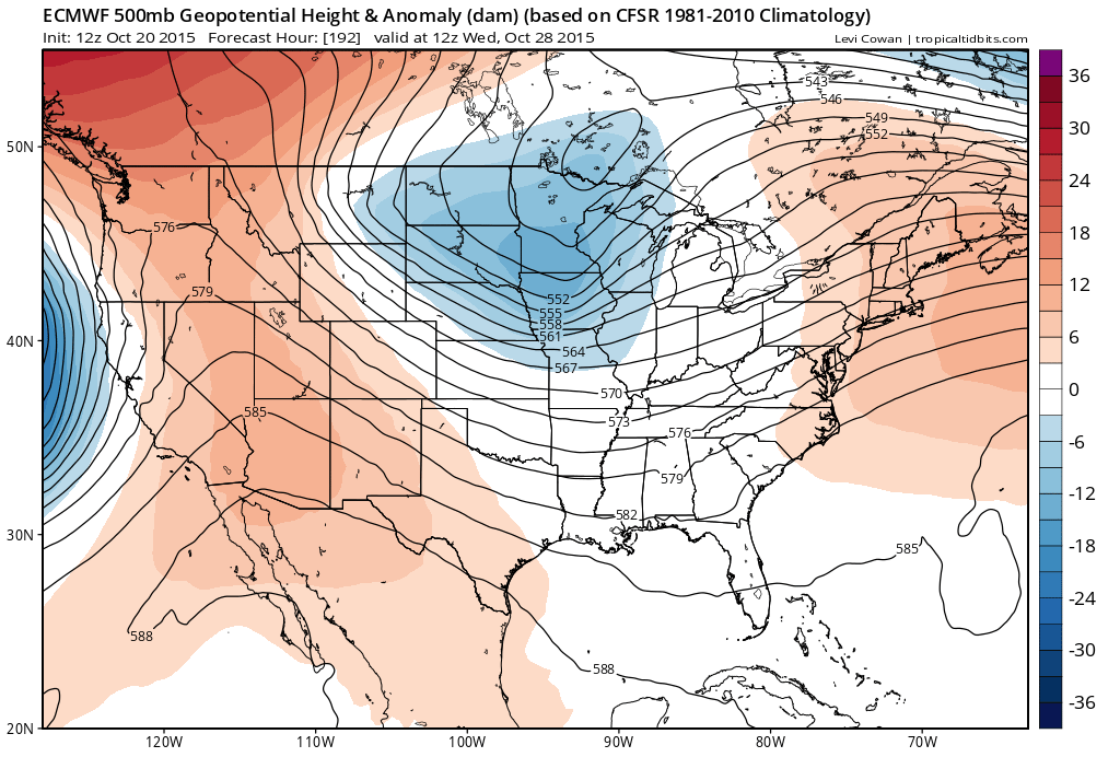 The overnight series of the European has pretty much backed away from a dynamic upper air look and has just a cold front with rain ahead of it. Im not surprised at this as it has been the order of the day for that model for weeks. The GFS and the Canadian on the other hand have on the most recent run, developed a more intense upper air regime and a colder overall look to it.

The bottom line is that its going to morph again in a few hours. Normally you can figure out something regarding consistency from run to run but there really just isn’t any which gives them all the opportunity to be completely wrong.
No real changes in the short range outlook as I check thing this morning other than the fact the models want to bring Sunday’s cold front through just a little bit faster and and it through here by Sunday morning instead of late in the day. This probably means a little temperature adjustment for Sunday may be in order and I might go a little lower. Also the front does seem to produce a few showers late Saturday night into Sunday morning. 70s here today and Thursday..then 50s Friday and 50s to lower 60s Saturday.
Tropical Storm Patricia forms south of Mexico and is forecast to move inland. It is also forecast northward and the moisture could make its way into East Texas. I will have more on this later.
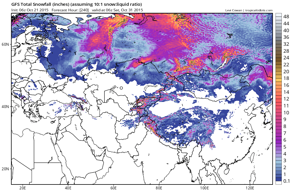
Finally this morning there is always Siberian snow cover growth over the next 10 days and there is no change here as models continue to show rapid growth south of 60 north. This is actually the total snowfall forecast to fall over the next 10 days.
We also figured we may as well show you the Canadian model snow for Eastern Canada which looks fairly busy. This is another area where the growth of snow cover is running above normal this fall.

This is all food for thought this morning as I try to wake up and get going today.