Weather Models: Near Record Warmth, Cooler Weekend
We are coming toward the end of this warm spell. The last 2 days were really great for early November. But now moisture is going to begin to get involved at low levels. High pressure is setting up an onshore flow beginning tonight and while the air is relatively dry for the time being, the low levels will saturate and some clouds will arrive. After midnight some fog is likely to develop along coastal areas and gradually move inland. How far inland remains a question. There should be a few hours with clear skies and light winds so this should allow temperatures to drop perhaps into the 40s in coldest spots before the fall comes to a grinding halt.
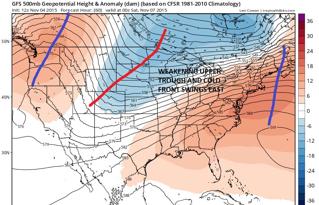
Most weather models bring in a little light rain or drizzle in the area later Thursday or Thursday evening. I don’t think it amounts to much. What is happening aloft is that the east coast ridge that has been strong all week is finally weakening and allowing the next cold front to approach and move through here for Friday night. Temperatures Thursday will be in the 60s to near 70 because of clouds but Fridays highs should be in the low to mid 70s which could approach records in some places.

Everything in the atmosphere is moving along at a decent clip. The upper air support is lacking so once the front hits the coast Friday evening there will be one or 2 showers with it and then that should be it. Once it moves offshore the weekend looks good and so does Monday of next week.
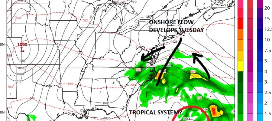
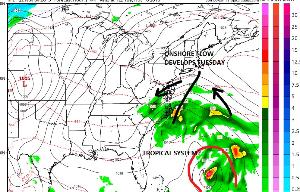
Beyond Monday a few question marks develop. The flow is forecast to become onshore again. The GFS and other weather models form a low off the Mid Atlantic coast and embedded in that is some sort of tropical system. How real that is I’m not exactly sure. The gfs model has been doing this for a few days. Other models seem to put more emphasis on a low offshore that is non tropical in nature. Either way it does open the door for at least some clouds here Tuesday into Wednesday and we will lean in this direction for now and wait for later weather models to figure out just exactly what is going on.
Longer term I posted about this earlier today. There does not appear to be anything in the longer term however the day run models especially the European had a slightly different look to it down the road. Im going to look at this a little deeper and time permitting will post about this during this evening.