
Since the long range adventure continues to be a four times a day ride down all sorts of roads, I thought I’d take a look today with regards to any clues beyond the 5 day period. A couple of things that stand are the fact that the GFS weather model has another tropical storm of some sort forming north of Puerto Rico and heading for the Bahamas. We just had Hurricane Kate move out to sea today so there is still time from the standpoint of climatology for another one to occur. Also there are mixed signals now in the NAO/AO/PNA indicators. The index charts this morning show the North Atlantic Oscillation going negative but some members stay positive. The Atlantic Oscillation on the other had has some of its members going negative and some of the member staying slightly positive. The PNA or Pacific North America indicator which has been been slightly negative for the last few weeks is trending to neutral and forecast to turn slightly positive. A positive PNA favors a colder pattern.
The frustration in all this, and now you can see it first hand with my posts from the last week or so, is the volatility of models drives you crazy!! It seems weather models offer changes beyond day 10 except that each run it is beyond day 10 and another week goes by! So we will try to make sense of today’s weather models.

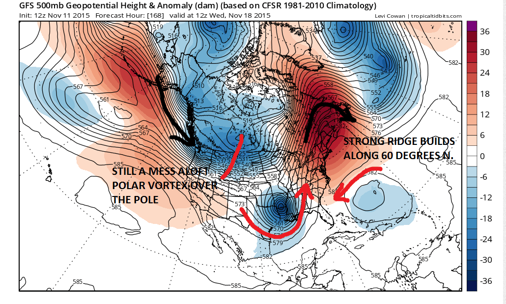
First off there is the GFS at day 7 which is a week from today. There are all sorts of things going on. The vortex is still locked north of Siberia at high latitudes however there is a strong ridge forecast to build along 60 degrees west and it builds all the way up to Greenland. At this point we have the NAO and AO index dropping from strongly positive to near the zero line. Also there is a strong system in the southern stream moving into the Central Gulf of Mexico. East of Florida is a possible tropical system that is being indicated. It is sort of crazy quilt of things all over the place and frankly I can envision all sorts of different outcomes from all of this beyond day 7.

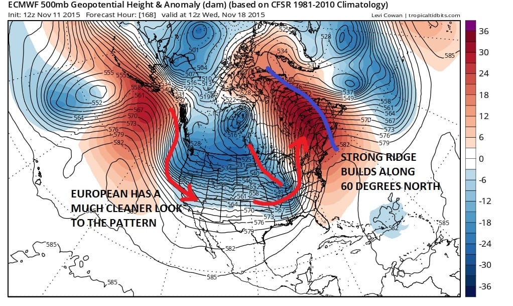
The European is not that different from the GFS weather model. It just has a much “cleaner” look to it especially in the Pacific. Both models have the strong ridge along 60 degrees west. Both models have the vortex complex well north of Alaska and Siberia. The question for both of these models is where it goes from here.
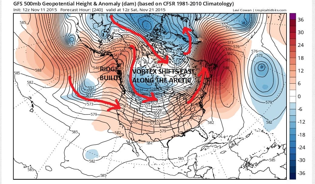
By day 10 both the GFS and European weather models have interesting developments. Both seem to start to show signs of the vortex shifting away from the arctic and move more to east. The European has this a bit more than the GFS but the idea is similar on both models. The European has the colder flow coming into Canada for the first time a quite a while. The overall look still appears to be something in flux. The ridge is still rather strong in the east with the GFS showing the ridge further east than the European. There appears to be the look of change here. However again I caution the volatility of the models is going to make this change again. Also the question is if this is correct, does it hold or does it change again?
 It is hard to draw any conclusion from this with regards to the second half of the month. The atmosphere seems to be battling all these forces all at the same time with regards to el nino/nao/ao/pna. The last 3 are coming off recent peaks. El nino seems to be strengthening again based on latest water temperatures. All I can say going forward is let’s wait for the next run and see where it takes us.