
Weather Models: Joestradamus Is On Watch!
When we look at the overall upper air pattern across the northern hemisphere we can see what happens when you have the Atlantic Oscillation and North Atlantic Oscillation at probably the highest postive number we have seen all year. This is about as far as opposite as you can get with regards to a weather pattern that looks like late fall or early winter.
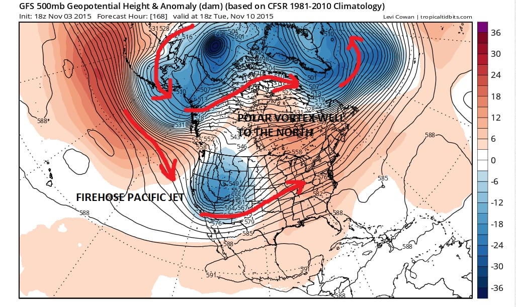
One of the signature characters of the strong postive Atlantic and North Atlantic Oscillations is that the polar vortex pulls well to the north toward the North Pole. Notice on both the 168 hour and the 240 hour GFS (and other weather models confirm this) the vortex is sitting north of Alaska! If you follow the arrows around it tells you how weather systems are moving and where our air is coming from. There is no cold air intruding into the United States from anywhere. Eve the coolest of air moving into Southwest Canada over time is not truly polar air. There is nothing in the flow that can bring cold air here until that vortex near Alaska either breaks down or reforms somewhere else. You need to create a flow from Alaska to the Southeast US coast to get cold air in here (in general..there are other ways) and you can’t get it with a pattern like this.
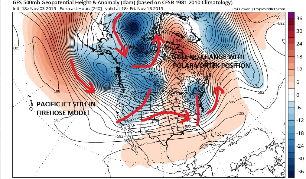
What may be a little different here however is the firehose Pacific Jet does begin to bring weather systems into the west and those weather systems will be moving across. If the east coast ridge weakens as the model shows it will allow these systems to move across and create a more active pattern with regards to chances for rain. The best we will be able to do with regards to cold air will be produced perhaps by developing lows or what I call do it yourself cold air. It is air that is not really polar in origin but is created by the dynamics of the atmosphere. This time of year snow lovers won’t be able to do much with that.
Now beyond the 10 day period the long range GFS weather models or the ensembles were pointing to the both oscillations coming back to neutral and going negative around mid month. This could be the reason why the weather models (both the European and the GFS) have a stormier look to them. We have been down this road before so I will wait to see a turn before I actually believe it. There are other indicators that argue against this so until proven otherwise we will approach this with a cautious eye. Even if it does change there needs to be a few other things that have to realign in order to see the pattern truly change.