
Weather Models Back Off From Interior Snows

Weather Models Back Off From Interior Snows
It is not as if the models are saying no snow across the interior Northeast this weekend. However weather models except for the Canadian are handling the events in the east differently than the last few days. The key to all of this is a coastal low that is going to develop offshore. This low was going to be the block required to force the approaching Great Lakes system to dive further south and east and be very deep. Weather models except for the Canadian seem to be backing away from this idea with a weaker low offshore.


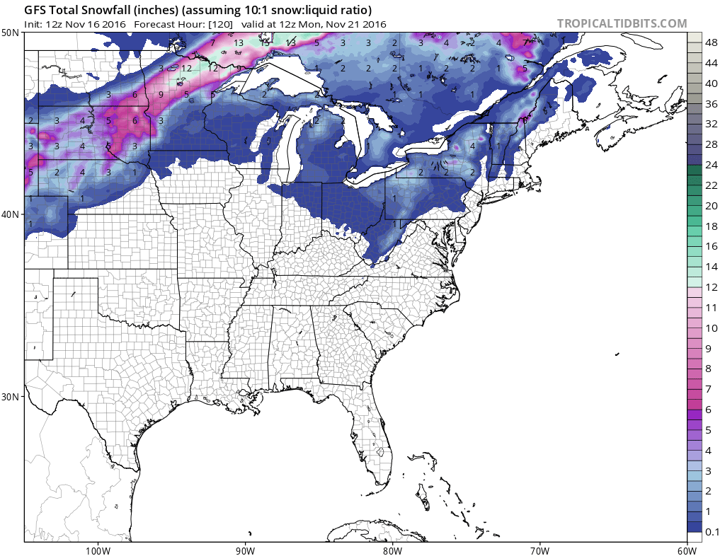
Above we have the GFS model forecast for Friday night. The top map is yesterday’s. The bottom map is today’s. The Atlantic storm is less deep on today’s run. This causes the approaching system from the west to essentially move along to the east. According to the GFS model, this would mean a simple cold front coming through late Saturday and then colder for Sunday into Monday with some lake effect snows to the north but nothing extraordinary.
The European weather model still has a rather vigorous upper feature further south than the GFS however it is also less deep than shown over the last several days.
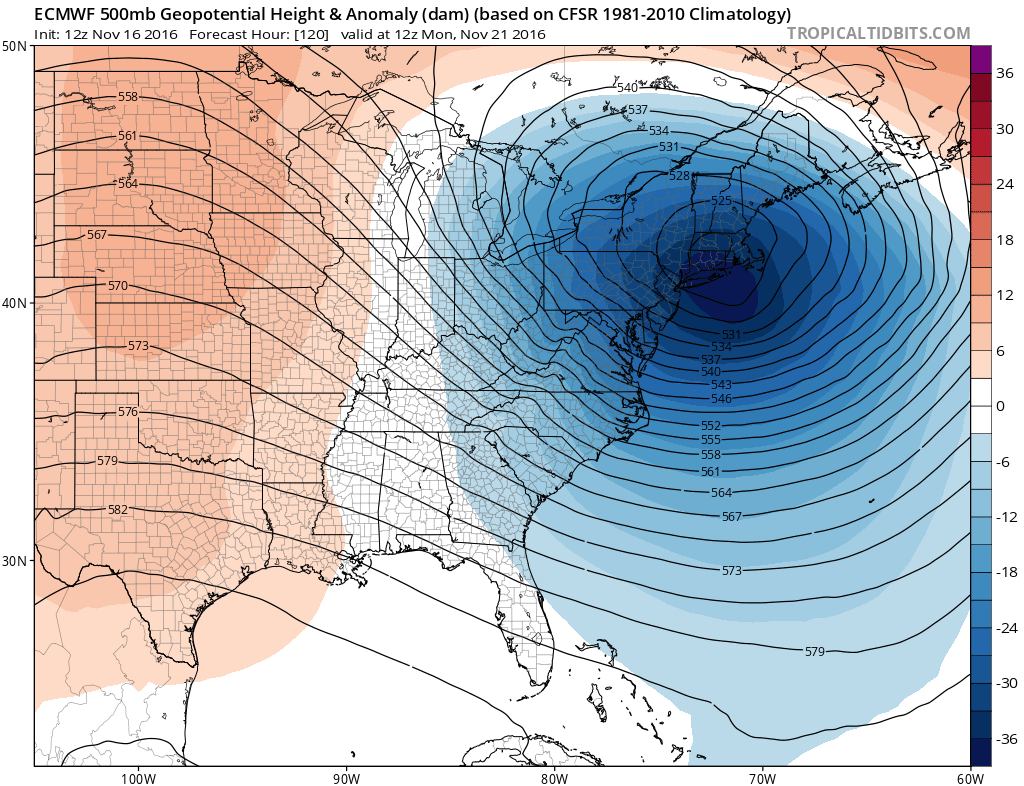
The Canadian weather model remains the deepest and the strongest of all the models and still holds the door open for a more robust snowfall for the interior northeast and the snowbelt areas.

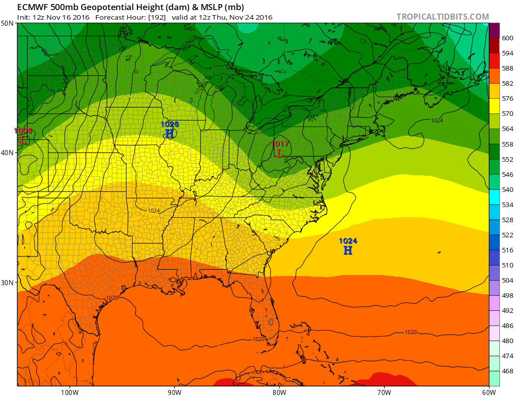
From a forecast standpoint, since the key to all this is the Atlantic offshore low and how it interacts with the next system, we will have to wait for a few more runs to see if the weaker look going forward is indeed the cast. The strength of this lead system is important because it will set the table for a possible future weather event later Thanksgiving week. If it is weaker, there will be less blocking and the next system could probably go left as the GFS suggests…or if it is stronger, it could force a colder look in the northeast later next week and cause the next weather system to pass to the south as per the European model.
MANY THANKS TO TROPICAL TIDBITS FOR THE WONDERFUL USE OF THE MAPS
SNOW REMOVAL COMPANIES FOR YOUR WINTER NEEDS
LONG ISLAND ROCKLAND COUNTY Connecticut

![]()


WINTER 2016-2017 PART 1 OCEAN WATER TEMPERATURES
WINTER 2016-2017 PART 2 ARCTIC SEA ICE AND SIBERIAN SNOW COVER
FiOS1 News Weather Forecast For Long Island
FiOS1 News Weather Forecast For New Jersey
FiOS1 News Weather Forecast For Hudson Valley
NATIONAL WEATHER SERVICE SNOW FORECASTS
LATEST JOESTRADAMUS ON THE LONG RANGE
Weather App

Don’t be without Meteorologist Joe Cioffi’s weather app. It is really a meteorologist app because you get my forecasts and my analysis and not some automated computer generated forecast based on the GFS model. This is why your app forecast changes every 6 hours. It is model driven with no human input at all. It gives you an icon, a temperature and no insight whatsoever.
It is a complete weather app to suit your forecast needs. All the weather information you need is right on your phone. Android or I-phone, use it to keep track of all the latest weather information and forecasts. This weather app is also free of advertising so you don’t have to worry about security issues with your device. An accurate forecast and no worries that your device is being compromised.
Use it in conjunction with my website and my facebook and twitter and you have complete weather coverage of all the latest weather and the long range outlook. The website has been redone and upgraded. Its easy to use and everything is archived so you can see how well Joe does or doesn’t do when it comes to forecasts and outlooks.
Just click on the google play button or the apple store button on the sidebar for my app which is on My Weather Concierge. Download the app for free. Subscribe to my forecasts on an ad free environment for just 99 cents a month.
Get my forecasts in the palm of your hand for less than the cost of a cup of Joe!
![]()
