
Catastrophic Hurricane Patricia is making landfall as a category 5 hurricane near Puerto Vallarta Mexico. All weather models support the idea of some of the moisture from Hurricane Patricia heading our way Wednesday into Thursday morning of this coming week. In fact models have been noticeably faster with moving this along as high clouds could arrive here later Tuesday afternoon with rain here by Wednesday morning.
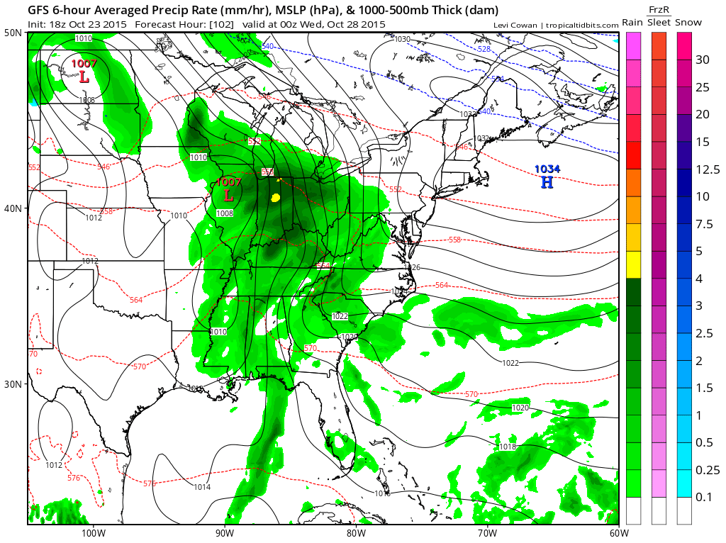
The weather models starting with the GFS have it pretty clear with a low that develops this weekend in the western Gulf of Mexico moves northeast up the west side of the Appalachians with a warm front to the coast. There should be a strong southeast flow that sets up ahead of this providing good moisture inflow and with some luck we will get a little tropical enhancement from whatever is left from Hurricane Patricia.I’m hoping the outcome from all this is a sold couple of inches of rain when it is all said and one. With the faster motion the rains could be done here overnight Wednesday night and we will be drying out on Thursday.

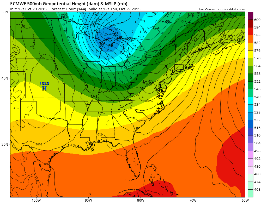
Weather models are always one to play catch up to reality and the faster speed makes sense given the fact that Hurricane Patricia is coming ashore about 8-10 hours faster than earlier forecast. The European model idea isn’t too much different.
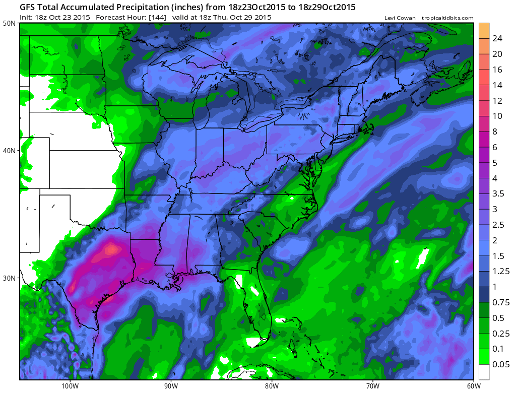
With regards to rainfall the weather models from the GFS to the Canadian are pretty similar with the rainfall forecast showing about 1 to 2 inches of rain with heavier amounts to the west of the coast. Im going along with this for now. What will be interesting to see this weekend is whether the remnants of Hurricane Patricia have a surviving core and reform into a tropical storm in the Western Gulf of Mexico later Saturday or Sunday. The hurricane will be moving across mountainous terrain but it will be doing so pretty fast thanks to a strengthening southwest flow aloft. It is possible though I don’t think it alters the forecast logic for next week.

By Thursday morning even the European has the rain long gone from here as colder air returns which sets us up for dry conditions for the end of next week. Longer term I still think the pattern is getting much more active and each day we will see something new on the weather models to look forward to as we move into early November.
For the latest on Hurricane Patricia go to the tropics page on the website. The latest local forecast for the weekend into early next week is also available. Finally download my weather app and subscribe to my forecasts. The app is free and the subscription is just 99 cents.