Weather Model Confusion Friday

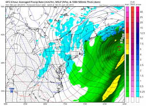
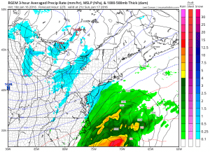
We are slowly but surely progressing to the weekend and we still have not completely resolved the issue of the coastal low offshore and the weather system approaching from the Great Lakes. Models tonight are enhancing some light precipitation along some coastal areas but they all do it in slightly different ways. They all seem to have some sort of trough moving through here Friday morning.
Weather Model Confusion Friday NAM GFS & RGEM FOR FRIDAY


 All three models seem to have something going on near the coast with the Canadian RGEM model the most bullish such as it is with precipitation amounts with the coastal low. Amounts are light and around .10 of an inch except between .15 & .20 over Central and Eastern Long Island and the Eastern half of Connecticut. The RGEM suddenly is the slowest of the bunch and the furthest west of all the models. Right now the precipitation is so light that inspite of the cold air aloft the model is calling for rain. This probably means that the bottom of the atmosphere is not sufficiently cold enough to support anything more than a mix.
Weather Model Confusion Friday NAM GFS & RGEM FOR FRIDAY PRECIPITATION FORECAST
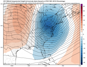
All of this is due to how the models are dealing with the deepening trough in the East and how progressive it is moving west to east.
The GFS shows a rather impressive looking trough by Friday morning and that in and of itself would produce some precipitation. The problem is that the trough sharpens a little too far east to impact the coastal low. We can’t see the upper air from the RGEM but given the position of the coastal low it would suggest it is probably a shade west of the GFS.
For now I think the best approach is for a period of wet snow mixed with rain between late Thursday night and early Friday afternoonfor all areas from Eastern Pennsylvania to Southern New England is probably the best approach with this until we can resolve this mess. It is very odd to see the models so wide apart this late in the game regarding this so we have to unfortunately punt until the next 2 runs to get a firm grasp of all this. Either the cold front will cause some precipitation to fall inland, or the coastal low will produce something for the Jersey shore Long Island and Connecticut, or possibly both.
Weather Model Confusion Friday Satellite & Radar Loops


Right now the satellite loop shows a well defined system moving through the Great Lakes while the Southeast radar shows some showers developing that will move into the Southeast and eventually the Carolinas. The RGEM solution is intriguing because it deepens the surface low so far to the west. To be honest, I’m not sure how this is all going to play itself out.
In the meantime Thursday should be a little colder than Wednesday with sunshine giving way to arriving clouds followed by something (God knows what) later Thursday night or during the day Friday. Highs Thursday and Friday should be in the upper 30s to around or just over 40 except lower 40s in areas further south.
NATIONAL WEATHER SERVICE SNOW FORECASTS
LATEST JOESTRADAMUS ON THE LONG RANGE
Weather App
Winter is here! Don’t be without Meteorologist Joe Cioffi’s weather app. It is a complete weather app to suit your forecast needs. All the weather information you need is right on your phone. Android or I-phone, use it to keep track of all the latest weather information and forecasts. This weather app is also free of advertising so you don’t have to worry about security issues with your device. An accurate forecast and no worries that your device is being compromised.
Use it in conjunction with my website and my facebook and twitterand you have complete weather coverage of all the latest weather and the long range outlook. The website has been redone and upgraded. Its easy to use and everything is archived so you can see how well Joe does or doesn’t do when it comes to forecasts and outlooks.
Just click on the google play button or the apple store button on the sidebar for my app which is onMy Weather Concierge. Download the app for free. Subscribe to my forecasts on an ad free environment for just 99 cents a month.
Get my forecasts in the palm of your hand for less than the cost of a cup of Joe!


