
Weather Forecasting Models Hinting at 1 More Tropical System?
From the standpoint of this meteorologist, this tropical season has been easy to predict in some ways and frustrating in others. The most frustrating thing is the fact that weather forecasting models were over zealous in developing numerous tropical storms and hurricanes that simply never happened. Now that the season is winding down to a close it is probably only fitting that there could possibly be one more and weather forecasting models such as the European and the GFS model are doing just that.
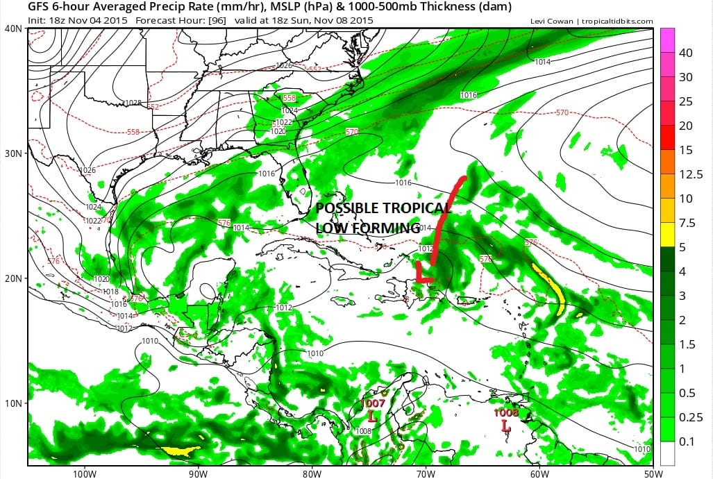
This is the GFS forecast map for Sunday afternoon and you can where I marked this out on the map that there is some sort of low that is going to form north of the islands. This appears to be a low shear enviroment that the low finds itself in.

November tropical storms don’t happen every year and it is quite likely that if this does occur it will probably be a system that never really gets going but the fact that the model has been doing this for days is something that up until know I have discounted. But since we are now within a short term time frame, the fact that it is still there has raised my interest a bit.
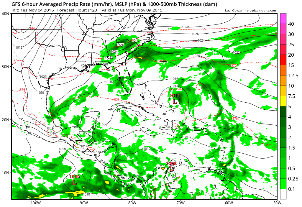
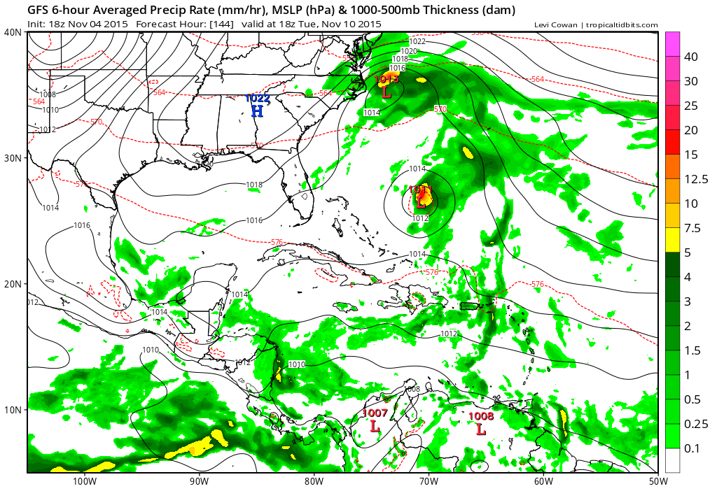
The model seems to want to develop a low there into next Tuesday. Notice there is also a non tropical system of some sort that forms off the Carolina’s and then moves it to just off the Virginia coast. High pressure to the north will likely produce some gusty winds from Virginia Beach southward based on this look. Models than couple the system and move it northeast from there which seems to be the most likely solution at this point.
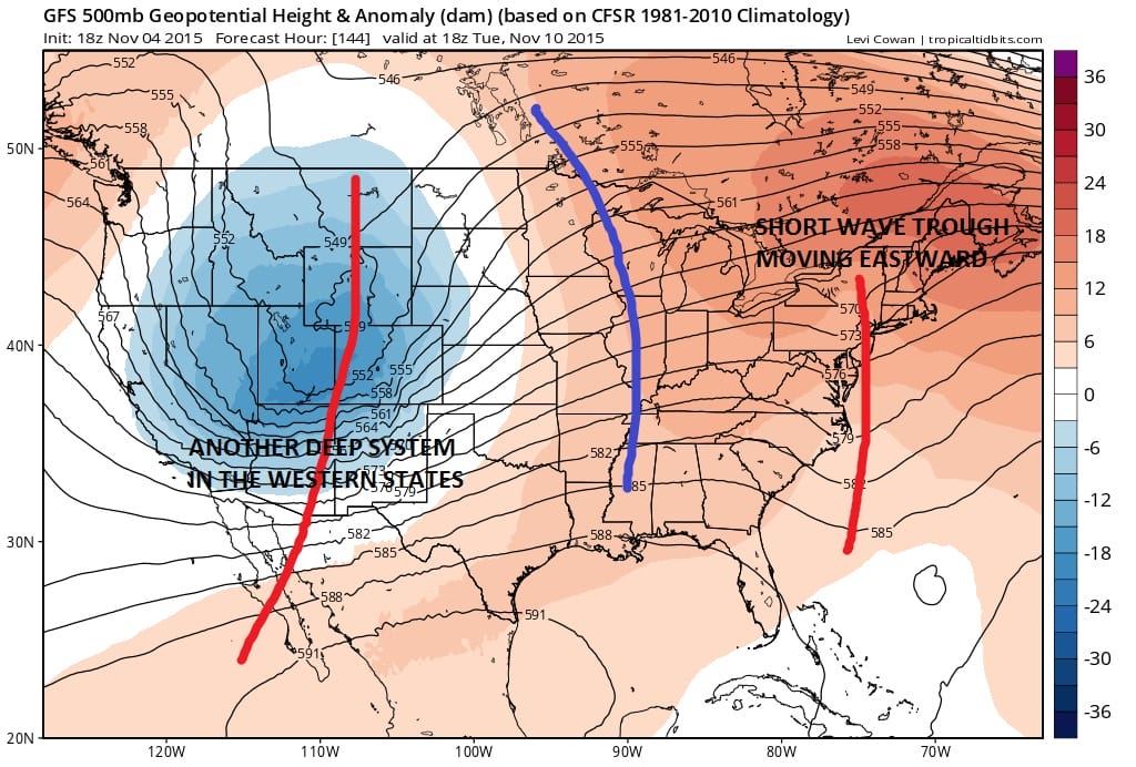
The upper air pattern here would not be conducive for any threat to the east coast given there is a short wave trough moving off the east coast and the flow is pretty much west to east. For Tuesday and Wednesday of next week the primary concern here would be whether any clouds (or any rain) from the non tropical system wind up further north then currently forecast. The European model takes a little longer with this but it ultimately winds up with the same solution at this point given the flow aloft.

Given that there really isn’t too much to watch, at least this gives tropical storm fans something to look at as the season draws to its inevitable close.