
Weather Forecast Models Diverge Longer Term
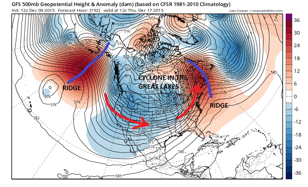
Weather forecast models and figuring out which one is right and which is wrong is never an easy thing. Today’s runs are a perfect example of this and set the table beyond the middle of next week in 2 different ways. Over the last few days JOESTRADAMUS has pointed out that how the models handle the cutting cyclones into the Great Lakes would have some impact in the weather over the northeast. It will be the difference between whether we see heating again with a strengthening east coast ridge (yet again) or something different as the European suggests.

These two models diverge significantly. The European certainly has a blockier look to it first off. Notice the model differences both in Eastern Canada and off the west coast. This is a huge difference because while one weather forecast model (gfs) would eventually fly the ridge back up aggressively in the east, the European has different ideas.
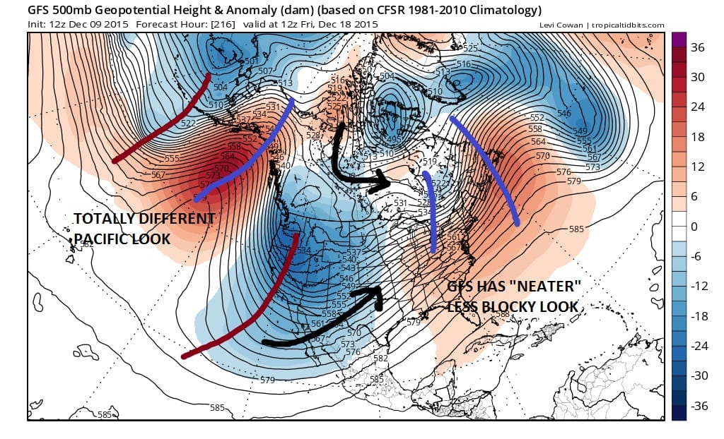

The looks on both models are totally different at day 9. The GFS would argue that the colder air for later next week would take us 20 degrees above normal to 5 to 10 degrees above normal. The European reshapes Eastern Canada enough to actually show a greater intrusion of colder air that would at least bring temperatures down to near normal over the east. Also the west is completely different as the GFS would imply another deep trough in the west. The European has a more blocky look all the way around. These are all very key differences. Is the GFS having trouble recognizing a blockier pattern after days of showing one….or is the European now reacting to a blockier pattern developing which up until now it has not had a handle on?
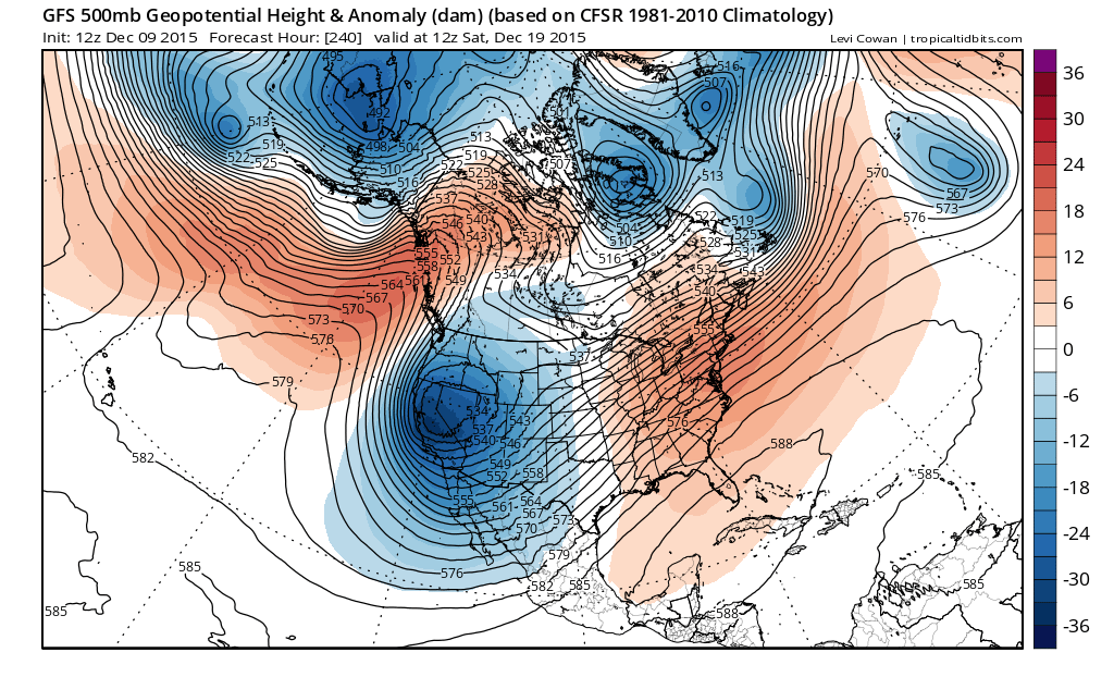
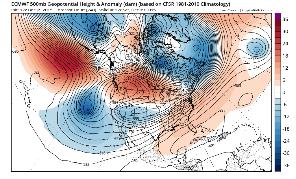
The differences only grow even bolder at 240 with the ridge in the east ready to fly up on the GFS again while the European holds the ridge back thanks to the stronger system in Eastern Canada. The European has a pronounced northern jet feeding in some colder air. The GFS would focus everything on one deep trough in the west. Why oh why are these things never easy????
Im not sure honestly which way this goes. In the end it will depend on which model is correct about the approaching cyclones that cut to the Great Lakes next week. The one for Monday at least brings an end to the extreme above normal temps. Too many questions beyond that to answer at this point.