
Weather forecast model known as the NAM or North American Model is a good but not perfect forecast tool for the short range and it has been rather bullish on rainfall for the next 2 days. It brings up the rain in waves with 3 ahead of the cold front and one just behind it. The plan is that each one will put down some rain and when it is done we can finish up with 1.50 to 2 inches of rain.
The satellite loop shows the clouds now beginning to move toward the north as the moisture to the west and south builds up a bit. You can see how it is fighting the dry air mass over New England which will eventually give way late this afternoon and this evening.


The first waves of rain are hitting that dry air on the northern fringe and that rain is falling apart but eventually as the air mass over us saturates, the rain will be able to hold together as it moves north. Some rain should reach Southern New Jersey this evening and Southeastern Pennsylvania and then gradually creep northward. The nam has rain here by morning though again it breaks the areas up so there should be some dry periods in between.
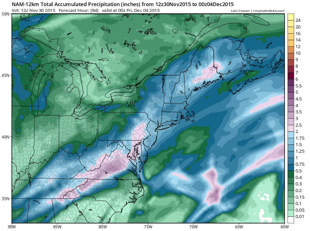
The total rainfall map shows the heaviest rain is a little west than it was earlier but the models do tend to shift areas from run to run. This the first substantial rain for the area in the last 10 days. Once this is done Wednesday evening it is likely that we will stay dry right through the weekend with temperatures near or a little above normal through the period. There are still no signs of any cold air building up in Canada. Even though meteorological winter starts on December 1st (three coldest months December-February), winter is not exactly going to arrive on time.
JOESTRADAMUS ON THE LONG RANGE


