
Weather Forecast Model GFS Overnight Confusing JOESTRADAMUS
Weather forecast model analysis isn’t easy. It is especially difficult right now as we keep seeing the GFS model do different things that lead you to believe change is coming and then goes right back to the dominant pattern. Last’s nights model run to be completely honest was utterly confusing to me. It seems that the active Pacific jet is now going into high gear which is creating all sorts of instability especially from day 10 onward. To be honest, I don’t really believe what the run did because some of it seems a little far fetched. Here is my latest video which explains it all as best I can. Again it was very confusing to me.
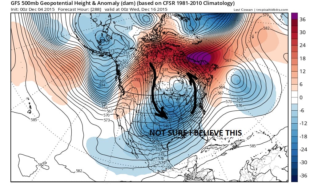
I’m not sure of so many things here. Some of it just doesn’t seem reasonable. The model has been guilty on and off for the last few weeks of overdoing development in the east. It has had a tendency to make upper lows in the east that never happen because of the strong mean ridge that has been unrelenting. The trough in the west has been so dominant and so has the vortex complex up in the Arctic. The same question remains. Is it beginning to break down and reposition. Today’s longer term NAO signals were trending toward neutral mid month. Is the model beginning to react to other things going on in the atmosphere around the globe? Needless to say we have to punt again.
With regards to the coastal low for Tuesday this model joins the European showing a much weaker system and we will wait until later today to render a verdict on that. I will update all of this during the day Friday especially after seeing the early morning gfs run and the overnight European weather forecast model. Something tells me I won’t know much more.
SHORT RANGE FORECAST FOR NEW YORK NEW JERSEY CONNECTICUT AND PENNSYLVANIA
SNOW CONTINUES IN THE WEST BUT IS LACKING IN THE EAST OVER THE NEXT 10 DAYS…SKIING OUTLOOK
UPDATED WINTER FORECAST FOR 2015-2016