
Weather For The Weekend: Looks Good Friday Through Monday!
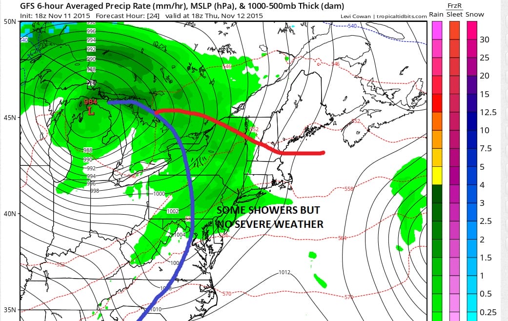
The forecast looks pretty straight forward over the next 5 to 7 days. No big storms are on the horizon through the middle of next week. The only issue is Thursday as a cold front approaches. That front is from a rather small but intense storm system that is moving through the upper Midwest. We are seeing strong thunderstorms tonight in parts of the upper Midwest however those showers and thunderstorms are not going to make it here. The low center is actually going to track well to our north and west. While some showers will survive the trip east, they won’t be severe and actually will be more of the nuisance variety.

Whenever you see the signature comma shape on the satellite loops or a radar it is usually a fairly intense feature. This is what we are seeing tonight. The track north and west means the southern end of the front will be the primary rain producer. We don’t have much moisture available since yesterday’s low spent it all out of the atmosphere. Rainfall amounts from the next front will likely be under a quarter of an inch. Skies tonight start partially clear but gradually become overcast by morning. Most temperatures overnight will be in the 40s to near 50. Highs Thursday with showers from mid morning to late afternoon in the mid 50s to around 60 or so.

Tonight the radar is quiet. What you see here are false returns that often happens under conditions of partially clear or clear skies with light winds. Nothing should appear on the radar until later tonight across western areas of this view.
Once the showers are done by late afternoon or evening Thursday we should see skies partially clear Thursday night. Friday through Sunday will be dry with sunshine each day and temperatures in the low to mid 50s for the highs which is about where we should be for this time of year.
JOESTRADAMUS ON THE LONG RANGE