
Weather For The Weekend: Cold & Dry
The weather for the weekend is cold and dry. By cold we mean normal for mid December cold, not arctic I will freeze in place cold. That cold air is only going to be with us for a very short time as there is no blocking and everything in the atmosphere continues to move right along. This means the blow torch returns to some degree next week with Christmas Eve (Thursday) likely to be the warmest day of the stretch.
Satellite loops show two distinct storm systmes. The one in the Atlantic is chugging along to the east while another weaker cylcone heads to the western Great Lakes. The trailing cold front is pretty obvious on the loop and it extends from the Ohio Valley southward. On that front a wave will develop and that will bring in rain during Thursday and Thursday night though it will be long gone by Friday morning.


We are beginning to see rain develop on the southeast radar loop and this will be where our rain will be coming from. It should be a decent shot of rain but it will be moving pretty quickly so it won’t have time to put down more than a half to three quarters of an inch. No rain tonight as clouds increase. Then rain moves into southern areas of New Jersey and Southeast Pennsylvania in the early morning and reaching northern and eastern areas by mid morning to noon.
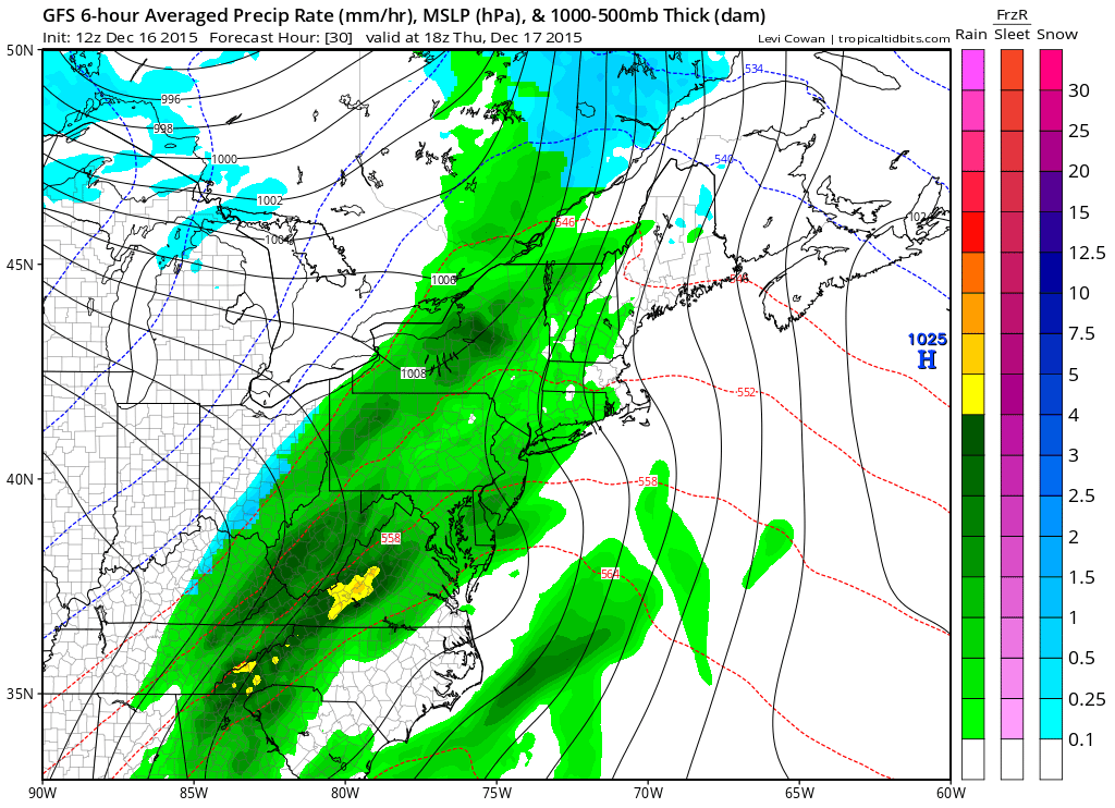
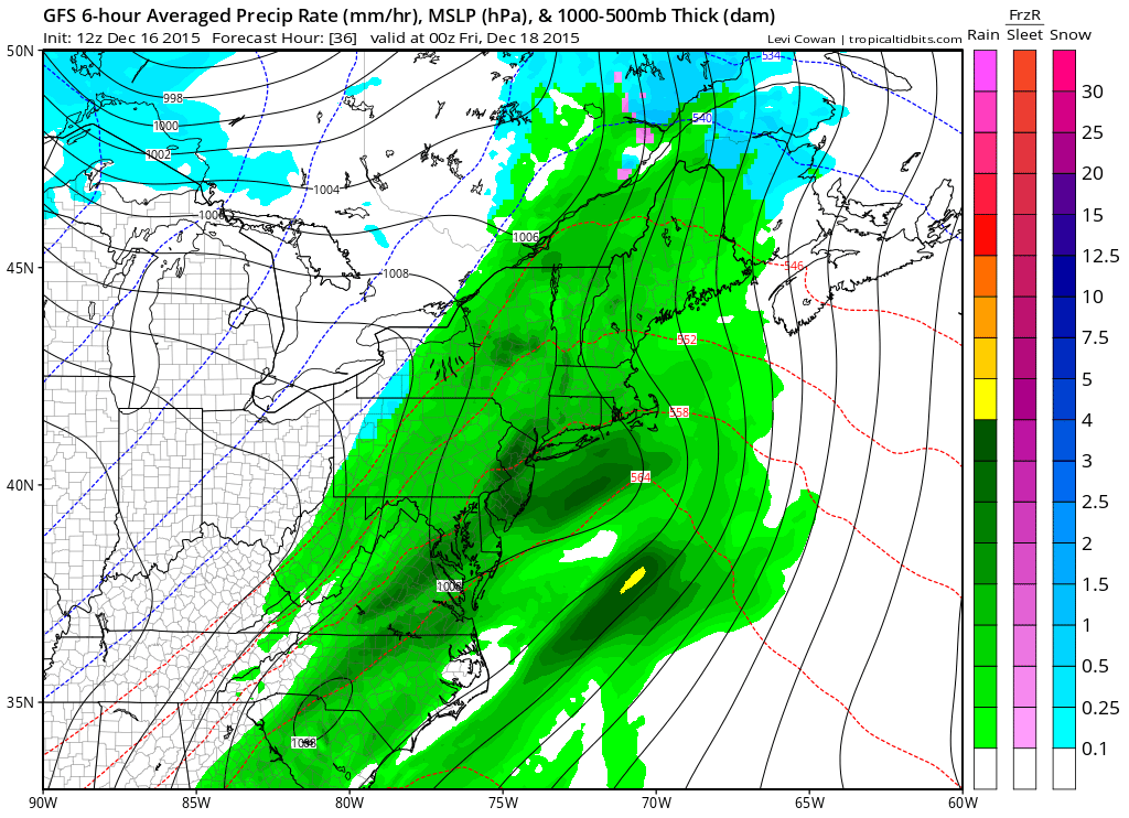
Rain continues into the evening and ends from south to north as the wave goes by. Temperatures are going to be a bit tricky but they should make the 50s in most areas. Once the wave clears the coast to the northeast, cold air will start to arrive on Friday.
The cold air will not come in fast enough to change the rain to snow. That’s off the table. Temperatures will eventually settle into the 40s later Friday and by Saturday morning we should be in the 20s to near 30 everywhere. Saturday’s highs won’t get out of the 30s. By Sunday the core of the cold air will be well east and we should bounce back into the 40s with some sunshine and then back into the 50s by Monday.
Long range developments were discussed at lenght earlier and here was my video analysis of the GFS model from overnight.
Also you may not have heard but JOESTRADAMUS went stratospheric earlier this afternoon and sees some signs beginning to appear at that level of the atmosphere that could spell a break in this long term warm pattern we have been in.
JOESTRADAMUS GOES STRATOSPHERIC
JOESTRADAMUS OVERNIGHT MODEL ANALYSIS


