
Weather Conditions Relax Over The Weekend Showers Monday
The major storm that brought rain and winds of 60 mph or more yesterday has moved on off to the northeast. Wind conditions have relaxed and we can look forward to a nice day of weather here with sunshine, less wind and temperatures in the 30s. In the wake of the storm colder air has moved in but it is not arctic air so we are a worst a few degrees below average today. The satellite picture just shows some patchy clouds well inland of the coast. Regional radar is picking up on a little lake effect action in Western NY and parts of Western Pennsylvania and that is just about it. No weather issues are on the table for the weekend.
SATELLITE

REGIONAL RADAR

Skies should start clear tonight but some clouds will arrive late tonight. Most lows will be in the mid to upper 20s but teens are likely north and west of the coast. Sunday should be a decent day though I think there will be some clouds around. That will help to keep temperatures down a bit. Highs should reach the upper 30s and lower 40s.
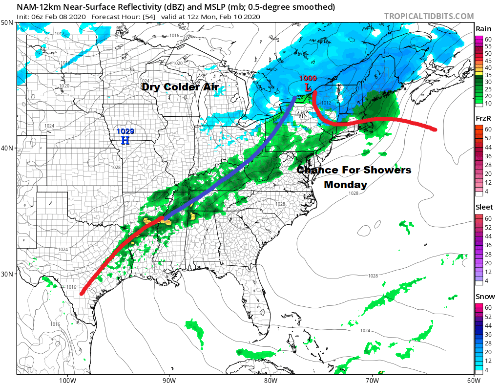
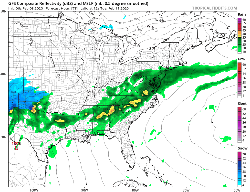
Monday sees low pressure going by to our north with a trailing cold front and a chance for showers. Highs will reach the 40s to near 50 in some spots. That front stalls out to our south and we have two waves of low pressure that will move along it. The first on Tuesday will likely bring some rain with it and highs in the 40s to some lower 50s.
The second wave that comes late next week might time out with colder air moving across Southern Canada, the Great Lakes, and New England. The key word here is “might” because that really is the only way snow lovers will see much of anything regarding snow is if everything times out perfectly.
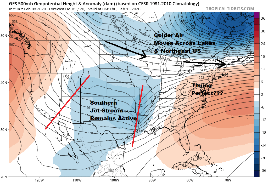
Overnight weather model runs showed what happened when things could time out perfectly. For snow lovers however it is 6 days out it is highly likely that we will see the timing adjust over the next few days. I wouldn’t get too excited about this right now.
BE SURE TO DOWNLOAD THE FREE METEOROLOGIST JOE CIOFFI WEATHER APP &
ANGRY BEN’S FREE WEATHER APP “THE ANGRY WEATHERMAN!
MANY THANKS TO TROPICAL TIDBITS FOR THE USE OF MAPS
Please note that with regards to any severe weather, tropical storms, or hurricanes, should a storm be threatening, please consult your local National Weather Service office or your local government officials about what action you should be taking to protect life and property.


