Wave Train Begins Monday Through Thursday Unsettled

At least we managed to squeeze out a decent Saturday with sunshine and we should manage to do the same for Sunday though we will likely see some arriving clouds. We do have an approaching cold front for tonight. Cold air is minimal at the coast so when the front comes in tonight it will be mostly rain. The nam shows rain arriving at the coast with some snow inland possible.The satellite picture shows clouds starting to push in from the west. Highs today will be in the 40s in most places except the 30s well north and west of the coast.
SATELLITE

REGIONAL RADAR

Regional radar is mostly on the quiet side for now but we will likely see activity pick up from the west later today into tonight as this first front approaches. Some precip aloft is showing up on local radars but due to the very dry air overhead today nothing will be reaching the ground.
LOCAL RADAR NEW YORK CITY

LOCAL RADAR PHILADELPHIA


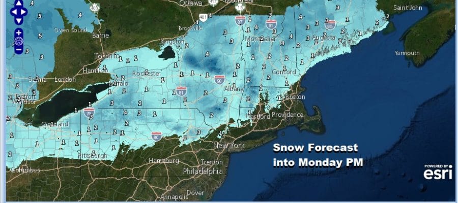
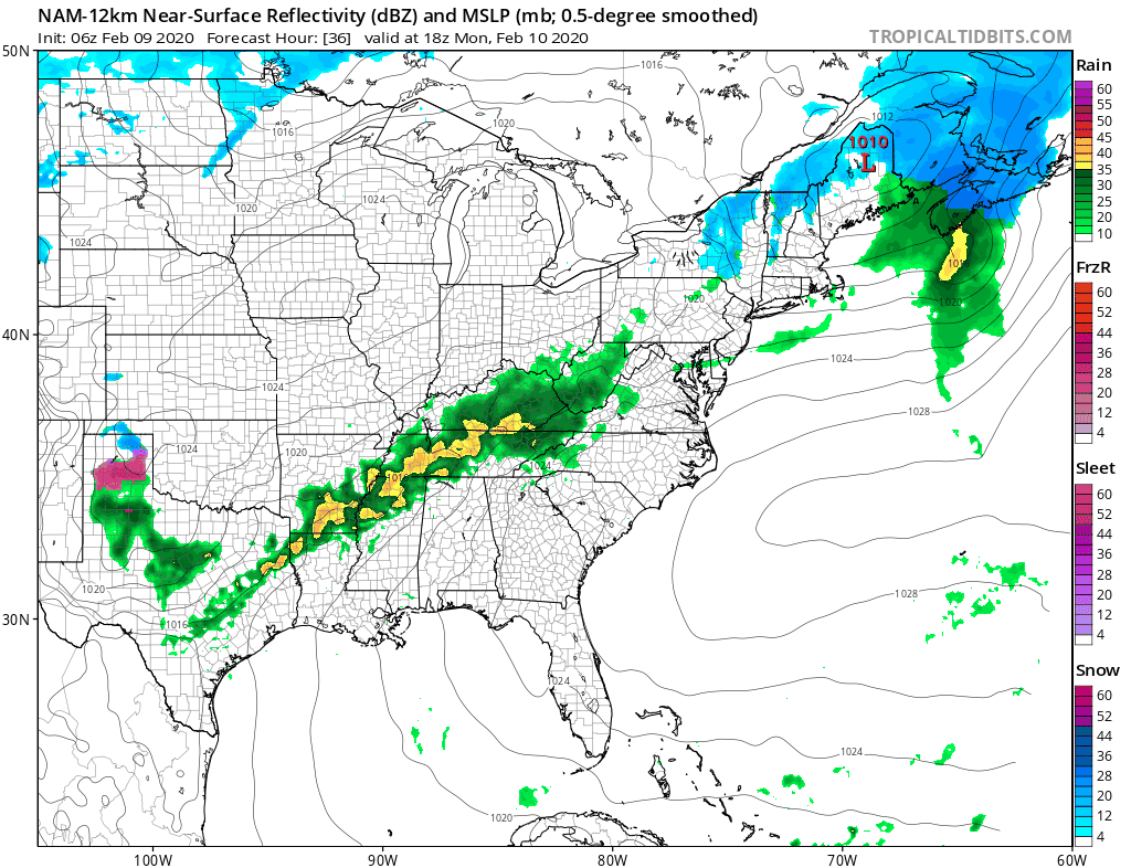
The NAM model and others run a rather straight forward game for this low moving across the Great Lakes and Upstate NY and New England. This looks to be a 1 to 3/2 to 4 inch snow producer well to the north and west of the coast with no major consequences and not much upside potential even well to the north.

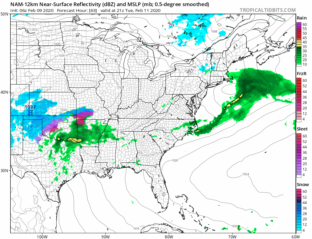
Most of the action will come to an end in the morning. The rain along the coast overnight into Monday morning will be on the order of a quarter of an inch or less. Monday’s highs will be mostly in the lower 40s well north and west of the coast to upper 40s and lower 50s for most other areas. Just as the front moves through Monday it slows down and stalls across the Mid Atlantic states where a second wave develops and moves northeast bringing rain back northward to perhaps just north of NYC Monday night into Tuesday morning.
This wave is not that strong and the rain will likely be on the order of above a quarter to a half inch from Eastern Virginia to Southern New Jersey with lesser amounts as you head north. Once the second wave is done we dry out Tuesday afternoon with perhaps some sun coming back and highs in the 40s. It will turn a little colder Tuesday night and Wednesday bring sunshine and arriving clouds with highs in the upper 30s and lower 40s.
Wave number 3 is going to be the strongest of the bunch and clouds increase on Wednesday. Take note of the snow in the Northern Great Lakes. There is a cold front there with colder air racing southeastward. The wave developing out of the Southern Plains and tracking to Kentucky is racing against the colder air to the north. The timing of the two streams of the jet stream (north and south) will determine rain snow lines and snow amounts from this.
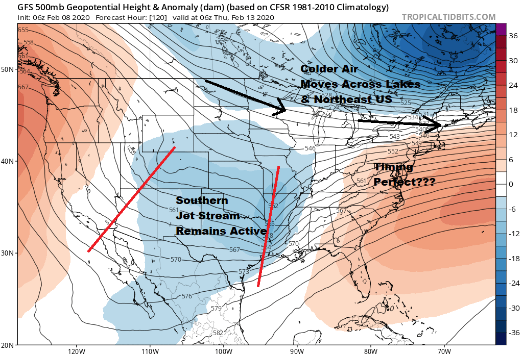
We showed this illustration of the upper air pattern for late next week to show how this all tries to play out and yes the timing would have to be perfect in order for accumulating snow at the coast beyond some snow at the start. Weather models do indicate that possibility of some snow at the beginning along the coast before a change to rain. This would be for Wednesday night into Thursday. Given the overall pattern it is hard to see how this plays out as mostly snow for coastal areas and the big cities. It would seem the cold air gets here too late. Inland it will be a different story especially along and northwest of Route 84.
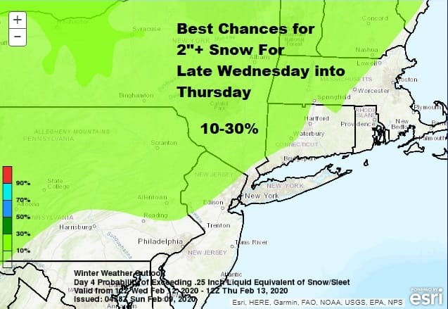
The Storm Prediction Center has a 10-30% probability line a little further south to just north and west of Philadelphia and NYC for this midweek possibility. We will be talking about the weather for the week ahead on this Sunday morning’s Coffee with Joe & Joe Show beginning at 11am
BE SURE TO DOWNLOAD THE FREE METEOROLOGIST JOE CIOFFI WEATHER APP &
ANGRY BEN’S FREE WEATHER APP “THE ANGRY WEATHERMAN!
MANY THANKS TO TROPICAL TIDBITS FOR THE USE OF MAPS
Please note that with regards to any severe weather, tropical storms, or hurricanes, should a storm be threatening, please consult your local National Weather Service office or your local government officials about what action you should be taking to protect life and property.


