Watching Gulf of Mexico Northwest Caribbean Late Week
Watching Gulf of Mexico Northwest Caribbean Late Week
At the moment we are still seeing the impacts of a upper trough in the Central Gulf States that extends southward into the Northwest Caribbean. The result has been a seemingly endless stream of moisture that has impacted Florida in a big way especially South Florida. Up to a foot of rain has fallen in the past week in some places. That moisture stream continues with the trough still in place.

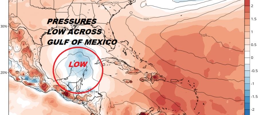
Looking at the satellite pictures of the Gulf of Mexico & the Caribbean the moisture flow continues northward so more rain for Florida especially South Florida. Pressures are lower than average in this region so we have to look for the possibility of some sort of low pressure developing later this week.

Indeed models do all show some sort of low forming later Wednesday or Thursday either in the NW Caribbean or the South Central Gulf of Mexico. The European model today shows low pressure forming in the South Central Gulf which makes sense but whether it develops into anything substantial or not remains to be seen. We are still very early for tropical storm formation even in the Gulf of Mexico. If we were a few weeks into June I might be a bit more bullish on development. The environment is going to be marginally conducive here.
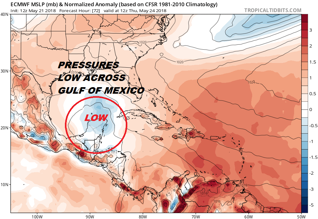
If this system does develop even slightly it could be a big rain maker for the Gulf Coast late this week and this weekend. Of course the moisture flow over Florida would likely continue and increase as the weak wears on. The National Hurricane Center is monitoring this system and has issued an outlook regarding it.
Widespread cloudiness and showers extending from the northwestern
Caribbean Sea across Cuba and the Florida peninsula are associated
with the interaction of a large upper-level low with a weak surface
trough.  While environmental conditions are expected to be
unfavorable for development during the next couple of days, some
gradual development is possible later this week while the system
moves into the central or eastern Gulf of Mexico. Regardless of
development, locally heavy rainfall is possible across western Cuba
and Florida over the next several days.  For more information on
the heavy rain threat, please see products issued by your local
weather office. The next Special Tropical Weather Outlook on this
system will be issued by 800 PM EDT tonight.
* Formation chance through 48 hours...low...near 0 percent.
* Formation chance through 5 days...low...20 percent.
FiOS1 News Weather Forecast For Long Island
FiOS1 News Weather Forecast For New Jersey
FiOS1 News Weather Forecast For Hudson Valley