Warmer Weather Ahead Dry Through Friday Thunderstorms Friday Night Saturday
It wasn’t the best of weekends but it wasn’t a complete washout either. Just when I had given up on sunshine breaking out this afternoon the skies broke wide open as the low clouds dissipated. We finished Memorial Day with sunshine and skies are either clear or partially clear this evening. The radars are quiet. Skies tonight will start clear but some low clouds and some patchy fog will develop especially near coastal areas. Most lows will be in the 50s to near 60 in the warmer urban settings.
SATELLITE

REGIONAL RADAR

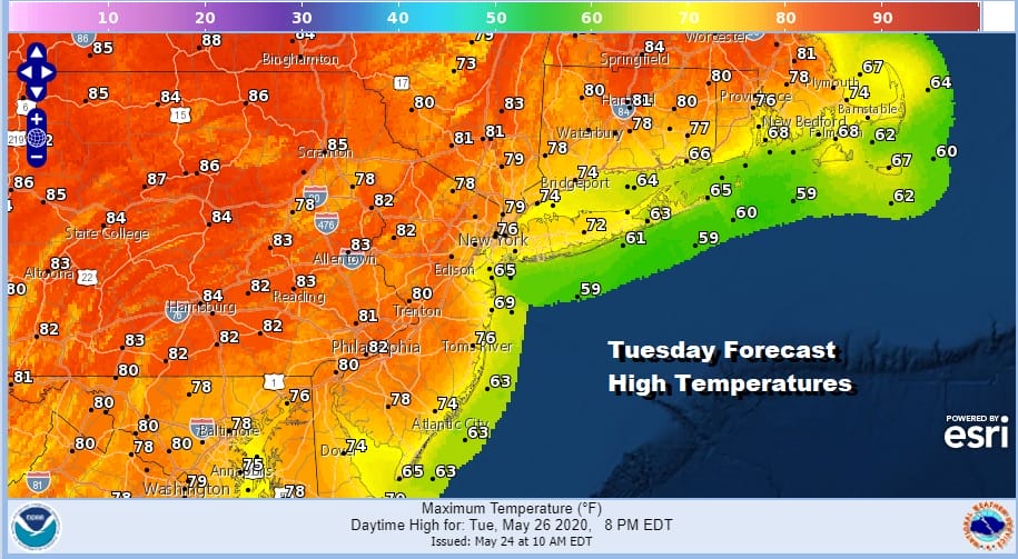
On to Tuesday through Friday with high pressure off the East Coast and only a light onshore low expected. This means the days will start off with some low clouds and patchy fog but we should burn off to sunshine rather quickly and certainly by midday at the latest. Tuesday’s highs along the coast will reach the 70s except right at the shore. Inland and west highs could reach 80 or even lower 80s.
The nights will get progressively warmer as the week wears on. Upper 50s and low 60s will be the bottom Wednesday morning and low to mid 60s Thursday and Friday morning. Look for morning low clouds followed by sunshine both Wednesday and Thursday. Highs both days will be in the 70s along the immediate coast and low to mid 80s inland.
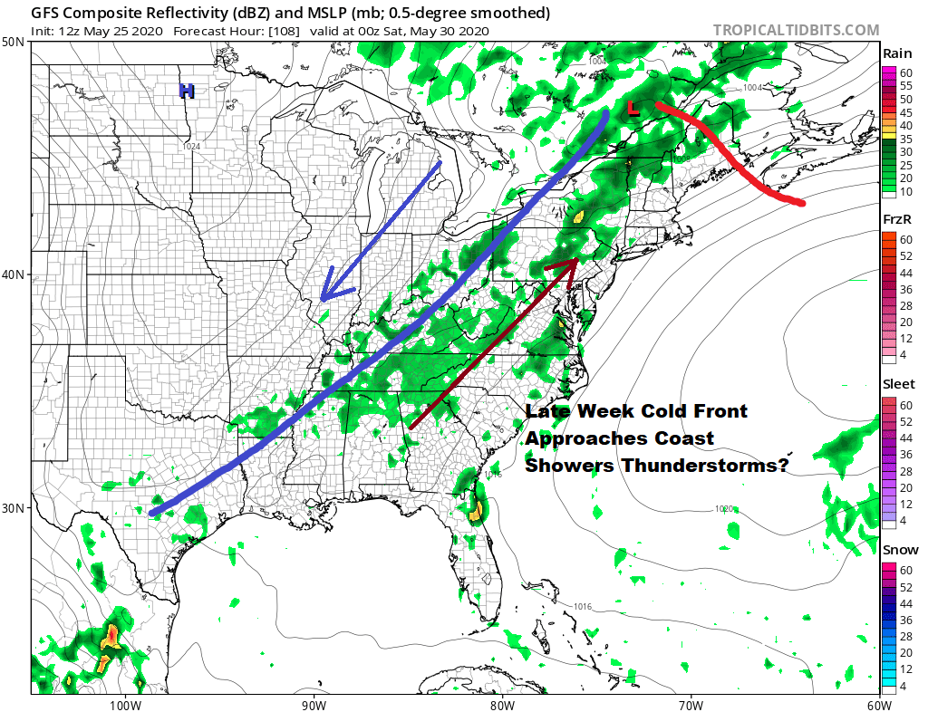
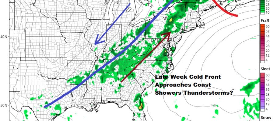
Friday with a southwest flow ahead of a cold front it will be warm and humid with sunshine. Highs will reach the upper 70s to middle 80s. There is a fair chance for thunderstorms late in the day into Friday night especially inland. The next cold front will take its time moving through and there will likely be showers and thunderstorms around on Saturday.
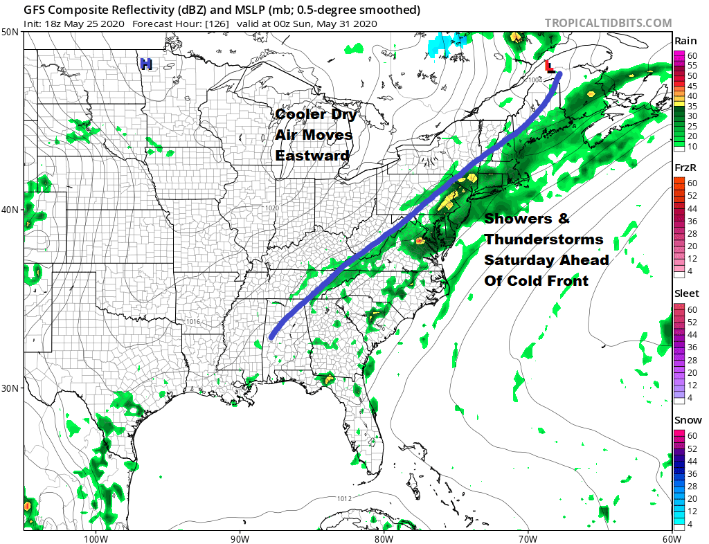
Saturday could be a day for severe weather risk as the cold front is being driven by a strong upper trough moving across the Great Lakes and Northeast. Drier cool air comes in for Sunday and the start of next week.
BE SURE TO DOWNLOAD THE FREE METEOROLOGIST JOE CIOFFI WEATHER APP &
ANGRY BEN’S FREE WEATHER APP “THE ANGRY WEATHERMAN!
MANY THANKS TO TROPICAL TIDBITS FOR THE USE OF MAPS
Please note that with regards to any severe weather, tropical storms, or hurricanes, should a storm be threatening, please consult your local National Weather Service office or your local government officials about what action you should be taking to protect life and property.


