Warmer Start To Week Colder Finish Rain Sleet And Snow Inland
Tonight we are seeing a warm front moving slowly through and producing some light precipitation of rain and even some wet snow. Some inland elevated areas north and west of the coast (above 1000 feet) are seeing enough to whiten up the ground in spots. Clouds are sitting overhead tonight holding temperatures in the 30s to lower 40s. Precipitation is light and will play through ending after midnight in most places. This sets us up for warmer weather into early Wednesday.
SATELLITE

REGIONAL RADAR

Regional and local radars are showing the light precipitation sliding to the southeast. Nothing in here is anything but light according to surface observations and temperatures are all above freezing.
LOCAL RADAR NEW YORK CITY

LOCAL RADAR PHILADELPHIA


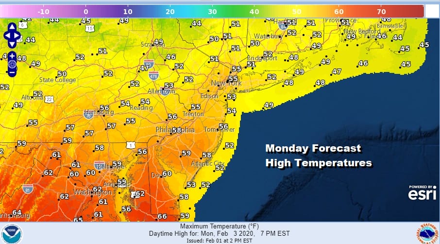
Monday is likely to be the best day of the week as we break out into some sunshine. Highs will reach the low to mid 50s from NYC north and east and upper 50s to around 60 or so south and west.
Tuesday we being to see a cold front make its approach but temperatures will still make it up into the 50s. There may be a few showers around Tuesday in the morning followed by a break and then some showers Tuesday night into Wednesday morning as the front passes through.
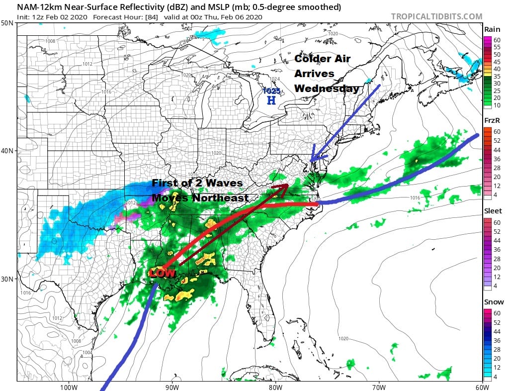
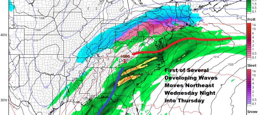
The front is going to stall out and weather conditions may improve a bit on Wednesday. Colder air will be dropping southward around a building high to the north. The first of several waves will develop and precipitation will come back later Wednesday night into Thursday.
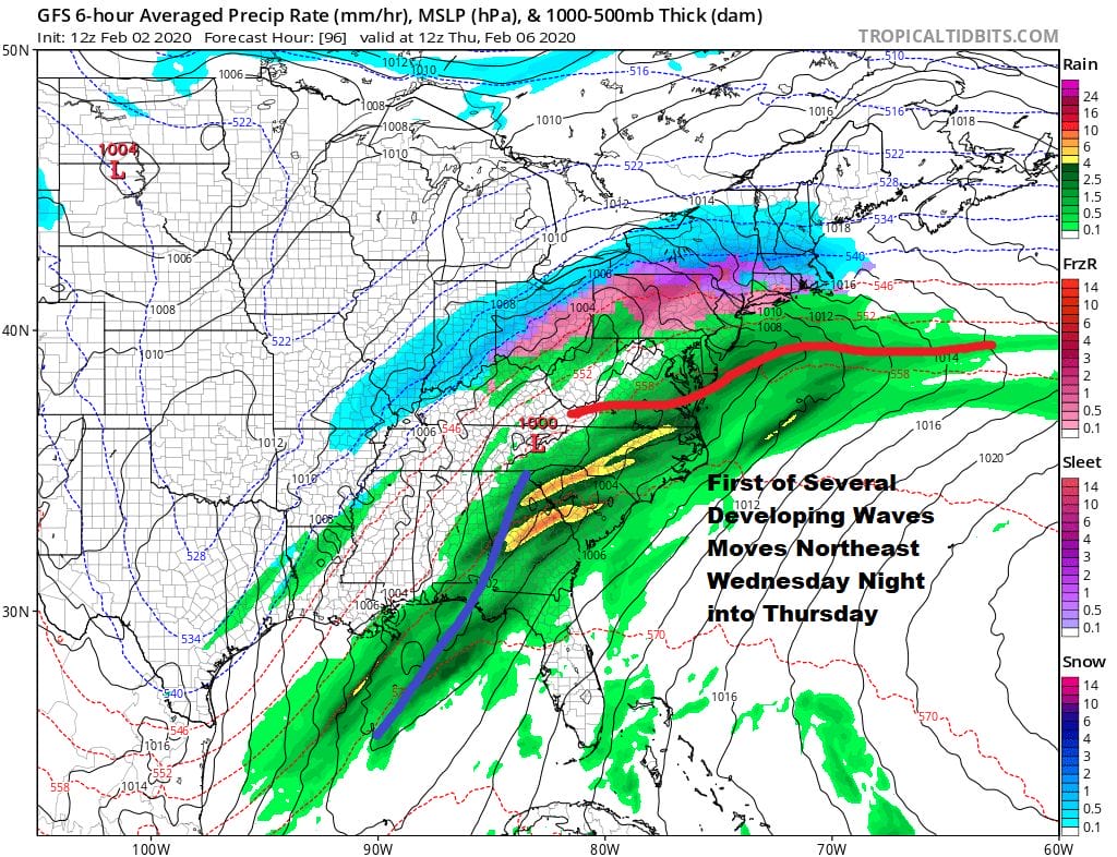
Cold air will hold in for awhile and there will be snow sleet and rain developing Wednesday night into Thursday morning. There is nothing to keep the high in so eventually warmer air does win out and change any wintry precipitation to rain though north and west of the coast we could see the cold air hold on for awhile. We may get a break in the action and the 2 other waves will follow.
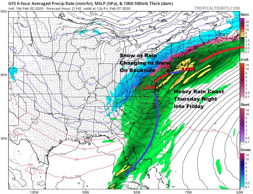
As each wave goes by colder air will be drawn southward and on the backside we will see rain changing back to sleet or snow inland but along the coast it will be rain until the last wave goes by. Perhaps we could see it change over to snow before it ends but that is always a tenuous proposition. Given the way the winter has gone it is likely a bet against it. This is a very wet system so rainfall amounts could be on the order of a couple of inches this week especially along the coast. Longer range there is really no sign of any change in the overall pattern. Therefore the only way we see any kind of accumulating snow at the coast would be if everything were to time out perfectly. The one thing we should keep an eye on would be the extent of low level cold air Wednesday and how far south it gets. We may need to due some adjusting in the forecast if the cold air is a little more important. Cold air follows this system however the flow in the Atlantic is like a fire hose so it is likely that any cold air that comes in will pull out in time for the next weather system that heads our way after this mess plays itself out.
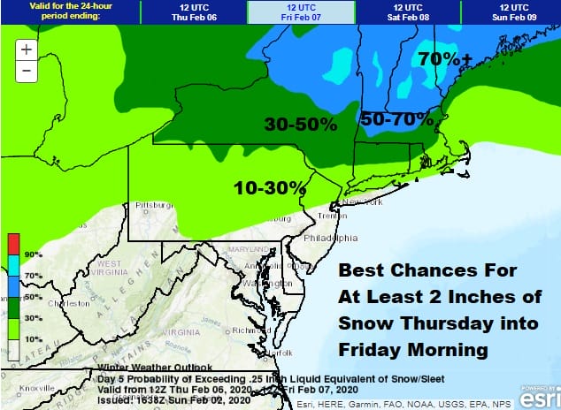
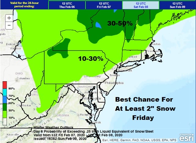
The maps above are the Weather Prediction Center’s chances for at least 2 inches of snow covering Thursday and Friday as we are dealing with separate waves. We will attempt an early call on this system sometime on Monday.;
BE SURE TO DOWNLOAD THE FREE METEOROLOGIST JOE CIOFFI WEATHER APP &
ANGRY BEN’S FREE WEATHER APP “THE ANGRY WEATHERMAN!
MANY THANKS TO TROPICAL TIDBITS FOR THE USE OF MAPS
Please note that with regards to any severe weather, tropical storms, or hurricanes, should a storm be threatening, please consult your local National Weather Service office or your local government officials about what action you should be taking to protect life and property.


