Warmer More Humid Midweek Thunderstorms Thursday Summer Weather Continues
Rain has long moved away and weather conditions have slowly improved today. That improving trend should continue tonight though there are some high clouds still around. We will have a mix of clear skies and some high clouds overnight with most lows in the 60s. The local radars are silent and the regional radar has the only rain off the North Carolina coast and of now consequence here.
SATELLITE

REGIONAL RADAR

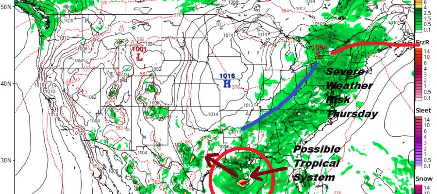
Tuesday we should have some sunshine with some patchy clouds here and there. It will be very warm but not hot and the humidity will be reasonable but on the edge of uncomfortable. Highs will reach the 80s everywhere. Then the go to a higher humidity set up on Wednesday with sunshine and highs in the mid 80s to lower 90s with humidity levels inching higher. We don’t expect any thunderstorms until Thursday with the next cold front approaching. Thursday could be another day with severe weather risks around with tropical air, dew points reaching into the 70s and a cold front forcing its way through. We will elaborate more on this as we get closer to Thursday.
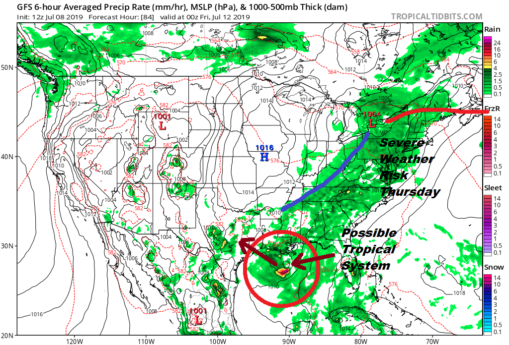
We are also still seeing the idea that the southern end of a frontal boundary in the Northeast Gulf of Mexico will break away and move westward, gradually acquiring tropical characteristics as it does so. Afternoon weather models are all on board with this idea but we yet to the system develop so until it does this is all rather speculative. Upper air conditions certainly appear favorable for development as well as very warm waters of the Gulf of Mexico supportive. The question of proximity to land is on the table and that could hinder development…OR..the system could find its way a bit further south giving ti more room to grow. Let’s get it going and we can figure out what holds for the end of the week. A westward motion is likely here so it does give it a track across the entire Northern Gulf of Mexico if this materializes. It is going to be very interesting to watch this home grown system later this week if it gets going.
MANY THANKS TO TROPICAL TIDBITS FOR THE USE OF MAPS
Please note that with regards to any tropical storms or hurricanes, should a storm be threatening, please consult your local National Weather Service office or your local government officials about what action you should be taking to protect life and property.


