Warmer Breezy Day Ahead Sunday Brings Rain Snow As Next Low Moves North

Weather in 5/Joe & Joe Weather Show Latest Podcast
Warmer Breezy Day Ahead Sunday Brings Rain Snow As Next Low Moves North
Last night’s storm system has moved along to the northeast and we should see improvement as the day goes on. The winds will pick up and we will see developing sunshine from west to east. It will be a rather warm day with temperatures this afternoon mostly in the 50s! There is little in the way of cold air behind this system so we move along tonight with clear skies. Temperatures will start to ease and by morning most lows will be in the mid 20s to lower 30s. So goes the first half of the weekend, now on to the second half.
SATELLITE

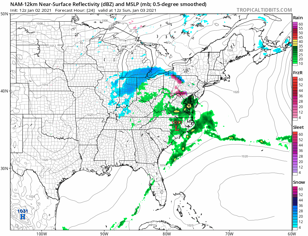
Precipitation on the regional radars has moved away to the northeast and there should be no other rain issues for the rest of today. The New England regional radar still has some work to do regarding getting rid of the last of the precipitation in Northern New England which is mostly snow.


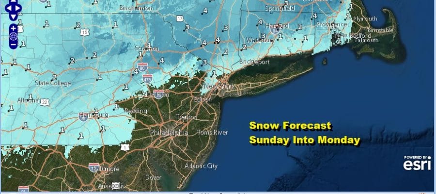
The tail end of the cold front from last night’s storm is stalled out along the Southeast Coast of the US and we have another wave of low pressure that is developing on this frontal boundary. That low moves northward. At the same time we have a weak high that builds in New England which bleeds southward colder air. It isn’t much in the way of colder air and it puts in a rather difficult position of having to forecast in an atmosphere where temperatures are at or near critical levels.
I think the bottom line here is that there just isn’t enough cold air to create a surprise situation so unless that part of the equation changes, this should not be a problem. Inland areas could see more of a wet snow with some accumulation. Intensity of precipitation and time of day will be the primary driver here. Snow and or rain develops from south to north around midday and lasts into the evening. Overnight into Monday morning there could be one last gasp of wet snow inland as the system moves away. Along the coast it looks to be mainly rain.
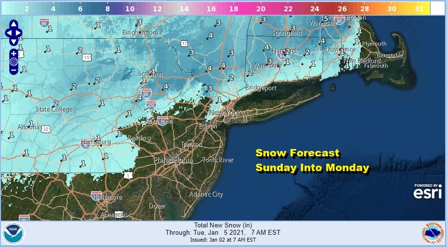
Above is the National Weather Service snow forecast map for Sunday night and Monday. Some of those higher numbers are due to elevation which could play a role here. The low will be to our east for the first half of next week making for breezy and chilly but mostly dry conditions into Thursday.
BE SURE TO DOWNLOAD THE FREE METEOROLOGIST JOE CIOFFI WEATHER APP &
ANGRY BEN’S FREE WEATHER APP “THE ANGRY WEATHERMAN!
MANY THANKS TO TROPICAL TIDBITS FOR THE USE OF MAPS
Please note that with regards to any severe weather, tropical storms, or hurricanes, should a storm be threatening, please consult your local National Weather Service office or your local government officials about what action you should be taking to protect life and property.


