Warmer Air Return Sunday Monday
Warmer Air Returns Sunday Monday
Now it is back the other way. A brief shot of near average air is giving way to another warm front cold front scenario which will play out with clouds for Sunday and the chance for passing showers. The satellite loop shows the clouds swinging eastward now as a warm front pushes up from the Middle Atlantic States.
SATELLITE LOOP

Regional radar shows showers in Virginia into South Central Pennsylvania moving northeastward and we can look for some of those showers during the early morning hours across Eastern Pennsylvania and eventually working its way up into Southern New England.
REGIONAL RADAR

LOCAL RADAR NEW YORK CITY

LOCAL RADAR PHILADELPHIA


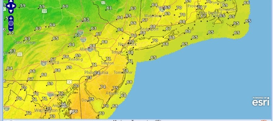
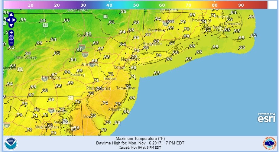
Sunday will not be a washout but there will be some passing showers to deal with. Temperatures will head back into the 60s. Then on Monday with the cold front approaching look for some sun and clouds ahead of it Monday into the early afternoon before showers move through with the cold front. Highs could reach the upper 60s and lower 70s depending on how much sun we get Monday morning.
WARMER AIR MONDAY FORECAST HIGH TEMPERATURES
Colder weather returns Tuesday as the front pushes south. It now looks like that wave behind the front will not be much of a factor. Tuesday’s highs will be just in the 50s and we should see below average temperatures at least into Thursday. Models diverge after that with the GFS warming things up beginning on Friday while the European model has a much colder look going into next weekend.
 GET JOE A CIGAR IF YOU LIKE

FiOS1 News Weather Forecast For Long Island
FiOS1 News Weather Forecast For New Jersey
FiOS1 News Weather Forecast For Hudson Valley


