Warm Weather Clouds Still Hanging Around Today
Showers Saturday Cooler Sunday

Weather in 5/Joe & Joe Weather Show Latest Podcast
Warm Weather Clouds Still Hanging Around Today
Showers Saturday Cooler Sunday
We are continuing to deal with cloud issues in parts of the area today. Dry air has cleared out most of Southern New England where high pressure is trying to build. Some of that dry air should push southward today so look for breaks to develop in the cloud cover as the day wears on. Highs today will be in the 70s. There are no radar issues to speak of today nor will there be for the rest of the week.
SATELLITE

WEATHER RADAR

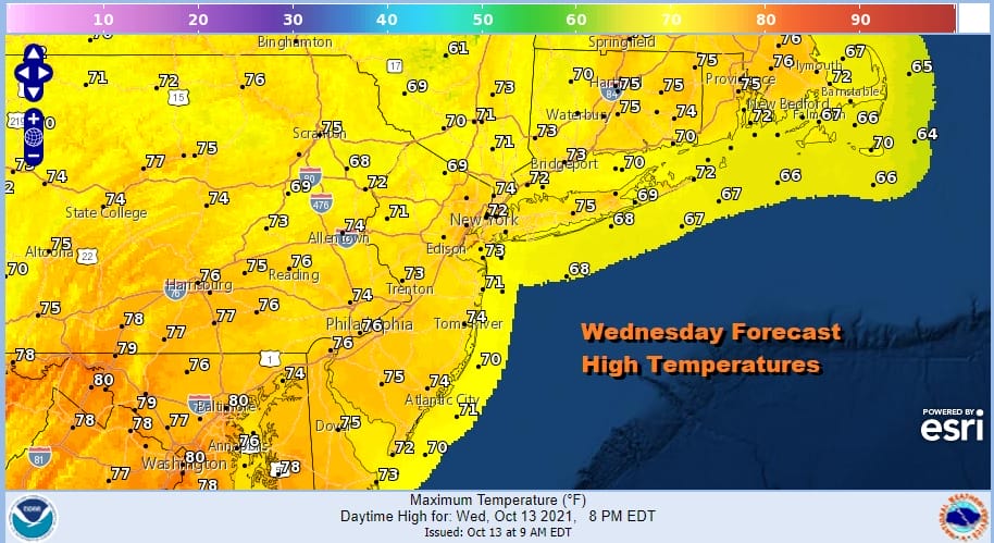
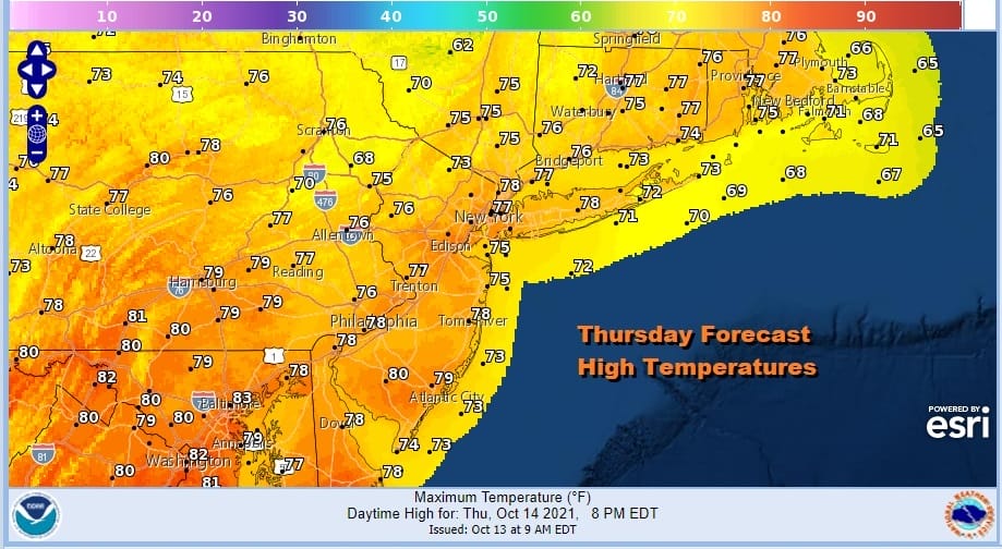
The next 2 days will be rather warm across the area. Tonight we will see some low clouds and patchy fog develop with most lows in the mid 50s to lower 60s. Thursday we expect those low clouds to burn off and skies should be no worse than partly sunny. Highs will reach the 70s to around 80 degrees.
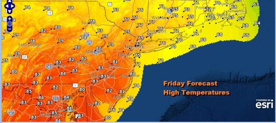
Friday will be the warmest day of the week and it could turn out to be the last very warm day of the early Autumn season. We will start with morning low clouds in some areas but on the whole it looks to be a mostly sunny day with highs reaching the upper 70s and lower 80s.

Saturday brings the first cold front through the area in nearly 2 weeks. The ridge in the East breaks down and a storm now in the Northern Plains that is producing heavy snow in Eastern Wyoming and Eastern Montana will moves across the Northern Great Lakes and Southern Canada. Look for some showers Saturday especially in the afternoon and there could be a few thunderstorms with the frontal passage. Highs Saturday will be in the 70s.
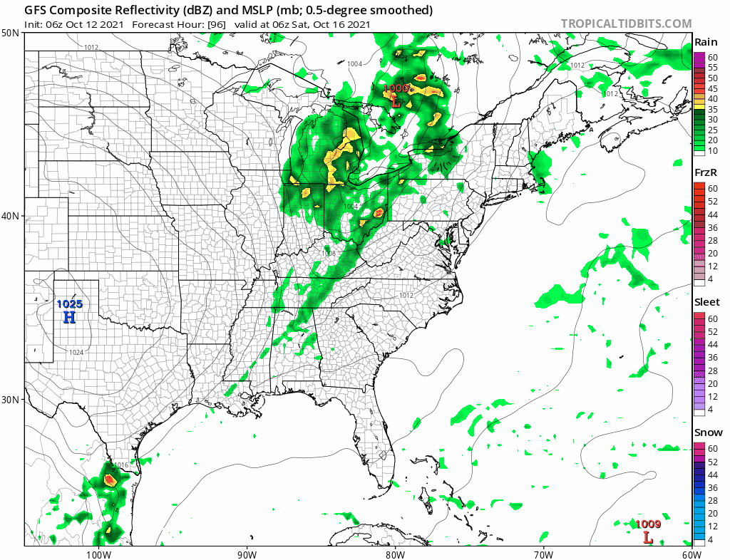
The air mass behind the front is cooler so we will see temperatures closer to average or even a shade below average after the front passes. Sunday should be a better day with a mix of sun and clouds but highs will only be in the 60s. Next week sees a cool start and another front arrives probably Thursday with an even cooler air mass behind that one. It will be dry through Wednesday and then we will be a bit unsettled at the end of next week as the next front passes. These fronts will not be big rain producers as the pattern switches from warm and mostly dry to cool and mostly dry. No major storms or tropical systems are on the horizon.
BE SURE TO DOWNLOAD THE FREE METEOROLOGIST JOE CIOFFI WEATHER APP &
ANGRY BEN’S FREE WEATHER APP “THE ANGRY WEATHERMAN!

MANY THANKS TO TROPICAL TIDBITS & F5 WEATHER FOR THE USE OF MAPS
Please note that with regards to any severe weather, tropical storms, or hurricanes, should a storm be threatening, please consult your local National Weather Service office or your local government officials about what action you should be taking to protect life and property.


