Warm Tuesday Colder Air Returns Rain Saturday
SHOP THE JOESTRADAMUS STORE
Warm Tuesday Colder Air Returns Rain Saturday
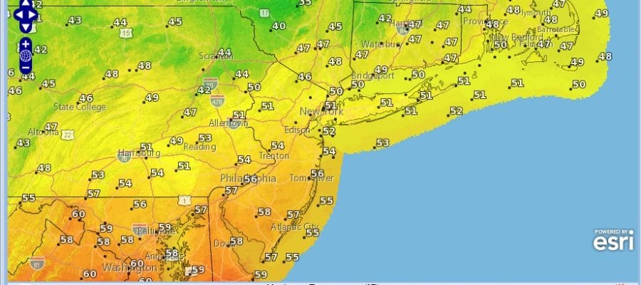
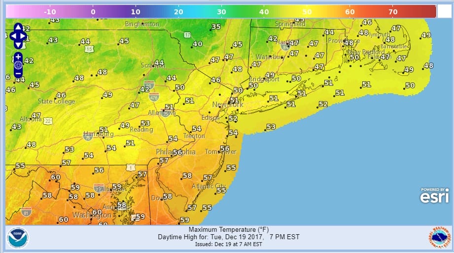
This rather quiet work week of weather continues today as warmer air briefly takes hold. Weather systems for the moment are moving along from west to east along the Canadian border which means we are basically in an up and down mode in between weather fronts. The satellite loop this morning shows some clouds going by mostly to our north. We should enjoy a decent amount of sunshine today and temperatures reaching the 50s.
TUESDAY FORECAST HIGH TEMPERATURES
A cold front will move through here late today and you can see the system with that is now moving across the Great Lakes. This front will have nothing more than a few clouds with it and no showers are forecast. It will turn a little colder tonight with lows in the upper 20s to middle 30s. Wednesday and Thursday we will see some sunshine but highs will only reach the upper 30s and lower 40s both days.
SATELLITE LOOP

REGIONAL RADAR

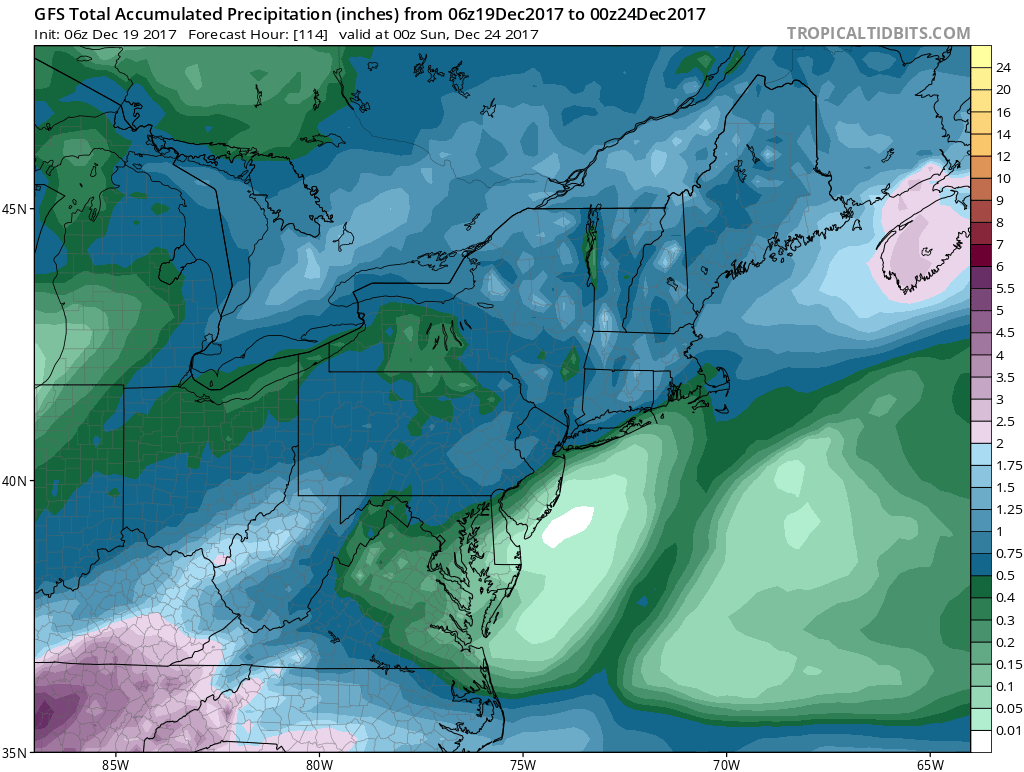
Friday we start to warm up but we also start to cloud up as well as the next cold front approaches. Temperatures will reach the upper 40s to lower 50s. Showers with the front will start to pop up Friday night with numerous showers here for Saturday and highs in the 50s to near 60. This could be a half inch to an inch of rain but notice that it cuts off sharply to the southeast with higher amounts north and west.
GFS FORECAST RAIN THROUGH SATURDAY EVENING.
CHRISTMAS EVE CHRISTMAS DAY FORECAST
The long talked about wave moving up the coast for Christmas Eve night and Christmas day remain on course. Weather models overnight have opened the door (slightly) the prospects for a White Christmas along the coast. and they have opened the door a bit wider for areas north and west of the coast. However there is still a lot of atmospheric work to do regarding how much cold air gets back in and how far south the cold air gets before precipitation cuts off.
GFS MODEL CHRISTMAS EVE & CHRISTMAS DAY CLICK TO ANIMATE
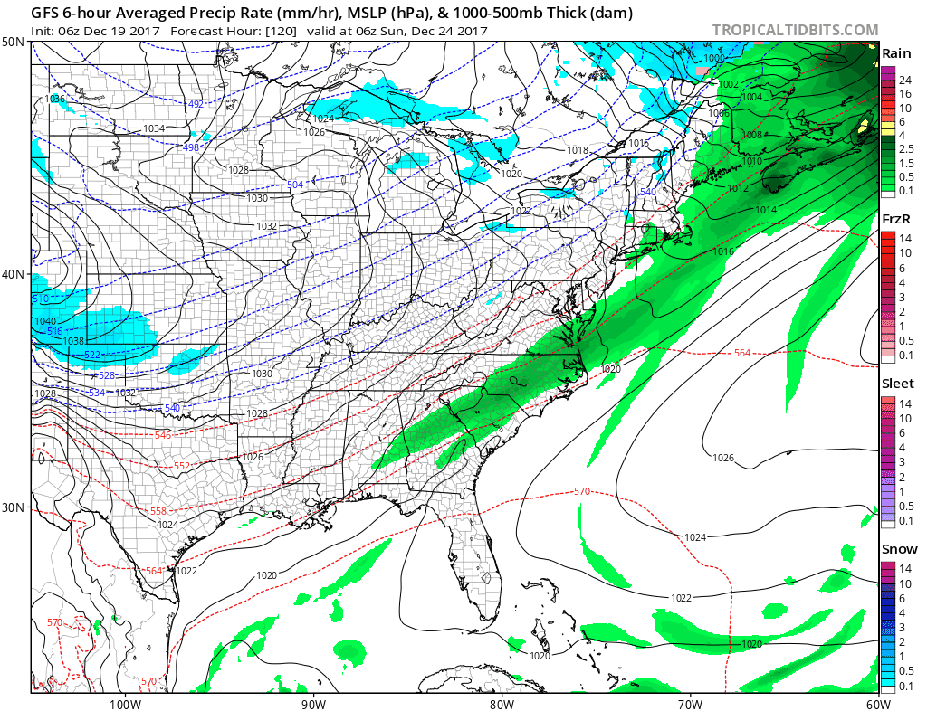
The European model right now argues for nothing like this as it is further west than the GFS model. However the European model did shift a bit to the east. The big question in all this is whether the cold air pouring into the Plains and Upper Midwest can nudge a little further east. It wouldn’t take very much at this point. This system looks to be a 1/2 inch to an inch of melted so somebody in the cold air will wind up with 6 plus inches out of this. Let’s see where weather models take us today with all this.
 GET JOE A CIGAR IF YOU LIKE

FiOS1 News Weather Forecast For Long Island
FiOS1 News Weather Forecast For New Jersey
FiOS1 News Weather Forecast For Hudson Valley


