
Warm Thursday Leads To Cold Snow Rain Saturday
Warm Thursday Leads To Cold Snow Rain Saturday
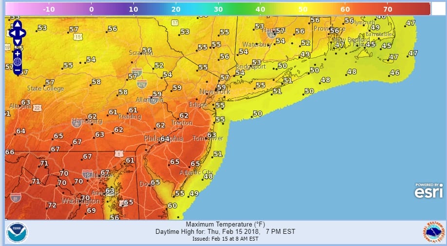
The volatility ride continues today as we see a warm front pushing northward with some patchy fog along coastal areas as well as some inland spots. We are waiting for clouds to break apart and allow for at least a few peaks of sunshine. Temperatures from New Jersey south and west should make it to the 60s today though cloud cover could limit how high in the 60s. North of NYC and Long Island 50s to near 60 should do it.
THURSDAY FORECAST HIGH TEMPERATURES
The next cold front in this fast pattern arrives tonight with some showers overnight into Friday morning before the front moves offshore. Behind the front a strengthening wind and colder air return. Clouds are gathering to the west and the regional radar will begin to pick up developing showers which should not arrive here until later this evening at the earliest.
US SATELLITE

REGIONAL RADAR

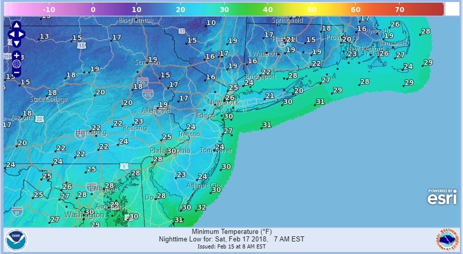
Once the front passes offshore temperatures will begin to fall and they will hit bottom Saturday morning in the teens to lower 20s.
SATURDAY MORNING FORECAST LOW TEMPERATURES
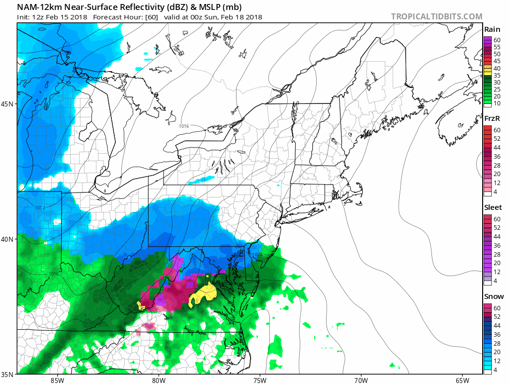
The question for later Saturday into Saturday night will be how much cold air holds on especially along the coast. This system seems to want to behave like others recently where warm air comes inland of the coast to just north and west of I-95. The latest NAM model was a little colder and pulls the rain snow line south of Long Island and to just south of Route 78.
NAM MODEL SATURDAY EVENING INTO SUNDAY MORNING CLICK TO ANIMATE
My early call forecast remains unchanged for now with higher amounts inland and lower at the coast where a change to rain for at least awhile is a possibility.

We will look at these numbers again later today when the entire run of the models is done. In the meantime enjoy the warmth we have
 GET JOE A CIGAR IF YOU LIKE

FiOS1 News Weather Forecast For Long Island
FiOS1 News Weather Forecast For New Jersey
FiOS1 News Weather Forecast For Hudson Valley


