Warm Sunny Monday Rain Tuesday Into Wednesday Morning
Late Week Snow Ice Rain

Warm Sunny Monday Rain Tuesday Into Wednesday Morning
Late Week Snow Ice Rain
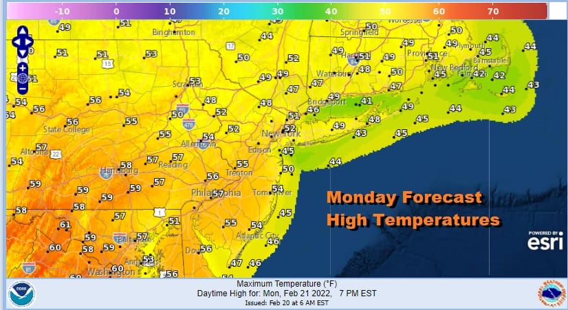
One nice thing about this time of year is when these cold air masses move out, the warmup that follows is faster and temperatures bounce higher than they would have a month or two ago. As long as we have sunshine and the right wind direction (not off the ocean) we can see temperatures go up and highs today will be in the 50s. The only exception will be areas with south and east facing shorelines where a sea breeze develops and keeps temperatures in the 40s like the Jersey shore, Long Island south shore and east end and coastal Southern and Southeastern New England. The satellite is showing mostly cloud free conditions and we expect this to remain the case until later this afternoon and evening when some clouds will arrive.
SATELLITE

WEATHER RADAR

Tonight clouds will increase with temperatures probably going nowhere. Lows will be in the 30s to lower 40s. Tuesday we will see rain developing. It will be spotty at first but then become steadier later in the afternoon and into Tuesday night. Low pressure heads to our west and gradient tightens up a bit. It appears that we could be close to wind advisory criteria Tuesday night so look for some gusty winds of 30 to 40 mph at times. This time around the wind issues will be more for coastal areas from Coastal NJ eastward rather than inland areas where winds should be under criteria. Temperatures will be mostly in the 50s except again near the coast.

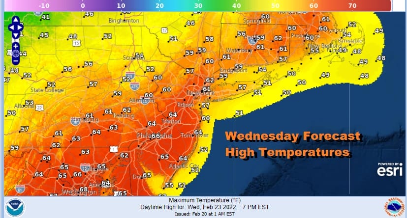
Rainfall amounts should be in the 1/2 to 3/4 inch range so there are no flash flood issues from what I see. Weather conditions will slowly improve on Wednesday as we wait for a cold front to pass later in the day. That means temperatures which will start out close to or even in the 50s in some areas will reach the mid to upper 60s away from the ocean, especially if we can get some sunshine into the mix.
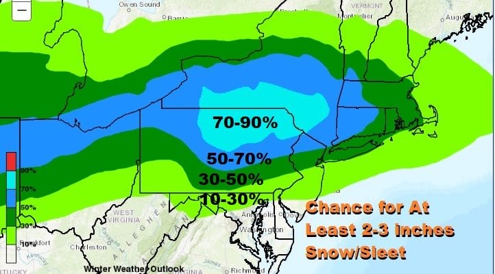
Volatility continues as temperatures drop to the 20s Wednesday night into Thursday morning as skies clear. However the next storm system heads our way from the southwest so look for increasing clouds Thursday with highs in the 30s. Right now we will see snow or sleet develop Thursday night and change to sleet and rain late Thursday night or early Friday morning before it ends.
We know it is going to do something Thursday night into Friday morning, but the where and what is still inc question. Again it will be all about the high to the north and weather models will continue to struggle with that. It might not be until Wednesday at the earliest where we have a better handle on this. Meanwhile the Weather Prediction Center has its own ideas on what to expect.
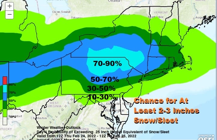
Considering the recent warmer trends on the models, WPC is being aggressive on it’s forecast. I will wait to see what they do with their forecast later today and their reasoning behind it. They have done some things that have seemed to go against with models are showing and have wound up being on the right side of the forecast so it is probably a good idea to pay attention to what they are doing. In the meantime we will keep an eye on things going forward.
BE SURE TO DOWNLOAD THE FREE METEOROLOGIST JOE CIOFFI WEATHER APP &
ANGRY BEN’S FREE WEATHER APP “THE ANGRY WEATHERMAN!
MANY THANKS TO TROPICAL TIDBITS & F5 WEATHER FOR THE USE OF MAPS
Please note that with regards to any severe weather, tropical storms, or hurricanes, should a storm be threatening, please consult your local National Weather Service office or your local government officials about what action you should be taking to protect life and property.


