Warm Showers Wind Cold Snow Locusts

MENTION JOE CIOFFI AND GET A 5% DISCOUNT
Over the next 5 days we will experience Warm Showers Wind Cold Snow Locusts…well maybe not the locusts! And NO I DON’T KNOW HOW MUCH SNOW SO DON’T ASK! What is clear is that there is a lot going on atmospherically and we are going to be swinging from one end of the weather spectrum to the other.
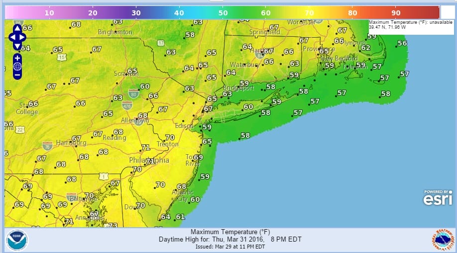
Let’s look at this in the order of how things are going to happen. First off Thursday will bring about a nice warm day with some sunshine along with a few clouds. Temperatures will reach 70 or better inland but the wind off the ocean means Coastal New Jersey and Long Island will be lower. Highs there could reach the 60s before the wind kicks in and takes temperatures back into the 50s. Thursday night and Friday we will see some showers as the next cold front approaches. The front is not that impressive so the showers won’t be continuous. One band will come in Thursday night and then a second weaker band during Friday afternoon. Temperatures on Friday will be in the 60s.
Warm Showers Wind Cold Snow Locusts Thursday’s Highs
WEATHER COMPLICATIONS FOR THE WEEKEND
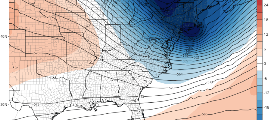
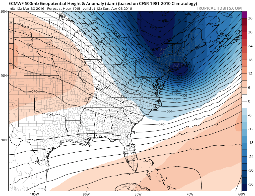
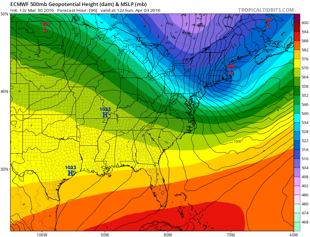
There are developing issues for the weekend. The front coming through looks to stall out. The Euro model has been hinting at this and now it does stall it out with another wave developing on the front. This could bring rain close to the area from the southeast during the day Saturday. Once that wave goes by attention will then shift to an intensifying storm just east of Boston. The storm will swing an arctic front through here Saturday evening. Once it goes by winds will increase to gale force and look for gusts over 50 mph Saturday night into Sunday morning along with falling temperatures. Some snow showers could come with that and it might be enough to whiten the ground up in areas just north of the coast. In fact it would not be a shock to see a coating to an inch or two in the Hudson Valley & Connecticut north of Route 84. Sunday will be windy and cold with some developing sunshine but highs will be just into the 40s and some areas may not get out of the 30s. The Euro model is especially bullish on the magnitude of the upper air feature as it drops it much further south than the other models. This actually brings the core of the cold air almost overhead on Sunday with a lot of upper air energy just to the east. This could actually create some snow issues for Boston out of this for Saturday night into Sunday morning. The wave that moves by on Saturday is a completely separate system from the one the Euro model develops Saturday night into Sunday morning.
Warm Showers Wind Cold Snow Locusts Euro Surface & Upper Air Forecast for Sunday Morning April 3, 2016
Weather models are all keying on a disturbance dropping southeast from the midwest for Monday night into Tuesday that could bring some precipitation..and yes it could be snow. If it comes at night it might amount to something on the light side. Temperatures will certainly remain cold enough into Tuesday and remember if it falls at night it sticks. If it falls during the day, it doesn’t. Fasten your seatbelts for the roller coaster ride of Warm Showers Wind Cold Snow Locusts.
One important note. The Euro model is the furthest south on all the models regarding the system on Saturday night into Sunday morning and for the one Monday night into Tuesday. Also it is the only model at the moment bringing a threat for rain here Saturday afternoon from the stalled front.
FiOS1 News Weather Forecast For Long Island
FiOS1 News Weather Forecast For New Jersey
FiOS1 News Weather Forecast For Hudson Valley
NATIONAL WEATHER SERVICE SNOW FORECASTS
LATEST JOESTRADAMUS ON THE LONG RANGE

NOMINATED FOR AN APPY AWARD FOR BEST WEATHER APP!!
Weather App

Don’t be without Meteorologist Joe Cioffi’s weather app. It is really a meteorologist app because you get my forecasts and my analysis and not some automated computer generated forecast based on the GFS model. This is why your app forecast changes every 6 hours. It is model driven with no human input at all. It gives you an icon, a temperature and no insight whatsoever.
It is a complete weather app to suit your forecast needs. All the weather information you need is right on your phone. Android or I-phone, use it to keep track of all the latest weather information and forecasts. This weather app is also free of advertising so you don’t have to worry about security issues with your device. An accurate forecast and no worries that your device is being compromised.
Use it in conjunction with my website and my facebook and twitter and you have complete weather coverage of all the latest weather and the long range outlook. The website has been redone and upgraded. Its easy to use and everything is archived so you can see how well Joe does or doesn’t do when it comes to forecasts and outlooks.
Just click on the google play button or the apple store button on the sidebar for my app which is on My Weather Concierge. Download the app for free. Subscribe to my forecasts on an ad free environment for just 99 cents a month.
Get my forecasts in the palm of your hand for less than the cost of a cup of Joe!
![]()