Warm Humid Wednesday Pop Up Showers Well Inland Severe Weather Well West
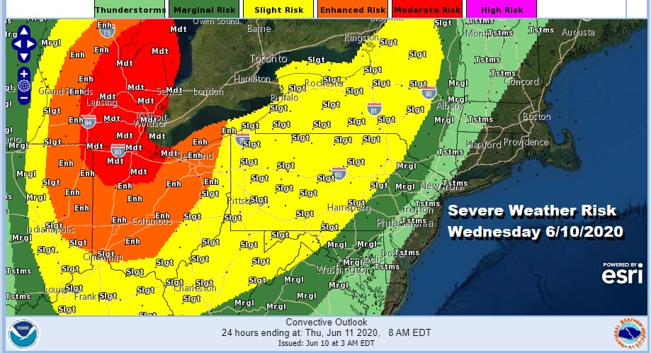
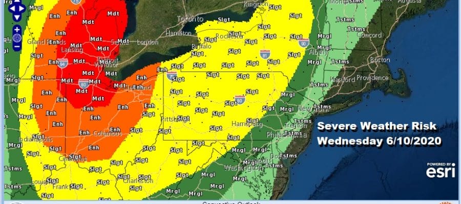
We do have an approaching cold front and we are in a warm humid air mass however there are some pluses today. The cold front is well to our west and the storm system that is driving it is well north in Canada. This should keep severe weather issues west and north of us during the day today and even into the first part of tonight. When risk does come into play we are talking marginal risk reaching from Southeast Pennsylvania to Northwest New Jersey and the Hudson Valley. A slight risk fo severe weather covers the rest of Pennsylvania including Northeast and South Central Pa and extending into Western Maryland.
SATELLITE

REGIONAL RADAR

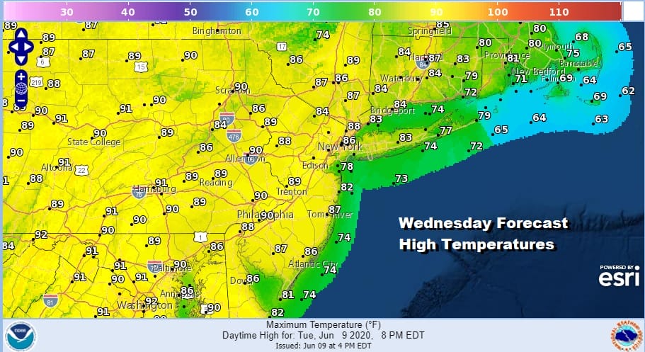
For now we are seeing sunshine and some clouds and while there could be a pop up shower or thunderstorm this afternoon, look for it to occur well inland. It will be a very warm day indeed with highs in the 80s to near 90 away from the coast and 70s to near 80 along the coastal areas where a wind off the ocean dominates.
Tonight brings the cold front close enough so that we will see some showers and thunderstorms scattered around. Most lows will be in the 60s to near 70. The front gets hung up tomorrow so look for showers and perhaps a thunderstorm or two scattered around into the afternoon. Highs will reach the upper 70s and lower 80s. Additional cloud cover likely holds temperatures down.
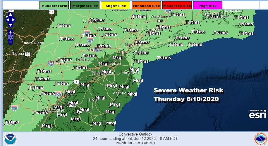
We do have the door open for severe weather risk Thursday as the Storm Prediction Center is showing an area from Central New Jersey southward. We could see this area nudged up a little further north.
Friday is looking like a good day as another weaker cold front approaches so there will be some sunshine in the mix with highs in the 80s. The front will pass and then stall offshore. This won’t impact our weather too much of Saturday and we should see sunshine with highs in the 70s to near 80. However Sunday we will probably see more clouds than sun with highs in the low to mid 70s. There may be the risk for showers late Sunday or Sunday night into Monday as a weak low spins up on the front off the Carolinas and moves northward. Nothing major is being indicated but it is something that could create a bit of wet weather late in the weekend. Saturday is looking like the better of the two weekend days.
BE SURE TO DOWNLOAD THE FREE METEOROLOGIST JOE CIOFFI WEATHER APP &
ANGRY BEN’S FREE WEATHER APP “THE ANGRY WEATHERMAN!
MANY THANKS TO TROPICAL TIDBITS FOR THE USE OF MAPS
Please note that with regards to any severe weather, tropical storms, or hurricanes, should a storm be threatening, please consult your local National Weather Service office or your local government officials about what action you should be taking to protect life and property.


