USE THE COUPON CODE “SPRING2026” AND GET 10 PERCENT OFF ON ANY PURCHASE
Very Humid Rain Thunderstorms Overnight Into Monday
Some Severe Weather & Flash Flood Risk
Another in what seems to be an endless parade of cold fronts is moving eastward today and ahead of this we are very humid. Tropical moisture is being drawn northward and that will leave us with clouds and some sunshine today with highs in the low to middle 80s. There could be a pop up shower or thunderstorm anywhere and anytime but the bulk of the activity will come this evening and tonight as the front gets closer and than temporarily stalls out over the Northeast and Mid Atlantic states. Satellite loops show a lot of clouds around with some breaks. Radars are busier to the west in Pennsylvania and those showers and storms will increase as the day wears on.
SATELLITE WITH LIGHTNING STRIKES
WEATHER RADAR
Tonight we get into the bulk of the heavy weather and we do have some adverse weather risks on the table. The Weather Prediction Center is indicating a 15 to 40 percent chance for flash flooding overnight and Monday. Rainfall amounts will be on the order of an inch to an inch and a half but as always with convection there will be those who see more and those who see less.
The lagging front also creates the potential for severe weather risk especially Monday when the front gets closer to the coast. The Storm Prediction Center is indicating a marginal risk for isolated severe thunderstorms from Eastern Pennsylvania & New Jersey to Massachusetts. This actually is a slight downgrade from yesterday when SPC had indicating a higher level slight risk for this region.
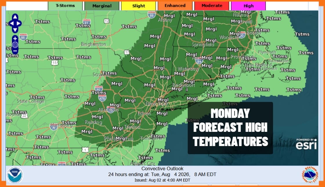
We will have on and off areas of downpours and thunderstorms overnight into Monday afternoon before the front finally begins to push eastward and offshore Monday evening. That should put an end to the rain. Monday temperatures will be in the upper 70s and lower 80s in most places. Weather conditions are set to improve Tuesday with slightly lower humidity and more in the way of sunshine.
MANY THANKS TO TROPICAL TIDBITS FOR THE USE OF MAPS
Please note that with regards to any severe weather, tropical storms, or hurricanes, should a storm be threatening, please consult your local National Weather Service office or your local government officials about what action you should be taking to protect life and property.