
Very Cold Into The Weekend Storm Southern Mid Atlantic
Passes Well South & East

Weather in 5/Joe & Joe Weather Show Latest Podcast
Very Cold Into The Weekend Storm Southern Mid Atlantic
Passes Well South & East
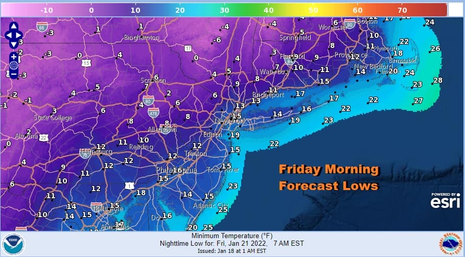
The arctic front was a little slower and we saw rain for 2 to 3 hours. The change over snow was delayed and as a result the snow didn’t stick. It is that simple. Those hours were lost and the cold air being delayed was all the difference. Now we look ahead to cold air coming in tonight on gusty north northwest winds. Skies will clear out and by morning, lows will be in the single digits inland and lower teens warmer urban areas and the coast. Throw in a gusty wind and you can knock off 10 to 15 or more degrees for wind chill.
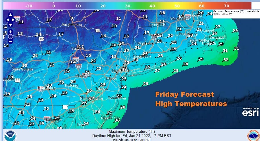
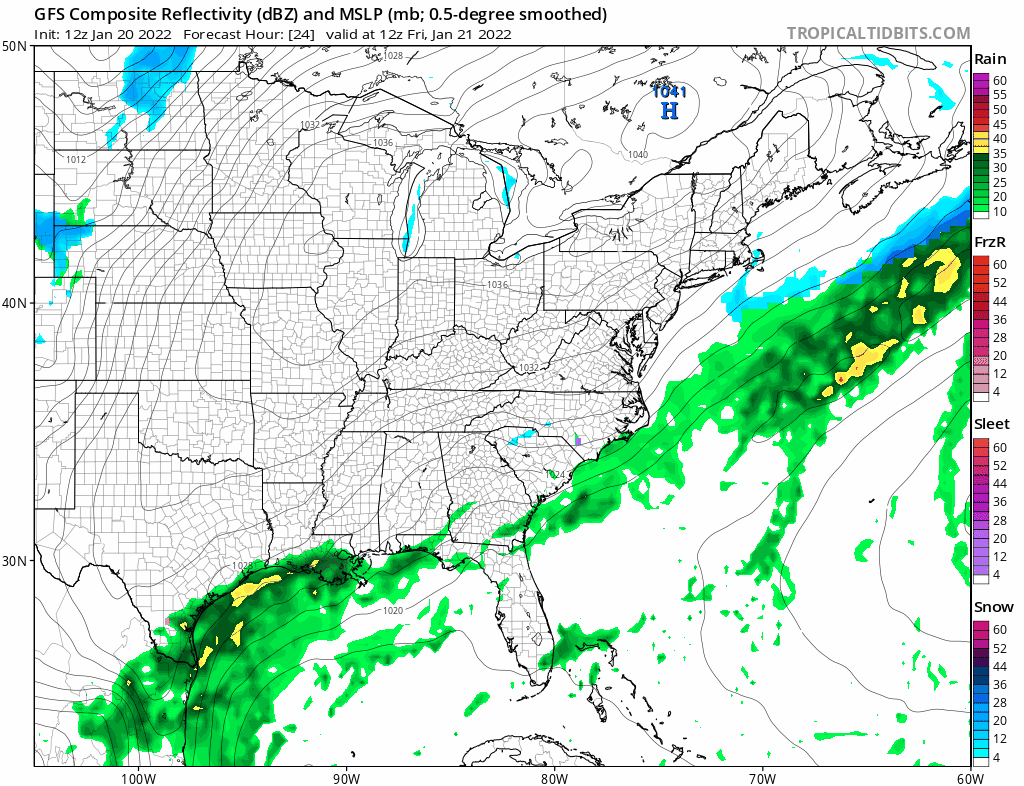
Friday will be a very cold day with some sunshine and a gusty wind. Highs will be just 20 to 25 and the wind will make it feel colder. Meanwhile on the satellite view the cloud line continues to sink slowly southward as the frontal boundary moves slowly offshore and stalls again out in the Atlantic. Radar echoes continue to push into the Middle Atlantic states and that is where all the action is going to be Friday and Friday night.
SATELLITE

WEATHER RADAR

Low pressure is going to develop off the Southeast US Coast. Cold air is draining southward again into Georgia and this sets up for snow and ice for North Carolina and a small portion of Northeastern South Carolina. It also sets for snow inland into Southeastern Virginia and some areas will see 6 inches or more. However this low can’t move north thanks to the high up in the Saint Lawrence Valley and a very flat west southwest flow off the East Coast.
This leaves us with a dry and okay weekend. Saturday morning will be another very cold morning with lows in the single digits and low teens and even some below zero readings inland. Sunshine on Saturday with a few high clouds early, especially south, will produce highs of in the 20s. Sunday look for a little bit of a bounce up into the 30s with some sun and clouds. A weak cold front will move through Sunday evening with not much with it. Monday will be dry with sunshine with maybe some late day clouds. Tuesday brings another arctic boundary and a little bit of moisture but nothing to write home about. We will thrown in the chance for some rain showers at the coast and some snow showers inland. Colder drier air follows after that. Longer range suggests some changes as we head into February with the January pattern breaking down and a trough shifting back to the west with a ridge in the east. That would put us in a warmer pattern to start the new month.
BE SURE TO DOWNLOAD THE FREE METEOROLOGIST JOE CIOFFI WEATHER APP &
ANGRY BEN’S FREE WEATHER APP “THE ANGRY WEATHERMAN!

MANY THANKS TO TROPICAL TIDBITS & F5 WEATHER FOR THE USE OF MAPS
Please note that with regards to any severe weather, tropical storms, or hurricanes, should a storm be threatening, please consult your local National Weather Service office or your local government officials about what action you should be taking to protect life and property.


