Very Chilly Into Wednesday As Cold Air Mass
Covers Northeast & Mid Atlantic
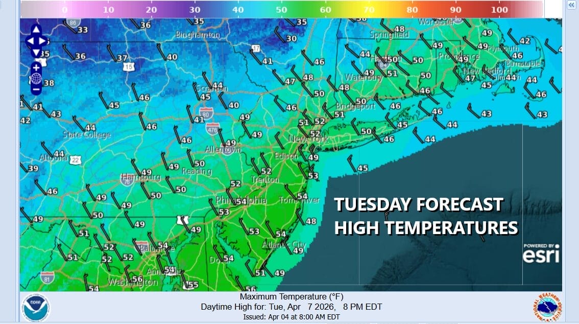
Another cold air mass (for April) is arriving today. The cold front associated with the leading edge of this cold air mass is passing through this morning and we will be left with gusty northwest winds, in and out sunshine today, and temperatures that really won’t be going anywhere. Highs will just be in the upper 40s and lower 50s in most places and that leads us to a cold night into Wednesday morning. Skies will be mostly clear. By Wednesday morning lows across much of Eastern Pennsylvania to Southern New England will be in the mid to upper 20s inland, and upper 20s and lower 30s coast & warmer urban locations.
SATELLITE WITH LIGHTNING STRIKES
WEATHER RADAR
The core of this cold air mass will move to the east Wednesday morning and offshore, but it will be slow to warm up over the next few days given that the wind direction is primarily from the south or southeast, and that is not a warm air flow during the spring months. We will see sunshine Wednesday and temperatures will bounce higher but the rise will be limited to getting back into the 50s.
Moving forward we will make some progress Thursday with highs in the 50s. Maybe some warm spots could reach 60 or so in South Jersey and points southward. Friday should finally be a day where we get into the 60s everywhere except for perhaps the immediate coast. We should see at least some sunshine both days. The next cold front likely passes Friday night into Saturday morning. Maybe we get a shower or two with that. Otherwise we look to a dry weekend and temperatures actually will be close to where they should be for this time of year. No major rain events are in the cards anytime soon as the dry weather pattern continues to hold firm in much of the Eastern US.
BE SURE TO DOWNLOAD THE FREE METEOROLOGIST JOE CIOFFI WEATHER APP &
ANGRY BEN’S FREE WEATHER APP “THE ANGRY WEATHERMAN!
MANY THANKS TO TROPICAL TIDBITS FOR THE USE OF MAPS
Please note that with regards to any severe weather, tropical storms, or hurricanes, should a storm be threatening, please consult your local National Weather Service office or your local government officials about what action you should be taking to protect life and property.