Typhoon Omais Key To August Pattern
Typhoon Omais Key To August Pattern
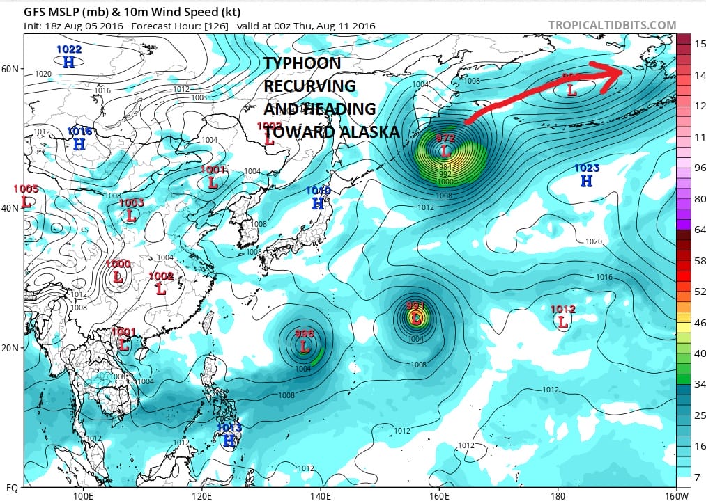
A few days ago we noticed (and so did others) that there was a recurving typhoon in the West Pacific that under the right conditions would lead to some longer term pattern shifts across North America. What usually happens is that a recurving typhoon eventually morphs into a deep low in the Gulf of Alaska which drives a trough down into the Eastern United States. The European model was the first to show this and now all the models and ensembles have jumped on board with this idea.
Typhoon Omais HWRF Model Wednesday August 10

Typhoon Omais GFS Model Wednesday August 10
Now remember this is a process and not necessarily a prediction so we need to see how this all plays out over the next week to 10 days. If troughing results in the east this would make things cool and wetter for the second half of the month. Also with troughing in the east, it would be one of the necessary ingredients for a hurricane or tropical storm to track up the east coast. REMEMBER THAT YOU CAN HAVE ALL THIS AND UNLESS A TROPICAL SYSTEM DEVELOPS..NOTHING HAPPENS!
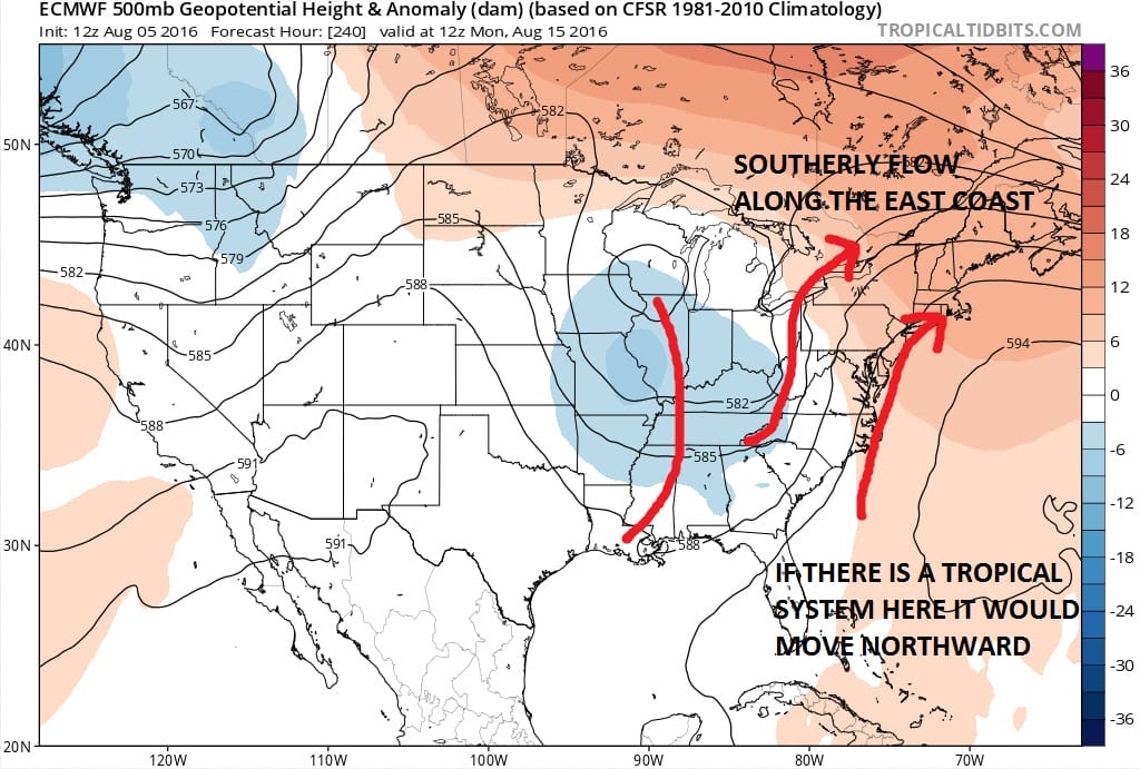
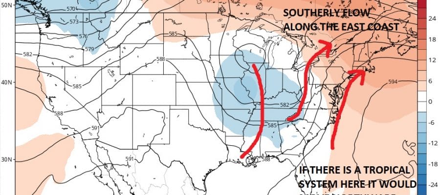
This brings us to today’s European day 10 upper air. I want to show you this because of what it is showing in the upper air structure. If a hurricane or tropical storm is going to move up the east coast, it has been my experience that you need a deep trough to the west. Most any other upper air set up is not conducive to east coast tropical storm threats. This type of jet stream set up is what you need to see. A trough in the Ohio Valley creates a southerly flow aloft along the east coast for a tropical storm or hurricane to ride northward. Now the big variable here is whether there will be a tropical system at all. Think back to Joaquin of last year. The upper air set up was absolutely nothing like this.
Again I’m not predicting anything here. I am merely stating that this is the kind of setup that is required for a serious tropical storm threat. Bear this in mind when you read others that talk about a threat to the east. Ask yourself whether the upper air is supportive. In the end that is the critical question.
Now assuming that nothing happens on the tropical side, the implication of troughing in the east means for a cooler wetter second half of August, assuming all things being equal which they seldom are. This is some food for though going forward.

MENTION JOE CIOFFI AND GET A 5% DISCOUNT
FiOS1 News Weather Forecast For Long Island
FiOS1 News Weather Forecast For New Jersey
FiOS1 News Weather Forecast For Hudson Valley
NATIONAL WEATHER SERVICE SNOW FORECASTS
LATEST JOESTRADAMUS ON THE LONG RANGE
Weather App

Don’t be without Meteorologist Joe Cioffi’s weather app. It is really a meteorologist app because you get my forecasts and my analysis and not some automated computer generated forecast based on the GFS model. This is why your app forecast changes every 6 hours. It is model driven with no human input at all. It gives you an icon, a temperature and no insight whatsoever.
It is a complete weather app to suit your forecast needs. All the weather information you need is right on your phone. Android or I-phone, use it to keep track of all the latest weather information and forecasts. This weather app is also free of advertising so you don’t have to worry about security issues with your device. An accurate forecast and no worries that your device is being compromised.
Use it in conjunction with my website and my facebook and twitter and you have complete weather coverage of all the latest weather and the long range outlook. The website has been redone and upgraded. Its easy to use and everything is archived so you can see how well Joe does or doesn’t do when it comes to forecasts and outlooks.
Just click on the google play button or the apple store button on the sidebar for my app which is on My Weather Concierge. Download the app for free. Subscribe to my forecasts on an ad free environment for just 99 cents a month.
Get my forecasts in the palm of your hand for less than the cost of a cup of Joe!

