
The Atlantic basin has been very quiet these last few weeks and this is really not out of character even in non el-nino years. Something about July where it seems things slow down after a June early burst but there are indications that something could develop next week off the southeast US Coast. More on that in just a bit but I just want to spend a little time on current conditions. You can see the latest satellite picture below and it shows some scattered convection off the east coast extending northeast over Bermuda and beyond. This is part of the old frontal trough and for now there isn’t much happening here and no signs of any kind of development
Scroll down for the Pacific satellite pic and summary and the forecast for next week.
Looking deeper into the tropics this is great week to have picked for any island visit as the Gulf of Mexico, the Bahamas, the Caribbean look about as cloud free as it ever gets. Outside of the normal daytime thunderstorm or downpour activity, it remains completely quiet in these regions.
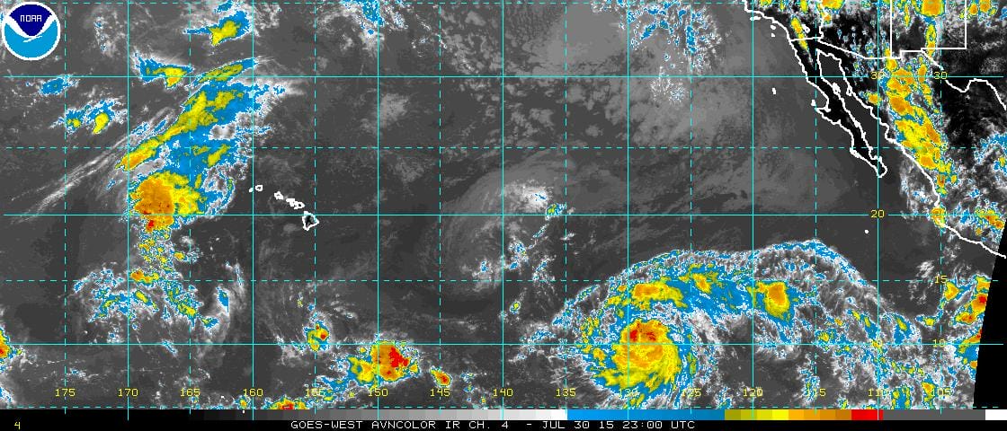 In the Pacific we have disturbed weather off the coast of Mexico that has been trying to develop over the last several days but it has been unsuccessful due to some shear aloft. The disturbance is moving northwest for the most part and it will soon be north of 20N where the ocean water temps are cooler. So if this doesn’t develop soon, it probably won’t. Other waves lie across the Pacific but nothing looks ominous for Hawaii at this time.
More on these systems from the National Hurricane Center in Miama as well as the Hurricane center from Hawaii which is responsible for the central Pacific. Now on to the potential for development off the east coast.
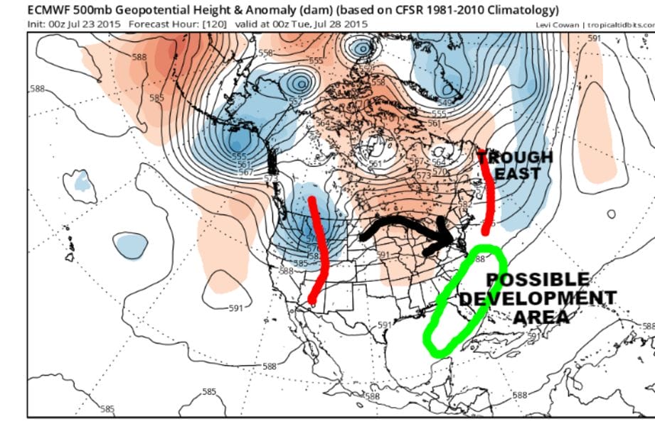 Normally I would not jump on these sorts of things off of one run and I haven’t posted anything about this the last few days however the European has been showing this on and off for the last several days so I think it is probably worth mentioning at this point. Since we have had 3 tropical storms develop outside the main tropic zone, it stands to reason that this trend will probably continue especially when you look at the absolute lack of activity showing up on satellite pics and unfavorable upper air winds across the tropic zone.
 The map above is for a week from today. The European shows 2 things here of interest. First off it does show some sort of tropical reflection off the southeast coast of the United States. It is also showing a approaching trough in the westerlies across the Great Lakes. All thing being equal, if the trough does not dig into the Appalachians, whatever forms there is likely to move out to the northeast over time. Indeed that is what the European shows at this point which is that progression continues north of 35N in the jet stream; in other words everything just moves along. From the standpoint of weather watching it will be something to look at but of course
 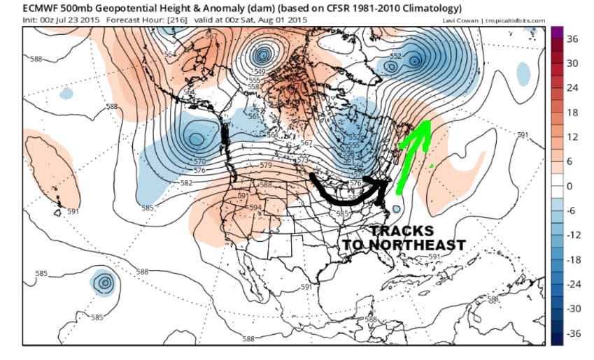 right now everything is in speculative mode and given the current state of the weather world being in blue skies and sunshine, it is hardly a concern other than in theory.