Tropical Wave Eastern Atlantic Moving Westward
Tropical Wave Eastern Atlantic Moving Westward
The next weather system with some potential development lies in the far Eastern Atlantic where it seems the action wants to be so far this hurricane season. Conditions in the Tropical Atlantic are forecast to become more conducive for development. At the moment there are issues across the Atlantic that pose questions. First off as the water vapor imagery indicates there is a large area of dry air from about 40 degrees west to the the Eastern Caribbean. This was part of a large area of Saharan dust that moved off the African coast last week and wound up bringing about the demise of Tropical Depression 4. That area of dry air seems to be shrinking a bit but it is still rather large and this could impede development.

We also have a strong upper low sitting to the northeast of the Leeward Islands which is producing strong winds shear conditions. This is still impacting the old tropical depression 4 which is basically an open wave northeast of Puerto Rico and showing little movement. Wind shear conditions are forecast to relax across the Atlantic over the next several days.

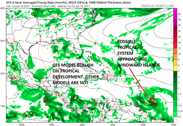
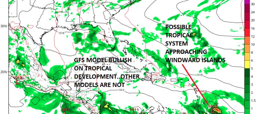
There has already been a lot of chatter regarding this disturbed weather off the African coast as the GFS model continues to organize and strengthen this into a tropical storm as it approaches the Windward Islands late this week.
The GFS model is the only model that develops this system at all. You can barely find hints of this system on the other global models. This has led the GFS to print out all sorts of solutions with major hurricanes moving up the East Coast on one run and taking it to the Western Gulf of Mexico on others. 1800 mile swings have been common place for something that hasn’t even developed yet if it develops at all. The GFS & Canadian models show light wind shear conditions which would be favorable for development but I suspect it is all that dry air in the Tropical Atlantic that may wind up impeding this from becoming anything other than an open wave. To speculate on individual model prints is silly and just a waste of time. Lets see what happens to this as it moves westward. The GFS was good at picking out Tropical Storm Brett & Tropical Depression 4 so maybe it is on to something. We will just have to watch and wait for the wave to get west of 50 degrees West which will be around Wednesday night or early Thursday.
Weather App
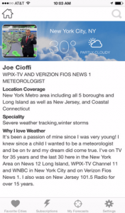
Don’t be without Meteorologist Joe Cioffi’s weather app. It is really a meteorologist app because you get my forecasts and my analysis and not some automated computer generated forecast based on the GFS model. This is why your app forecast changes every 6 hours. It is model driven with no human input at all. It gives you an icon, a temperature and no insight whatsoever.
It is a complete weather app to suit your forecast needs. All the weather information you need is right on your phone. Android or I-phone, use it to keep track of all the latest weather information and forecasts. This weather app is also free of advertising so you don’t have to worry about security issues with your device. An accurate forecast and no worries that your device is being compromised.
Use it in conjunction with my website and my facebook and twitter and you have complete weather coverage of all the latest weather and the long range outlook. The website has been redone and upgraded. Its easy to use and everything is archived so you can see how well Joe does or doesn’t do when it comes to forecasts and outlooks.
Just click on the google play button or the apple store button on the sidebar for my app which is on My Weather Concierge. Download the app for free. Subscribe to my forecasts on an ad free environment for just 99 cents a month.
Get my forecasts in the palm of your hand for less than the cost of a cup of Joe!
MENTION JOE CIOFFI AND GET A 5% DISCOUNT


