Tropical Storms Model Analysis
The video above was done this morning based on the overnight weather models. Given that every run is coming up with different solutions regarding the disturbed weather system 99L, we will attempt to break this down on what to look for over the next several days.
First off is the disturbance itself. Climatology favors this system developing once it clears 70 degrees west. Water temperatures are in the upper 80s over a large part of the Southwest Atlantic which is certainly favorable for development. However what is key is the system’s “core” needs to clear the islands. The island of Hispaniola in particular is a tropical storm killer due to the mountainous terrain. Once the tropical wave clears this island, the door is open for development. It isn’t guaranteed however since obviously upper level conditions need to be favorable as well.
Now let’s assume that this system does develop. What is the track in the longer term? Well among other things, the 2 most important indicators here will be how strong does this system get as it nears Florida. The second and probably more important question is the state of the upper air profile in the Southern United States eastward into the Atlantic.
Tropical Storms Model Analysis Last Night’s European Model Run
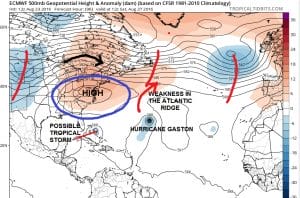
The reason why the European Model shifted they way it did this afternoon is clearly do to how the model handles the strong ridge that builds in the Middle Atlantic and Southeast at the end of this week. Last night’s European built that ridge strongly both east and west and held that ridge pretty much in tact. This forces any storm to track westward longer until it comes to another weakness in the ridge. According to last night’s European that was west of 90 degrees west. This allowed the storm to track across the open waters of the Gulf of Mexico over 90 degree water all the way. The result was a major almost Category 5 hurricane coming ashore in Southeast Texas/Southwest Louisiana.
Tropical Storms Model Analysis Today’s European Model Run
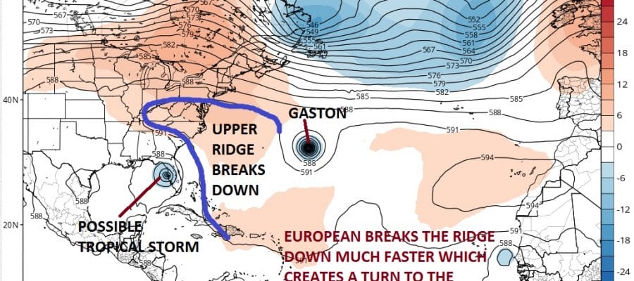
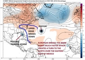
Now today’s European run handles that ridge differently. It breaks it down after the weekend and creates a weakness east of 85 degrees west. This is why the model turns the storm northward off the western coast of Florida and drives it northward into the panhandle of Florida. The close proximity to Florida itself causes a less deep tropical system to develop and move inland much further east than last night’s run. The strength and longevity of the upper ridge is going to be the key going forward to where this all winds up. One thing the ridge does is that it protects the Middle Atlantic and Northeast from any tropical storm moving up the coast.
MENTION JOE CIOFFI AND GET A 5% DISCOUNT
FiOS1 News Weather Forecast For Long Island
FiOS1 News Weather Forecast For New Jersey
FiOS1 News Weather Forecast For Hudson Valley
NATIONAL WEATHER SERVICE SNOW FORECASTS
LATEST JOESTRADAMUS ON THE LONG RANGE
Weather App
Don’t be without Meteorologist Joe Cioffi’s weather app. It is really a meteorologist app because you get my forecasts and my analysis and not some automated computer generated forecast based on the GFS model. This is why your app forecast changes every 6 hours. It is model driven with no human input at all. It gives you an icon, a temperature and no insight whatsoever.
It is a complete weather app to suit your forecast needs. All the weather information you need is right on your phone. Android or I-phone, use it to keep track of all the latest weather information and forecasts. This weather app is also free of advertising so you don’t have to worry about security issues with your device. An accurate forecast and no worries that your device is being compromised.
Use it in conjunction with my website and my facebook and twitter and you have complete weather coverage of all the latest weather and the long range outlook. The website has been redone and upgraded. Its easy to use and everything is archived so you can see how well Joe does or doesn’t do when it comes to forecasts and outlooks.
Just click on the google play button or the apple store button on the sidebar for my app which is on My Weather Concierge. Download the app for free. Subscribe to my forecasts on an ad free environment for just 99 cents a month.
Get my forecasts in the palm of your hand for less than the cost of a cup of Joe!


