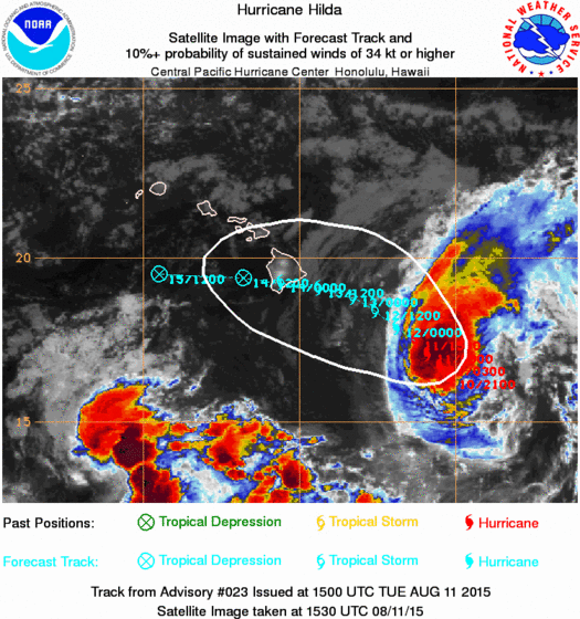
LOCATION...17.5N 151.3W ABOUT 290 MI...470 KM ESE OF HILO HAWAII ABOUT 505 MI...810 KM ESE OF HONOLULU HAWAII MAXIMUM SUSTAINED WINDS...85 MPH...140 KM/H PRESENT MOVEMENT...NW OR 315 DEGREES AT 7 MPH...11 KM/H MINIMUM CENTRAL PRESSURE...985 MB...29.09 INCHESHilda is still a hurricane and less than 300 miles east of the big island of Hawaii. The weakening trend and the more westerly course are tide together and it looks like Hilda might still be at minimal tropical storm strength when it reaches the big island of Hawaii Thursday morning. As the hurricane weakens it responds more to the low level easterlies and less with the upper flow. So the faster it weakens the more westward the course. Right now it would clip the big Island on Thursday but if the weakening trend accelerates it could make the westward turn sooner...which shifts the track to the south.
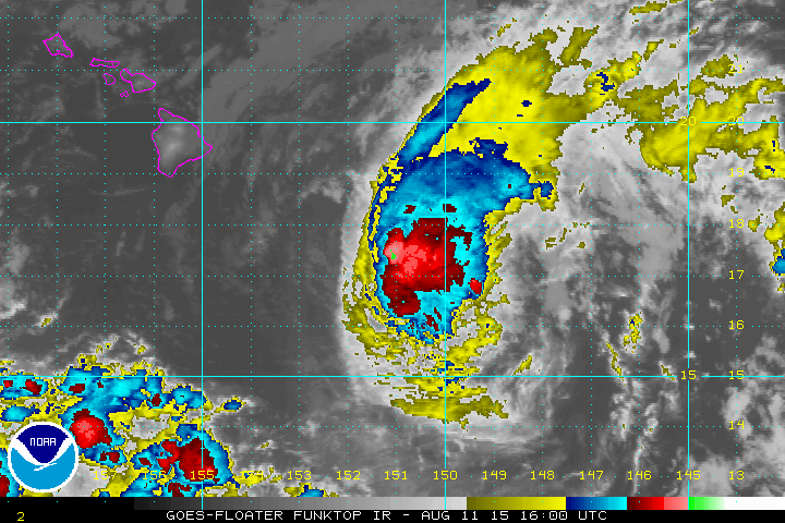
You can see on the satellite view, the strong winds are beginning to take their toll as the tops are starting to get blown off to the northeast. Hilda should weaken to a tropical storm later today given the current trends. The water vapor loop really shows it well and you can see how the hurricane gets stretched by the strong upper winds. http://www.ssd.noaa.gov/goes/west/cpac/flash-wv.html The tight shot below shows Hilda and how close it is to the big island of Hawaii.