Based on latest forecast trends and upper air steering, the tropical storm is just a shade further north. When your a forecaster trying to figure this out it is literally like threading a needle. The center of the tropical storm is forecast to pass just a handful of miles north of the island chain and it could straddle the entire island chain at that.
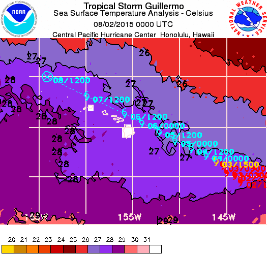
Ocean water temps around the islands are in the low 80s and this should be supportive for the tropical storm to either hold its own as it moves across or a very slow weakening trend due to other factors like shear. It should not restrengthen to a hurricane between now and Wednesday when the storm will be nearby the big island and moving west northwest.
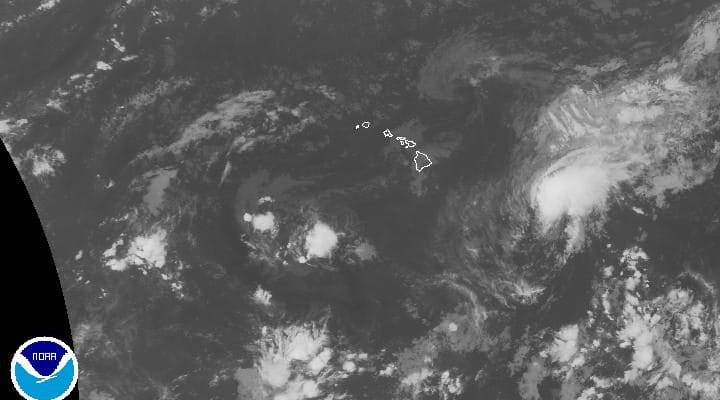
You can see from the satellite this afternoon that this is definitely no longer a hurricane as the convection on the west side appears to be lacking some. Westerly shear (strong winds aloft) continue to impede thunderstorm development near the low level circulation and this is likely to continue for the next several days. By the time the tropical storm arrives at the big island, top winds should be on the order of 50 to 60 mph and weakening as it moves west northwest over the other islands.
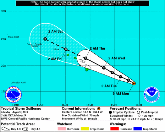
Tropical storm watches are likely to go up later today or tonight.